
 United Kingdom
 France
 Germany
 Netherlands
 Sweden
 USA
USA
 Italy
Italy
 Spain
Spain
More From Contributor


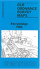


Ferrybridge South 1905
Ferrybridge South in 1905 in a fascinating series of reproductions of old Ordnance Survey plans in the Alan Godfrey Editions, ideal for anyone interested in the history of their neighbourhood or family. Selected towns in Great Britain and Ireland are covered by maps showing the extent of urban development in the last decades of the 19th and early 20th century.In this title: the map covers the southern part of Ferrybridge and also a portion of Knottingley. Coverage stretches from Cobblers Hill and Bubwith Bridge eastward to Knottingley station, and from Longbull Hill northward to Ferrybridge House. Features include Knottingley station, Knottingley Junction and sections of the MNER, LYR and NER railways, Wentcliff Hill, Gaggs Warren, Wentcliff Windmill, Ferrybridge Bone Manure Works,
Nodder's Windmill, Dandy Windmill. On the reverse is a good section of an earlier edition of the map, showing how much of the area looked in 1890.About the Alan Godfrey Editions of the 25
Nodder's Windmill, Dandy Windmill. On the reverse is a good section of an earlier edition of the map, showing how much of the area looked in 1890.About the Alan Godfrey Editions of the 25
Product Description
Reviews/Comments
Add New
Vouchers
No voucher codes found.
Do you know a voucher code for this product or supplier? Add it to Insights for others to use.
Do you know a voucher code for this product or supplier? Add it to Insights for others to use.
 Denmark