
 United Kingdom
 France
 Germany
 Netherlands
 Sweden
 USA
USA
 Italy
Italy
 Spain
Spain
More From Contributor


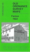
Fenton 1922
Fenton in 1922 in a fascinating series of reproductions of old Ordnance Survey plans in the Alan Godfrey Editions, ideal for anyone interested in the history of their neighbourhood or family. The map covers much of Fenton, one of the `Sixth Town` of the Potteries. Coverage stretches from Regent Road and Wellington Street eastward to Priors Fields and from Grove Road northward to Fenton Park. Features include North Staffordshire Railway with Fenton station, Great Fenton House, Glebe Collieries & Brick Works, Christ Church, Albert Square, Rialto Works, Baker`s Mill, Opal China Works, Fenton Potteries, St Michael & All Angels church, St Matthew`s church, Minerva China Works, Rubian Art Pottery, Oldfield Brick Works, Doric Pottery, Cemetery, Pool Dole, picture theatre, Town
Hall, short stretch of Biddulph Valley Branch but no stations, Foley China Works, Foley Potteries, tramways, Clarence Works, Golden Hill area, northern tip of Longton (St John the Baptist church is split by bottom sheetline), Etna Engineering Works, Priors Fields, other potteries and earthenware works, etc. Extracts from a 1912 directory are on the reverse, including a list of private residents for Fenton. About the Alan Godfrey Editions of the 25” OS Series:Selected towns in Great Britain and Ireland are covered by maps showing the extent of urban development in the last decades of the 19th and early 20th century. The plans have been taken from the Ordnance Survey mapping and reprinted at about 15 inches to one mile (1:4, 340). On the reverse most maps have historical notes
and many also include extracts from contemporary directories. Most maps cover about one mile (1.6kms) north/south, one and a half miles (2.4kms) across; adjoining sheets can be combined to provide wider coverage.FOR MORE INFORMATION AND A COMPLETE LIST OF ALL AVAILABLE TITLES PLEASE CLICK ON THE SERIES LINK.

Product Description
Reviews/Comments
Add New
Intelligent Comparison
Archived Product
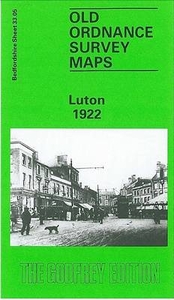
Luton 1922 Stanfords
£3.50
Archived Product

Hendon 1912 Stanfords
£3.50
Vouchers
No voucher codes found.
Do you know a voucher code for this product or supplier? Add it to Insights for others to use.
Do you know a voucher code for this product or supplier? Add it to Insights for others to use.
 Denmark