
 United Kingdom
 France
 Germany
 Netherlands
 Sweden
 USA
USA
 Italy
Italy
 Spain
Spain
More From Contributor


Eston 1927
Eston in 1927 in a fascinating series of reproductions of old Ordnance Survey plans in the Alan Godfrey Editions, ideal for anyone interested in the history of their neighbourhood or family. The map includes Old Eston, South Eston and California, with coverage extending eastward to Eston Nab, Eston Beacon and Lackenby Bank. Eston Bank with the site of Eston ironstone mines is in the centre of the map. Features include the station, Sheep Beck Bridge, Christ Church, High Street, Jubilee Road, hospital, etc. The various mineral lines are of special interest and include Eston Mines Sidings, Trustee Incline to Trustee Drift Level, Old Incline to Old Bank Drift Level, New Incline and tramway towards Lazenby Bank. A 1905 directory of Eston is on the reverse.About the Alan Godfrey
Editions of the 25” OS Series:Selected towns in Great Britain and Ireland are covered by maps showing the extent of urban development in the last decades of the 19th and early 20th century. The plans have been taken from the Ordnance Survey mapping and reprinted at about 15 inches to one mile (1:4, 340). On the reverse most maps have historical notes and many also include extracts from contemporary directories. Most maps cover about one mile (1.6kms) north/south, one and a half miles (2.4kms) across; adjoining sheets can be combined to provide wider coverage.FOR MORE INFORMATION AND A COMPLETE LIST OF ALL AVAILABLE TITLES PLEASE CLICK ON THE SERIES LINK.
Editions of the 25” OS Series:Selected towns in Great Britain and Ireland are covered by maps showing the extent of urban development in the last decades of the 19th and early 20th century. The plans have been taken from the Ordnance Survey mapping and reprinted at about 15 inches to one mile (1:4, 340). On the reverse most maps have historical notes and many also include extracts from contemporary directories. Most maps cover about one mile (1.6kms) north/south, one and a half miles (2.4kms) across; adjoining sheets can be combined to provide wider coverage.FOR MORE INFORMATION AND A COMPLETE LIST OF ALL AVAILABLE TITLES PLEASE CLICK ON THE SERIES LINK.

Product Description
Reviews/Comments
Add New
Intelligent Comparison
Archived Product
Syston 1902 Stanfords
£2.95
Archived Product

Syston 1902 Stanfords
£3.50
Archived Product
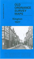
Kington 1927 Stanfords
£3.50
Archived Product
Urmston 1926 Stanfords
£2.95
Archived Product
Whiston 1925 Stanfords
£2.95
Archived Product

Urmston 1926 Stanfords
£3.50
Archived Product

Whiston 1925 Stanfords
£3.50
Vouchers
No voucher codes found.
Do you know a voucher code for this product or supplier? Add it to Insights for others to use.
Do you know a voucher code for this product or supplier? Add it to Insights for others to use.
 Denmark