More From Contributor
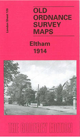
£8.99
A biography of the writer, broadcaster, conservationist & chronicler of colonial Kenya, whose memoir The Flame Trees of Thika (1959) achieved worldwide fame when made into a television drama series in 1981. Colonial Kenya inspired three great writers
- Karen Blixen (Out of Africa), Beryl Markham (West with the Night) & Elspeth Huxley. Huxley's writings (30 books in all: novels, biographies, & political accounts) have great political & social range, encompassing (in her Kenyan books) the exploits of the Happy Valley farmers
- made famous by James Fox's book White Mischief, poor white farmers & the lives of Africans alike. After a childhood spent in East Africa & wartime Britain, Elspeth married Gervas, a grandson of Thomas Huxley & cousin to Julian & Aldous Huxley, whom she knew well. She also later got to know Joy Adamson & the Leakeys. She travelled widely with her husband (an executive with the Empire Marketing Board) & wrote while constantly on the move. She worked for the BBC in World War II & became a Kenyan government adviser. In 1938 she bought a farm in Wiltshire, where she died in 1997. The author, Christine Nicholls, has access to all her letters & papers, & is familiar with many of the people & places in the book. Elspeth Huxley was a compelling personality & a brilliant letter-writer, extraordinarily energetic & effective in everything she did.

...
Archived Product
£2.75
Black & white street plan covering Elstree, Borehamwood & Shenley at Approx. 1:12, 400 scale with half-mile grid squares, & Radlett & Shenley together at Approx. 1:21, 000 scale. Both of these areas have street indexes. Shows some landmarks, public buildings such as schools, railway stations & police stations, & some notable private buildings & inns. Also

Includes::
a road map of Hertfordshire, covering Bishop's Stortford, Luton, Ayelsbury, Welwyn Garden City, Watford & North London at Approx. 1:250, 000.

...
Archived Product
£3.50
Elstree in 1895 in a fascinating series of reproductions of old Ordnance Survey plans in the Alan Godfrey Editions, ideal for anyone interested in the history of their neighbourhood or family. The map covers the area from Elstree village eastward to Woodcock Hill, & northward to the southern end of Elstree & Borehamwood station. Features include Elstree village, Hill House, St Nicholas church, Edgwarebury House, Deacons Hill, Woodcock Hill, Elstree Tunnel, Allum Lane, & the Artichoke pub. On the reverse are directories of Elstree in 1895 & of Little Stanmore with Edgware in 1890. This map is also Hertfordshire sheet 45.05 About the Alan Godfrey Editions of the 25” OS Series: Selected towns in Great Britain & Ireland are covered by maps showing the extent of urban development in the last decades of the 19th & early 20th century. The plans have been taken from the Ordnance Survey mapping & reprinted at about 15 inches to one mile (1:4, 340). On the reverse most maps have historical notes & many also include extracts from contemporary directories. Most maps cover about one mile (1.6kms) north/south, one & a half miles (2.4kms) across; adjoining sheets can be combined to provide wider coverage.FOR MORE INFORMATION & A COMPLETE LIST OF ALL AVAILABLE TITLES PLEASE CLICK ON THE SERIES LINK. ...
Archived Product
£3.50
Elswick in 1894 in a fascinating series of reproductions of old Ordnance Survey plans in the Alan Godfrey Editions, ideal for anyone interested in the history of their neighbourhood or family. Two maps have have been published for this area to show how it has changed over the years. Coverage stretches from Hodgkin Park eastward to Park Road, & from Sceptre Street southward to the Dunston riverside. Elswick Road & Scotswood Road run through the map, & features include the massive Elswick Works, NER railway with station, Elswick Colliery, St Joseph`s House, Elswick House, Elswick Hall, The Gables, Elswick Shipyard, South Benwell, New Benwell, Paradise, South Benwell Electric Light Works, Delaval Colliery, St John`s Cemetery, Wansbeck Home, etc; a smaller area south of the Tyne is also included, showing part of Dunston with a stretch of the NER Redheugh Branch, Atlas Rivet Works, Dunston Engine Works, saw mills, landing stages, etc. About the Alan Godfrey Editions of the 25” OS Series: Selected towns in Great Britain & Ireland are covered by maps showing the extent of urban development in the last decades of the 19th & early 20th century. The plans have been taken from the Ordnance Survey mapping & reprinted at about 15 inches to one mile (1:4, 340). On the reverse most maps have historical notes & many also include extracts from contemporary directories. Most maps cover about one mile (1.6kms) north/south, one & a half miles (2.4kms) across; adjoining sheets can be combined to provide wider coverage.FOR MORE INFORMATION & A COMPLETE LIST OF ALL AVAILABLE TITLES PLEASE CLICK ON THE SERIES LINK. ...
Archived Product
£3.50
Elswick in 1913 in a fascinating series of reproductions of old Ordnance Survey plans in the Alan Godfrey Editions, ideal for anyone interested in the history of their neighbourhood or family. Two maps have have been published for this area to show how it has changed over the years. Coverage stretches from Hodgkin Park eastward to Park Road, & from Sceptre Street southward to the Dunston riverside. Elswick Road & Scotswood Road run through the map, & features include the massive Elswick Works, NER railway with station, Elswick Colliery, St Joseph`s House, Elswick House, Elswick Hall, The Gables, Elswick Shipyard, South Benwell, New Benwell, Paradise, South Benwell Electric Light Works, Delaval Colliery, St John`s Cemetery, Wansbeck Home, etc; a smaller area south of the Tyne is also included, showing part of Dunston with a stretch of the NER Redheugh Branch, Atlas Rivet Works, Dunston Engine Works, saw mills, landing stages, etc. About the Alan Godfrey Editions of the 25” OS Series: Selected towns in Great Britain & Ireland are covered by maps showing the extent of urban development in the last decades of the 19th & early 20th century. The plans have been taken from the Ordnance Survey mapping & reprinted at about 15 inches to one mile (1:4, 340). On the reverse most maps have historical notes & many also include extracts from contemporary directories. Most maps cover about one mile (1.6kms) north/south, one & a half miles (2.4kms) across; adjoining sheets can be combined to provide wider coverage.FOR MORE INFORMATION & A COMPLETE LIST OF ALL AVAILABLE TITLES PLEASE CLICK ON THE SERIES LINK. ...
Archived Product
£3.50
Eltham in 1914 in a fascinating series of reproductions of old Ordnance Survey plans in the Alan Godfrey Editions, ideal for anyone interested in the history of their neighbourhood or family. Two versions cover this area, stretching from Leyland Road at Lewisham eastward to Eltham Green & a little beyond, & northward to Kidbrooke station. Several streets are being developed on the west side of the map, along the fringes Blackheath Park & Lewisham, also near St Peter`s church on The Avenue. The area around Eltham Green is largely rural. Coverage of the 1894 version has been extended by including on the reverse part of Kent Sheet 8.01 which takes it to the centre of Eltham village, with St John`s church, Court Yard, Eltham Court, the remains of Eltham Palace, & Well Hall station. About the Alan Godfrey Editions of the 25” OS Series Selected towns in Great Britain & Ireland are covered by maps showing the extent of urban development in the last decades of the 19th & early 20th century. The plans have been taken from the Ordnance Survey mapping & reprinted at about 15 inches to one mile (1:4, 340). On the reverse most maps have historical notes & many also include extracts from contemporary directories. Most maps cover about one mile (1.6kms) north/south, one & a half miles (2.4kms) across; adjoining sheets can be combined to provide wider coverage.FOR MORE INFORMATION & A COMPLETE LIST OF ALL AVAILABLE TITLES PLEASE CLICK ON THE SERIES LINK. ...
Archived Product
£17.99
Topographic survey of Portugal at 1:50, 000 from the Instituto Geográfico do Exército, the country’s military survey organisation. The maps have contours at 20m intervals & in addition to the standard features shown on topographic mapping at this scale also indicate various types of terrain or vegetation (s&, terraces, rocks, woodlands, vineyards, etc). Each sheet covers an area of 32 x 20km (20 x 12.5 miles approx). The maps have a 1-km UTM grid plus latitude & longitude coordinates for the map corners. Map legend & a glossary of terms used on the maps include English.EDITION DATES: most titles in this series date from 1990s or later. To see all the titles in this series please click on the series link. ...
Archived Product
£17.99
Topographic survey of Portugal at 1:100, 000 from the Instituto Geográfico Português, the country’s civilian survey organisation. The maps have contours at 50m intervals & in addition to the standard features shown on topographic mapping at this scale also indicate various types of vegetation (vineyards, olive groves, etc). Each sheet covers an area of 64 x 40km (40 x 25 miles approx). The maps have latitude & longitude margin ticks at 1’ intervals, plus show UTM coordinates for the map corners. Map legend is in Portuguese only.PLEASE NOTE
- EDITION DATES: some sheets at this scale date back to the 1950s or 1960s. For more recent editions please see IGP’s 1:25, 000 series where each 50K map is divided into four quarters. To see all the titles in the 1:100, 000 series please click on the series link.
...
Archived Product
£17.99
Topographic survey of Portugal at 1:50, 000 from the Instituto Geográfico Português, the country’s civilian survey organisation. The maps have contours at 25m intervals & in addition to the standard features shown on topographic mapping at this scale also indicate various types of vegetation (vineyards, olive groves, etc). Each sheet covers an area of 32 x 20km (20 x 12.5miles approx). The maps have latitude & longitude margin ticks at 1’ intervals & UTM coordinates for the map corners – each sheet also shows conversion details from BBLx (Bessel-Bonnie system, Datum Lisbon) to UTM. Map legend is in Portuguese only.EDITION DATES: most titles in this series have now been updated in the 1990s or later. To see all the titles in this series please click on the series link. ...
Archived Product
£12.99
Topographic survey of France at 1:25, 000 in IGN`s excellent TOP25 / Série Bleue series. All the maps are GPS compatible, with a 1km UTM grid plus latitude & longitude lines at 5’ intervals. Contours are at 5m intervals except for mountainous areas where the maps have contours at 10m intervals, vividly enhanced by hill shading & graphics for rocky terrain. Colouring with graphics indicates different types of vegetation or land use (deciduous or coniferous forests, moors, orchards, vineyards, etc). PLEASE NOTE: coverage of France at this scale is currently being revised – the format & the presentation of each title are indicated by the letters at the end of its Sheet Reference number (e.g. 0416ET, 3531ETR, 1923SB, etc.)MAPS WITH FULL TOURIST OVERPRINT & AN ENGLISH MAP LEGEND: all TOP25 maps & the SB editions of Série Bleue have an overprint highlighting waymarked walking trails including long-distance GR routes &, where appropriate, ski routes. Symbols indicate campsites, gîtes d’etape, refuges, equestrian centres & other recreational facilities or sites, tourist information centres, cultural heritage, etc. Towns & locations of particular interest are highlighted.- ET or OT = single-sided TOP25 map covering approx. 29x 21 km / 18x 13 miles.- ETR or OTR = waterproof & tear resistant TOP25 map covering the same area as the corresponding ET or OT number, but double-sided, printed on a smaller size sheet with a good overlap between the sides.- SB = Série Bleue map with full tourist overprint; these maps, first introduced in summer 2014, each cover approx. 29x 24km / 18x 15 miles.SÉRIE BLEUE maps with numbers ending in E (Est) or O (Ouest): most editions now indicate the GR routes, but do not show any other tourist information. Map legend is in French only. Each map covers approx. 14x 20km / 9x 12 miles. ...
Archived Product

Eltham 1894

Eltham in 1894 in a fascinating series of reproductions of old Ordnance Survey plans in the Alan Godfrey Editions, ideal for anyone interested in the history of their neighbourhood or family. Two versions cover this area, stretching from Leyland Road at Lewisham eastward to Eltham Green and a little beyond, and northward to Kidbrooke station. Several streets are being developed on the west side of the map, along the fringes Blackheath Park and Lewisham, also near St Peter`s church on The Avenue. The area around Eltham Green is largely rural. Coverage of the 1894 version has been extended by including on the reverse part of Kent Sheet 8.01 which takes it to the centre of Eltham village, with St John`s church, Court Yard, Eltham Court, the remains of Eltham Palace, and Well Hall
station.About the Alan Godfrey Editions of the 25” OS SeriesSelected towns in Great Britain and Ireland are covered by maps showing the extent of urban development in the last decades of the 19th and early 20th century. The plans have been taken from the Ordnance Survey mapping and reprinted at about 15 inches to one mile (1:4, 340). On the reverse most maps have historical notes and many also include extracts from contemporary directories. Most maps cover about one mile (1.6kms) north/south, one and a half miles (2.4kms) across; adjoining sheets can be combined to provide wider coverage.FOR MORE INFORMATION AND A COMPLETE LIST OF ALL AVAILABLE TITLES PLEASE CLICK ON THE SERIES LINK.
RIP - This product is no longer available on our network. It was last seen on 25.09.2019

This page now acts as a permanent archive for this product. Add more information using the comments box below to ensure it can still be found by future generations.

Use our search facility to see if it is available from an alternative contributor.
  • Availability: Out Of Stock
  • Supplier: Stanfords
  • SKU: 9780850543933
Availability: In Stock
£3.50

Product Description

Eltham in 1894 in a fascinating series of reproductions of old Ordnance Survey plans in the Alan Godfrey Editions, ideal for anyone interested in the history of their neighbourhood or family. Two versions cover this area, stretching from Leyland Road at Lewisham eastward to Eltham Green & a little beyond, & northward to Kidbrooke station. Several streets are being developed on the west side of the map, along the fringes Blackheath Park & Lewisham, also near St Peter`s church on The Avenue. The area around Eltham Green is largely rural. Coverage of the 1894 version has been extended by including on the reverse part of Kent Sheet 8.01 which takes it to the centre of Eltham village, with St John`s church, Court Yard, Eltham Court, the remains of Eltham Palace, & Well Hall station. About the Alan Godfrey Editions of the 25” OS Series Selected towns in Great Britain & Ireland are covered by maps showing the extent of urban development in the last decades of the 19th & early 20th century. The plans have been taken from the Ordnance Survey mapping & reprinted at about 15 inches to one mile (1:4, 340). On the reverse most maps have historical notes & many also include extracts from contemporary directories. Most maps cover about one mile (1.6kms) north/south, one & a half miles (2.4kms) across; adjoining sheets can be combined to provide wider coverage.FOR MORE INFORMATION & A COMPLETE LIST OF ALL AVAILABLE TITLES PLEASE CLICK ON THE SERIES LINK.

Reviews/Comments

Add New

Price History

Vouchers

No voucher codes found.
Do you know a voucher code for this product or supplier? Add it to Insights for others to use.

Facebook

Jargon Buster

Contemporary - Modern era design
Contemporary - A design reference to indicate post war modern design
History - Anything that happens in the past. An acedemic subject.
Road - a manmade lane or a path that is used to speed up travel.
Contemporary - An object that is living in the same time.
Hall - A room at the inside of an entrance of a house.
Ideal - Something that satisfies a perfect criteria.
Family - A group of people that live together made up from parents and children.

Supplier Information

Stanfords
Stanfords was established in 1853 and opened their iconic Covent Garden flagship store in 1901. They have become the top retailer of maps, travel books and accessories in the UK and arguably offer the largest selection of maps and travel books worldwide. Famous names such as Captain Robert Falcon Scott, Ranulph Fiennes and Michael Palin have purchased from Stanfords. They now have a shop in Bristol and both stores together with other venues operate a calendar of events including talks, book signings and exhibitions. As a specialist map retailer, the map selection is comprehensive and includes road maps, street maps and walking maps from worldwide destinations, as well as a selection of world atlases and wall maps. Books include travel guides and travel literature. Stanfords also stock globes, from miniatures made of blue marble to magnificent floor-standing globes. The website features a selection of interesting articles on travel topics.
Page Updated: 2023-11-12 20:15:36

Community Generated Product Tags

Oh No! The productWIKI community hasn't generated any tags for this product yet!
Menu