More From Contributor

£11.19
Laminated waterproof edition of a detailed topographic map of Cowal West & Isle of Bute from the Ordnance Survey Explorer series, covering Rothesay. Edition A1; Publication date November 2006 About this series: These highly detailed maps show all the administrative boundaries, settlements as small as isolated farms, the road network down to unfenced roads & country tracks, & field boundaries (hedges & drystone walls) which make navigation across the countryside much easier. Steep gradients on roads are indicated. Various landmarks, e.g. powerlines, archaeological sites, windmills, churches & lighthouses are shown & additional graphics indicate natural terrain features such as cliffs, scree, mud & vegetation variations. The contour interval is 5 metres in the lower parts of the country & 10 metres in the uplands, & spot heights are marked. Each map covers an area of 30 x 20km (i.e. approx. 19 x 12 miles), with some double-sided maps covering more, as indicated in the individual descriptions. The maps are fully GPS compatible, with the National Grid shown at 1km intervals & latitude & longitude indicated by margin ticks at 1'. The Explorer series has replaced the earlier, green-cover Pathfinder maps. The Explorer series is now complete & covers all of Engl&, Wales & Scotl&. Some sheets for popular areas like the National Parks are still branded as Outdoor Leisure (OL) maps, but are now included in this series as the cartography is the same as that in the Explorer Maps. The Explorer maps offer a substantial improvement on the Pathfinder series, with greater use of colour, larger area per map, & stronger emphasis on information for ramblers & tourists. This series is ideal for walking & other outdoor pursuits & each map shows a large amount of information for ramblers & tourists. Public rights of way are shown (except in Scotland), together with other routes with public access: National Trails & Recreational Paths, permitted paths & bridleways, & selected cycle routes. Open access land created under the Countryside & Rights of Way Act 2000 is marked. Tourist information

Includes::
caravan & camp sites, Park & Ride locations, recreation/leisure/sport centres, museums, historic buildings, English Heritage & National Trust sites, rural pubs, etc. The map legend is in English only, except for the tourist information content which is also in French & German.

...
Archived Product
£6.39
A detailed topographic map of Cowal West & Isle of Bute from the Ordnance Survey Explorer series, covering Rothesay. Edition A1; Publication date November 2006 About this series: These highly detailed maps show all the administrative boundaries, settlements as small as isolated farms, the road network down to unfenced roads & country tracks, & field boundaries (hedges & drystone walls) which make navigation across the countryside much easier. Steep gradients on roads are indicated. Various landmarks, e.g. powerlines, archaeological sites, windmills, churches & lighthouses are shown & additional graphics indicate natural terrain features such as cliffs, scree, mud & vegetation variations. The contour interval is 5 metres in the lower parts of the country & 10 metres in the uplands, & spot heights are marked. Each map covers an area of 30 x 20km (i.e. approx. 19 x 12 miles), with some double-sided maps covering more, as indicated in the individual descriptions. The maps are fully GPS compatible, with the National Grid shown at 1km intervals & latitude & longitude indicated by margin ticks at 1'. The Explorer series has replaced the earlier, green-cover Pathfinder maps. The Explorer series is now complete & covers all of Engl&, Wales & Scotl&. Some sheets for popular areas like the National Parks are still branded as Outdoor Leisure (OL) maps, but are now included in this series as the cartography is the same as that in the Explorer Maps. The Explorer maps offer a substantial improvement on the Pathfinder series, with greater use of colour, larger area per map, & stronger emphasis on information for ramblers & tourists. This series is ideal for walking & other outdoor pursuits & each map shows a large amount of information for ramblers & tourists. Public rights of way are shown (except in Scotland), together with other routes with public access: National Trails & Recreational Paths, permitted paths & bridleways, & selected cycle routes. Open access land created under the Countryside & Rights of Way Act 2000 is marked. Tourist information

Includes::
caravan & camp sites, Park & Ride locations, recreation/leisure/sport centres, museums, historic buildings, English Heritage & National Trust sites, rural pubs, etc. The map legend is in English only, except for the tourist information content which is also in French & German.

...
Archived Product
£3.50
Cowbridge in 1914 in a fascinating series of reproductions of old Ordnance Survey plans in the Alan Godfrey Editions, ideal for anyone interested in the history of their neighbourhood or family. The map provides good coverage of the town, including the High Street, West Village, East Village, Gibbet`s Hill, reamins of St Quintin`s Castle, Llanblethian Mill, Town Mills, Llwynhelyg House, Town Wall, St Mary`s church, railway with station & Goods station. A directory of Cowbridge in 1906 is on the reverse. About the Alan Godfrey Editions of the 25” OS Series: Selected towns in Great Britain & Ireland are covered by maps showing the extent of urban development in the last decades of the 19th & early 20th century. The plans have been taken from the Ordnance Survey mapping & reprinted at about 15 inches to one mile (1:4, 340). On the reverse most maps have historical notes & many also include extracts from contemporary directories. Most maps cover about one mile (1.6kms) north/south, one & a half miles (2.4kms) across; adjoining sheets can be combined to provide wider coverage.FOR MORE INFORMATION & A COMPLETE LIST OF ALL AVAILABLE TITLES PLEASE CLICK ON THE SERIES LINK. ...
Archived Product
£9.99
Map No. 113, Cowdrey
- North Sand Hills, CO, in an extensive series of GPS compatible, contoured hiking maps of USA’s national
...
Archived Product
£3.50
Cowley in 1934 in a fascinating series of reproductions of old Ordnance Survey plans in the Alan Godfrey Editions, ideal for anyone interested in the history of their neighbourhood or family. The map covers the Middlesex village of Cowley, just south of Uxbridge. Coverage stretches from Queen`s Road southward to Cowley Crescent, & from the GWR railway westward to the county boundary. Features include Neptune Works, Grand Union Canal, Yiewsley Mill House, Old Mill House, Clisby`s Bridge, Cowley House, GWR branch with Cowley station, Cowley Grove & Shovel Inn. Please note that the Buckinghamshire area of the map is left blank. On the reverse are directories for Cowley in 1890 & 1933. About the Alan Godfrey Editions of the 25” OS Series: Selected towns in Great Britain & Ireland are covered by maps showing the extent of urban development in the last decades of the 19th & early 20th century. The plans have been taken from the Ordnance Survey mapping & reprinted at about 15 inches to one mile (1:4, 340). On the reverse most maps have historical notes & many also include extracts from contemporary directories. Most maps cover about one mile (1.6kms) north/south, one & a half miles (2.4kms) across; adjoining sheets can be combined to provide wider coverage.FOR MORE INFORMATION & A COMPLETE LIST OF ALL AVAILABLE TITLES PLEASE CLICK ON THE SERIES LINK. ...
Archived Product
£6.95
Topographic coverage of mainland Spain at 1:50, 000 in the MTN50 (Mapa Topográfico Nacional) series from the Centro Nacional de Información Geografica, the country’s civilian survey organization. The maps have contours at 20m intervals, enhanced by relief shading, plus colouring and/or graphics to show different types of terrain, vegetation or land use. Boundaries of national parks & other protected areas are marked. In addition to all the usual information featured on topographic mapping at this scale, detailed presentation of the road & rail networks, rural tracks & paths, etc, the maps also show campsites & mountain refuges. On more recent editions some GRs, the official long-distance hiking routes, are also marked (although not as clearly as on hiking maps from other publishers). Each map covers 29.5x 18.5 km (with adjustments in the border or coastal areas). The maps have a 1-km UTM grid, plus margin ticks for latitude & longitude at 1` intervals. Map legend is in Spanish only.HOW TO CHOOSE THE RIGHT 50K MAP: all the titles in CNIG’s 200K Provincial Road Maps series at 1:200, 000 are overprinted with the grid for the 1:50, 000 maps & can be used to see the area covered by each 50K title. TO SEE THE LIST OF TITLES IN THIS SERIES PLEASE CLICK ON THE SERIES LINK.PLEASE NOTE
- MAP TITLES: the grids shown on our website serve both the civilian & the military 1:50, 000 topographic series. Although the areas covered by maps in both series are identical (apart from some border or coastal sheets), occasionally map titles differ – only one title is shown on the grid, usually the military one. In Galicia, the Basque country & in the Catalan speaking areas the tendency now is to use local place names rather than the often better known Castilian ones. Where possible, both versions are included in our titles. Map titles listed on our website are based on information received by us at the time of publication, but sometimes maps arrive showing a completely different title! As long as the map number is as ordered, the correct map has been supplied.
...
Archived Product
£12.99
Through artefacts, stories (passed down from generation to generation) & contemporary artworks, this book explains how to look at & appreciate Native American culture. What do certain animals represent? What does a shaman do? How does the tactile world, the animal world & the Spirit world interact? What do certain symbols mean? Of the more than 500 known tribes nearly 50 are represented, from all parts of the country. This book

Includes::
an index & a glossary of tribes.

...
Archived Product
£10.99
Cozumel map from Can-Do Publishing, with extensive information on all its tourist facilities. A guide rather than a conventional map, this title is filled with details of restaurants, bars & clubs, as well as various types of accommodation & waterfront facilities. Presented in two separate, double-sided pieces, this title contains: * A 61 x 92cm main sheet with on one side information about attractions on the island
- a map of the whole island is surrounded by enlargements of its more popular areas, plus panels providing details of beach clubs, tours, recreational facilities, etc. On the reverse are maps & panels with information on hotels & other accommodation, with contact details &, for selected ones, prices, number of rooms, etc.* A 61 x 46cm sheet covering the downtown area: restaurants on one side, many with descriptions & prices, plus on the reverse various attractions & facilities with coverage here extending to include the Puerta May & International Pier area.* Please note:* this title does not include a road conventional map covering the interior of the isl&.
...
Archived Product
£17.99
Topographic mapping from Mexico’s national survey agency, Instituto Nacional de Estadística, Geografía e Informática. The maps have contours at 20m intervals with relief shading & indicate various types of terrain & vegetation, e.g. dense vegetation, cultivated areas, swamps, sand dunes, salt pans, etc. UTM grid is at 10km intervals, with latitude & longitude shown by margin ticks at intervals of 5`. Map legend is in Spanish only. To see the other titles in this series please click on the series link. ...
Archived Product
£4.99
Cozumel & the Riviera Maya in the Moon Spotlight guide series; covering a range of specific local cities, districts, areas & regions in North, Central & South America & targeted at those seeking to travel to a specific area within a country. Each of the guides has been extracted in full from the relevant country Moon Handbook & individual titles focus on a particular city, region or notable area of the destination. Many of the guides in the series are unique in their coverage, although are limited in putting the destination into its wider geographical context that a more comprehensive guide would provide. Stylistically, Moon ...
Archived Product

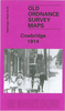
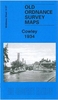
Cowley Road - A History

Once a ”respectable” white working-class suburb, Cowley Road is today the heartland of alternative Oxford. Famous for its restaurants and specialist shops, the street has also developed a n enviable reputation for its music and nightlife. Half a century of immigration and student growth has transformed Cowley Road into a lively thoroughfare synonymous with youth and multicultural expression. Annie Skinner traces the development of Cowley Road, looking at the impact of changing population and tastes on an urban environment. She considers how the street survived potentially devastating planning blight, witnessed political ferment in the 1970s and 1980s, and finally became a fashionably bohemian part of Oxford. Based on interviews and local archives, she reveals a largely untold
history of a street that is both typical of modern Britain and unique in its political and cultural dynamism. * Cultural melting-pot: churches and mosques; restaurants and retailing; a multi-ethnic community. * Politics and protest: revolutionaries and hippies; a tradition of radicalism; feminism and gay rights; the fight against racism; reds and greens.* Dancing in the street: Radiohead, Supergrass and the Zodiac; the street that never sleeps; the Cowley Road Carnival.
RIP - This product is no longer available on our network. It was last seen on 25.09.2019

This page now acts as a permanent archive for this product. Add more information using the comments box below to ensure it can still be found by future generations.

Use our search facility to see if it is available from an alternative contributor.
  • External links may include paid for promotion
  • Availability: Out Of Stock
  • Supplier: Stanfords
  • SKU: 9781904955108
Availability: In Stock
£5.99

Product Description

Once a ”respectable” white working-class suburb, Cowley Road is today the heartland of alternative Oxford. Famous for its restaurants & specialist shops, the street has also developed a n enviable reputation for its music & nightlife. Half a century of immigration & student growth has transformed Cowley Road into a lively thoroughfare synonymous with youth & multicultural expression. Annie Skinner traces the development of Cowley Road, looking at the impact of changing population & tastes on an urban environment. She considers how the street survived potentially devastating planning blight, witnessed political ferment in the 1970s & 1980s, & finally became a fashionably bohemian part of Oxford. Based on interviews & local archives, she reveals a largely untold history of a street that is both typical of modern Britain & unique in its political & cultural dynamism. * Cultural melting-pot: churches & mosques; restaurants & retailing; a multi-ethnic community. * Politics & protest: revolutionaries & hippies; a tradition of radicalism; feminism & gay rights; the fight against racism; reds & greens.* Dancing in the street: Radiohead, Supergrass & the Zodiac; the street that never sleeps; the Cowley Road Carnival.

Reviews/Comments

Add New

Intelligent Comparison

Oooops!
We couldn't find anything!
Perhaps this product's unique.... Or perhaps we are still looking for comparisons!
Click to bump this page and we'll hurry up.

Price History

Vouchers

No voucher codes found.
Do you know a voucher code for this product or supplier? Add it to Insights for others to use.

Facebook

Jargon Buster

White - A colour combining all colours
History - Anything that happens in the past. An acedemic subject.
Road - a manmade lane or a path that is used to speed up travel.
Alternative - Another available choice or possibility
Synonymous - A word that has a similar meaning to another.
Environment - The conditions and surrounding area.

Supplier Information

Stanfords
Stanfords was established in 1853 and opened their iconic Covent Garden flagship store in 1901. They have become the top retailer of maps, travel books and accessories in the UK and arguably offer the largest selection of maps and travel books worldwide. Famous names such as Captain Robert Falcon Scott, Ranulph Fiennes and Michael Palin have purchased from Stanfords. They now have a shop in Bristol and both stores together with other venues operate a calendar of events including talks, book signings and exhibitions. As a specialist map retailer, the map selection is comprehensive and includes road maps, street maps and walking maps from worldwide destinations, as well as a selection of world atlases and wall maps. Books include travel guides and travel literature. Stanfords also stock globes, from miniatures made of blue marble to magnificent floor-standing globes. The website features a selection of interesting articles on travel topics.
Page Updated: 2023-11-12 20:15:36

Community Generated Product Tags

Oh No! The productWIKI community hasn't generated any tags for this product yet!
Menu