
 United Kingdom
 France
 Germany
 Netherlands
 Sweden
 USA
USA
 Italy
Italy
 Spain
Spain
More From Contributor


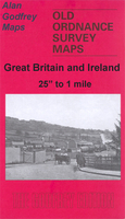
Chesterfield 1914
Chesterfield in 1914 in a fascinating series of reproductions of old Ordnance Survey plans in the Alan Godfrey Editions, ideal for anyone interested in the history of their neighbourhood or family. Selected towns in Great Britain and Ireland are covered by maps showing the extent of urban development in the last decades of the 19th and early 20th century.In this title: the map covers Chesterfield, extending westward to New Brampton and southward to the Whitehouses area. Features include Midland Railway with station, GCR railway with Market Place station and Great Central station, Midland Railway Brampton Branch with several sidings and industrial connections, Tube Works, St Mary & All Saints church, Market Place, New Square, Market Hall, tramways, Bryan Donkin Engineering Works,
Broad Oak Foundry, Hospital, Station Hotel, Queen's Park, West Park area, Furnacehill area, New Brampton area, Wheatbridge Mills, Brampton Iron Works, Brampton Colliery, Holme Brook Works, Workhouse, Boythorpe Colliery (disused), many other industrial works, etc. On the reverse is a list of private residents for Chesterfield and New Brampton from the 1891 directory.About the Alan Godfrey Editions of the 25
Broad Oak Foundry, Hospital, Station Hotel, Queen's Park, West Park area, Furnacehill area, New Brampton area, Wheatbridge Mills, Brampton Iron Works, Brampton Colliery, Holme Brook Works, Workhouse, Boythorpe Colliery (disused), many other industrial works, etc. On the reverse is a list of private residents for Chesterfield and New Brampton from the 1891 directory.About the Alan Godfrey Editions of the 25
Product Description
Reviews/Comments
Add New
Intelligent Comparison
Archived Product
Chesterfield Midi Stanfords
£3.99
Archived Product
Petersfield 1908 Stanfords
£3.50
Vouchers
No voucher codes found.
Do you know a voucher code for this product or supplier? Add it to Insights for others to use.
Do you know a voucher code for this product or supplier? Add it to Insights for others to use.
 Denmark