
 United Kingdom
 France
 Germany
 Netherlands
 Sweden
 USA
USA
 Italy
Italy
 Spain
Spain
More From Contributor


Central Asia
Indexed, waterproof and tear-resistant road map with topographic and tourist information for the Central Asian countries of Uzbekistan, Turkmenistan, Kyrgyzstan and Tajikistan, plus the southernmost part of Kazakhstan between Almaty and Qyzylorda. The map, published by Reise Know-How as part of their highly acclaimed World Mapping Project, is double-sided to provide the best balance between a good scale and a convenient size sheet.Road and rail networks are easy to see on a clear base which shows the area

Product Description
Reviews/Comments
Add New
Intelligent Comparison
Archived Product
Central Asia Stanfords
£15.99
Archived Product
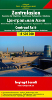
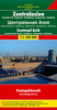
Central Asia F&B Stanfords
£10.99
Archived Product
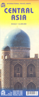
Central Asia ITMB Stanfords
£9.99
Archived Product
Central Australia Stanfords
£8.95
Archived Product
Central America Stanfords
£7.95
Archived Product
Central America Stanfords
£10.99
Archived Product

Central America Stanfords
£16.99
Archived Product
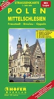
Central Silesia Stanfords
£15.99
Vouchers
No voucher codes found.
Do you know a voucher code for this product or supplier? Add it to Insights for others to use.
Do you know a voucher code for this product or supplier? Add it to Insights for others to use.
 Denmark