
 United Kingdom
 France
 Germany
 Netherlands
 Sweden
 USA
USA
 Italy
Italy
 Spain
Spain
More From Contributor


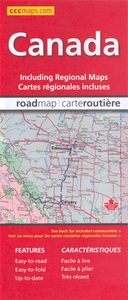
Canada (CCC Map)
Canada at 1:6, 000, 000 on a double-sided map from the Canadian Cartographics Corporation combining an overview map of the country with, on the reverse, more detailed mapping of its more densely populated regions.On one side is an overview map of the whole country at 1:6, 000, 000 extending north beyond 75º of latitude to include the southern part of Ellesmere Island. Each province is presented in different colour. The map shows the road network, highlighting Trans-Canada Highway. Railway lines are not included. Numerous rivers and lakes provide topographic information, with national or provincial parks and forests highlighted. The map has latitude and longitude lines at 5º intervals and also shows time zone boundaries.On the reverse the more densely populated areas are shows on
separate panels with their road networks presented in greater details:* Southern Québec around Montréal and Québec City at 1:1, 250, 000* Ontario from Ottawa to Windsor and Detroit at 1:1, 000, 000* Southern New Brunswick with central Nova Scotia at 1:900, 000* Southern Manitoba, Saskatchewan from Regina to Saskatoon, and Alberta around Calgary and Edmonton, each at 1:1, 875.000* Southern British Columbia from Vancouver Island to the Kootenay Lake at 1:1, 875, 000Also provided is a comprehensive distance table.*Please note:* following a number changes among Canadian cartographic publishers maps previously published by MapArt Publishing may now be available under one of the following imprints: MapArt, Canadian Cartographics Corporation or JDM Géo Inc. Within a series, therefore,
some titles may still be published as MapArt whilst others will be available as Canadian Cartographics Corporation or JDM Géo Inc.
 "Pin It")
Product Description
Reviews/Comments
Add New
Vouchers
No voucher codes found.
Do you know a voucher code for this product or supplier? Add it to Insights for others to use.
Do you know a voucher code for this product or supplier? Add it to Insights for others to use.
 Denmark