More From Contributor

£5.99
California Deserts Camping & Hiking in the Moon Spotlight guide series; covering a range of specific local cities, districts, areas & regions in North, Central & South America & targeted at those seeking to travel to a specific area within a country. Each of the guides has been extracted in full from the relevant country Moon Handbook & individual titles focus on a particular city, region or notable area of the destination. Many of the guides in the series are unique in their coverage, although are limited in putting the destination into its wider geographical context that a more comprehensive guide would provide. Stylistically, Moon ...
Archived Product
£6.99
California Deserts Camping & Hiking (including Death Valley Mojave, Joshua Tree & Anza-Borrego) in the Moon Outdoor Guides series; exploring a wide range of outdoor activities
- including camping, biking fishing & hiking
- in a number of various American states & regions. Moon is one of America

...
Archived Product
£13.59
California in the Discover series from Lonely Planet; covering a range of countries worldwide & practically designed to allow travellers to find the most iconic sites & attractions at a glance. Uniquely designed, each title in the series

Includes::
a series of lists of the best things to do & see, with highlights, thematic

...
Archived Product
£15.99
California in the Thomas Cook Driving Guides series; comprising a range of guides dedicated to exploring a selection of the best car tours & drives in Britain, Europe, Australasia & North America. The guides are designed to provide readers with a flexible reference source to explore the region or country by car; taking in the best local attractions & things to do & see. Recommended driving tours are linked with local sights for each chapter & total driving time is indicated clearly. An introductory section gives an overview of the destination with details of the place & its people, history, art & architecture, culture, geography & food & drink. Each chapter is divided into a touring area which is rated in categories such as architecture, entertainment & children to allow readers to plan a drive accordingly. Individual chapters give an outline of the region & provide practical guidance on getting there & around. A dedicated ...
Archived Product
£5.99
California in the Essential Guides Series from the AA, exploring the best places to see & things to do in a range of popular destinations. Each illustrated, pocket-sized guide is divided into five sections
- the essence of the area, planning your trip, the best places to see, best things to do & an exploration of notable highlights, organised by area. An introductory chapter profiles each destination &

Includes::
notes on local cuisine & recommendations for short breaks. A planning section advises on pre-trip preparations & getting there & around as well as outlining useful language tips & what


...
Archived Product
£16.99
California Eyewitness travel guide from Dorling Kindersley is a lavishly illustrated book concerned with providing the visitor with detailed background information to sightseeing in the country & a broad cultural introduction. Popular historical buildings & museums are often described with cutaway diagrams allowing you to view ...
Archived Product
£12.74
California Eyewitness travel guide from Dorling Kindersley is a lavishly illustrated book concerned with providing the visitor with detailed background information to sightseeing in the country & a broad cultural introduction. Popular historical buildings & museums are often described with cutaway diagrams allowing you to view ...
Archived Product
£10.99
California at 1:600, 000 on a large, double-sided road map from Freytag & Berndt with a booklet attached to the map cover containing an index & street plans of downtown Los Angeles & San Francisco plus The Strip area of Las Vegas. The map divides California north/south with a generous overlap between the sides. Coverage extends eastwards to include Las Vegas with Lake Mead & the Hoover Dam. Bold relief shading with plenty of names of mountain ranges, etc, plus colouring for national/state parks & other protected areas. Outside the major conurbations road network is well presented, with road & junction numbers easy to read & driving distances marked on most small local routes. Unfortunately, in the San Francisco Bay area & particularly in the Los Angeles conurbation the map shows so many place names that road network is very difficult to follow. Icons highlight various places of interest, including numerous campsites. The map has latitude & longitude lines at intervals of 20’. Multilingual map legend included English. The index is in a separate booklet attached to the map cover; the booklet also provides street plans of central Los Angeles, San Francisco & Las Vegas. ...
Archived Product
£18.99
California Fishing in the Moon Outdoor Guides series; exploring a wide range of outdoor activities
- including camping, biking
...
Archived Product

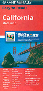
California Easy-to-Read Rand McNally

California Easy-to-Read map from Rand McNally, US leading publisher of road maps and street plans, in their extensive series of state maps. Additional panels provide enlargements for the three main urban conurbations: the San Francisco Bay area (SF – Oakland – San Jose), Los Angeles and Vicinity (extending east to San Bernardino and Riverside) and San Diego and Vicinity – each with a street plan of downtown area (SF, LA and SD); plus Bakersfield; Fresno; Lancaster - Palmdale; Modesto; Monterey - Salinas; Oceanside; Oxnard - Ventura; Palm Springs; Sacramento; Santa Barbara; Santa Rosa; Stockton; Yosemite National Park, Joshua Tree National Park; Kings Canyon and Sequoia National Parks; and Lake Tahoe Region.For clarity of road information Rand McNally state maps present the road
network on a plain background, with no or little topographic detail. Driving distances are indicated on all principal highways and on many local routes. National or state parks and other protected areas, Indian Reservations and restricted entry military zones are highlighted and symbols indicate campsites, rest areas, various places of interest, etc. Each map shows local administrative boundaries with names of the counties, is indexed and gives geographical coordinates as margin ticks usually at 1° intervals. Rand McNally state maps are available in two formats: double-sided Easy-to-Read maps with numerous enlargements for cities and/or most visited areas, and laminated Easy-to-Fold maps in a more handy format but with smaller print. TO SEE THE LIST OF RAND McNALLY STATE MAPS
PLEASE CLICK ON THE SERIES LINK.
RIP - This product is no longer available on our network. It was last seen on 25.09.2019

This page now acts as a permanent archive for this product. Add more information using the comments box below to ensure it can still be found by future generations.

Use our search facility to see if it is available from an alternative contributor.
  • Availability: Out Of Stock
  • Supplier: Stanfords
  • SKU: 9780528881107
Availability: In Stock
£6.99

Product Description

California Easy-to-Read map from Rand Mc Nally, US leading publisher of road maps & street plans, in their extensive series of state maps. Additional panels provide enlargements for the three main urban conurbations: the San Francisco Bay area (SF – Oakland – San Jose), Los Angeles & Vicinity (extending east to San Bernardino & Riverside) & San Diego & Vicinity – each with a street plan of downtown area (SF, LA & SD); plus Bakersfield; Fresno; Lancaster
- Palmdale; Modesto; Monterey
- Salinas; Oceanside; Oxnard
- Ventura; Palm Springs; Sacramento; Santa Barbara; Santa Rosa; Stockton; Yosemite National Park, Joshua Tree National Park; Kings Canyon & Sequoia National Parks; & Lake Tahoe Region. For clarity of road information Rand Mc Nally state maps present the road network on a plain background, with no or little topographic detail. Driving distances are indicated on all principal highways & on many local routes. National or state parks & other protected areas, Indian Reservations & restricted entry military zones are highlighted & symbols indicate campsites, rest areas, various places of interest, etc. Each map shows local administrative boundaries with names of the counties, is indexed & gives geographical coordinates as margin ticks usually at 1° intervals. Rand Mc Nally state maps are available in two formats: double-sided Easy-to-Read maps with numerous enlargements for cities and/or most visited areas, & laminated Easy-to-Fold maps in a more handy format but with smaller print. TO SEE THE LIST OF RAND Mc NALLY STATE MAPS PLEASE CLICK ON THE SERIES LINK.

Reviews/Comments

Add New

Price History

Vouchers

No voucher codes found.
Do you know a voucher code for this product or supplier? Add it to Insights for others to use.

Facebook

Jargon Buster

Palm - The centre of a hand when facing upwards
Palm - A hardware manufacturer of smart phones and personal digital assistants
Santa - Also known as Santa Claus is a legendary figure believed to bring gifts to good children on the night of Christmas Eve / Christmas Day
Network - A link and communication between things. Often computers or people.
Road - a manmade lane or a path that is used to speed up travel.
Laminated - A thin layer of plastic that gives a coating and shine to a material.
Print - A mechanical process of putting text onto paper. It can also relate to a pattern on an item.

Supplier Information

Stanfords
Stanfords was established in 1853 and opened their iconic Covent Garden flagship store in 1901. They have become the top retailer of maps, travel books and accessories in the UK and arguably offer the largest selection of maps and travel books worldwide. Famous names such as Captain Robert Falcon Scott, Ranulph Fiennes and Michael Palin have purchased from Stanfords. They now have a shop in Bristol and both stores together with other venues operate a calendar of events including talks, book signings and exhibitions. As a specialist map retailer, the map selection is comprehensive and includes road maps, street maps and walking maps from worldwide destinations, as well as a selection of world atlases and wall maps. Books include travel guides and travel literature. Stanfords also stock globes, from miniatures made of blue marble to magnificent floor-standing globes. The website features a selection of interesting articles on travel topics.
Page Updated: 2023-11-12 20:15:36

Community Generated Product Tags

Oh No! The productWIKI community hasn't generated any tags for this product yet!
Menu