More From Contributor

£20.00
Fine Cell Work is a charity which makes beautiful handmade products in British prisons. Our unique products have been designed in collaboration with some of the country’s leading contemporary designers & are all h&-produced in limited editions. Teaching prisoners high-quality needlework boosts their self-worth, instils self-discipline, fosters hope & encourages them to lead independent, crime-free lives. They are trained by volunteers before carrying out their work in-cell & in prison workshops. We also provide post-prison support upon release. At our London-based community hub we provide work experience, formal training & employment to ex-prisoners, with the aim of getting them back into work. Fine Cell Work in numbers:• We work in 32 prisons• We work with 500 prisoners a year, we have 200 prisoners on a waiting list to join• We made 4872 products in 2017 in prisons across the UK• On average prisoners spend 24 hours a week stitching• The most difficult cushion takes 200 hours to stitch • 96% of stitchers are men• The reoffending rate amongst Fine Cell Work’s trainees is 7% compared to a national average of 46% ...
Archived Product
£14.99
Match the upper sides & undersides of the wings of 25 species of butterfly from around the world in this beautifully illustrated matching game. With all kinds of stunning species--from the painted lady to the violet emperor--this fun & educational game is an ideal gift that will appeal to nature lovers everywhere.

Includes::
a mini dossier on each species. Can also be used as a memory game when you get to know the butterflies. Collect more pairs than your opponent to win!

...
Archived Product
£16.00
This is a definitive rock climbing guidebook to the diverse mountain crags Buttermere, Newlands & the sandstone sea cliffs of St Bees in the Lake District. It is published by the Fell & Rock Climbing Club & written by Colin Read & Paul Jennings. It is profusely illustrated with action climbing photos & Phil Rigby`s superb color photo diagrams & containing a wealth of interesting historical information. The book features 340 pages, plastic cover, & marker ribbon. ...
Archived Product
£2.95
Buxton in 1897 in a fascinating series of reproductions of old Ordnance Survey plans in the Alan Godfrey Editions, ideal for anyone interested in the history of their neighbourhood or family. Selected towns in Great Britain & Ireland are covered by maps showing the extent of urban development in the last decades of the 19th & early 20th century. In this title: the map covers the centre of the spa town of Buxton, extending eastward to Fairfield & Fairfiel Farm. Southward coverage extends to Spencer Road, westward to Burlington Road. Features include the Midland & LNW stations, Higher Buxton station, Hogshaw area, Fairfield area, Buxton Gardens, Devonshire Hospital, Palace Hotel, The Pavilion, Cricket Ground, Corvar Hall, Wye House, Higher Buxton area, gas works, Sty Peter's church Fairfield, The Crescent, Hardwick Mount area, Trinity church, St John's church, Market Place, Old Hall Hotel, George Hotel, Spring Gardens, livery stables, Onward Cottages etc. On the reverse is a Buxton ' Private Residents' directory & a Fairfield directory for 1891. About the Alan Godfrey Editions of the 25 ...
Archived Product
£3.50
Buxton in 1897 in a fascinating series of reproductions of old Ordnance Survey plans in the Alan Godfrey Editions, ideal for anyone interested in the history of their neighbourhood or family. The map covers the centre of the spa town of Buxton, extending eastward to Fairfield & Fairfiel Farm. Southward coverage extends to Spencer Road & westward to Burlington Road. Features include the Midland & LNW stations, Higher Buxton station, Hogshaw area, Fairfield area, Buxton Gardens, Devonshire Hospital, Palace Hotel, The Pavilion, Cricket Ground, Corvar Hall, Wye House, Higher Buxton area, gas works, Sty Peter`s church Fairfield, The Crescent, Hardwick Mount area, Trinity church, St John`s church, Market Place, Old Hall Hotel, George Hotel, Spring Gardens, livery stables, Onward Cottages, etc. On the reverse is a Buxton ` Private Residents` directory & a Fairfield directory for 1891. About the Alan Godfrey Editions of the 25” OS Series: Selected towns in Great Britain & Ireland are covered by maps showing the extent of urban development in the last decades of the 19th & early 20th century. The plans have been taken from the Ordnance Survey mapping & reprinted at about 15 inches to one mile (1:4, 340). On the reverse most maps have historical notes & many also include extracts from contemporary directories. Most maps cover about one mile (1.6kms) north/south, one & a half miles (2.4kms) across; adjoining sheets can be combined to provide wider coverage.FOR MORE INFORMATION & A COMPLETE LIST OF ALL AVAILABLE TITLES PLEASE CLICK ON THE SERIES LINK. ...
Archived Product
£7.99
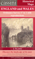
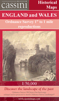
Map No. 119, Buxton & Matlock 1837-1842, in the Cassini Historical Series of old Ordnance Survey mapping of England & Wales at 1:50, 000 in a format designed to offer a convenient comparison with the present day coverage from the OS, & most locations in three different editions. Old historical maps have been combined so that the sheet lines correspond to the current Landranger series & reproduced with the scale changed from one inch to one mile to 1:50, 000. Most locations are covered by three separate maps, showing how the area has changed over the decades, with selected major cities also presented in a fourth edition. Old Series: the first detailed survey mapping dating for most areas from the first half of the 19th century, in black & white & with relief shown by hachuring. Revised New Series from 1880s/1900s, with some colouring & a mixture of hachuring & contour lines. Popular Edition from the inter-war years, with contour lines & colouring to indicate woodlands, parks, etc. New Popular Edition from the late 1940s, reproduced in the Cassini series for the major cities. Each map

Includes::
notes on the development of Ordnance Survey & the various series produced by them. For those interested in maps & cartography in general, the Cassini series also provides a fascinating insight into how Ordnance Survey cartographic style has developed over a period of over 100 years. Coverage

Includes::
present day Bakewell, Chesterfield, Dronfield, Clay Cross, Belper, Wirksworth, Ashbourne, Cheadle, Alton, Brailsford, Duffield, Mayfield, Hulland Ward, Tissington, Ilam, Ipstones, Waterhouses, Crich, South Wingfield, Cromford, Wetton, Warslow, Winster, Youlgreave, Hartington, Longnor, Rowsley Wingerworth, Monyash, Edensor, Baslow, Taddington, Eyam, Common Side, Grindleford, Tideswell & Dove Holes, with the Peak District National Park including the Dove Dale. PLEASE NOTE: Stanfords can also print on request mapping from all four series centring the map on a location of your choice. For more information please click on the link below.


...
Archived Product
£14.99
Map No. 119, Buxton & Matlock 1921-1923, in the Cassini Historical Series of old Ordnance Survey mapping of England & Wales at 1:50, 000 in a format designed to offer a convenient comparison with the present day coverage from the OS, & most locations in three different editions. Old historical maps have been combined so that the sheet lines correspond to the current Landranger series & reproduced with the scale changed from one inch to one mile to 1:50, 000. Most locations are covered by three separate maps, showing how the area has changed over the decades, with selected major cities also presented in a fourth edition. Old Series: the first detailed survey mapping dating for most areas from the first half of the 19th century, in black & white & with relief shown by hachuring. Revised New Series from 1880s/1900s, with some colouring & a mixture of hachuring & contour lines. Popular Edition from the inter-war years, with contour lines & colouring to indicate woodlands, parks, etc. New Popular Edition from the late 1940s, reproduced in the Cassini series for the major cities. Each map

Includes::
notes on the development of Ordnance Survey & the various series produced by them. For those interested in maps & cartography in general, the Cassini series also provides a fascinating insight into how Ordnance Survey cartographic style has developed over a period of over 100 years. Coverage

Includes::
present day Bakewell, Chesterfield, Dronfield, Clay Cross, Belper, Wirksworth, Ashbourne, Cheadle, Alton, Brailsford, Duffield, Mayfield, Hulland Ward, Tissington, Ilam, Ipstones, Waterhouses, Crich, South Wingfield, Cromford, Wetton, Warslow, Winster, Youlgreave, Hartington, Longnor, Rowsley Wingerworth, Monyash, Edensor, Baslow, Taddington, Eyam, Common Side, Grindleford, Tideswell & Dove Holes, with the Peak District National Park including the Dove Dale. PLEASE NOTE: Stanfords can also print on request mapping from all four series centring the map on a location of your choice. For more information please click on the link below.


...
Archived Product
£9.99
Map No. 119, Buxton & Matlock 1902-1903, in the Cassini Historical Series of old Ordnance Survey mapping of England & Wales at 1:50, 000 in a format designed to offer a convenient comparison with the present day coverage from the OS, & most locations in three different editions. Old historical maps have been combined so that the sheet lines correspond to the current Landranger series & reproduced with the scale changed from one inch to one mile to 1:50, 000. Most locations are covered by three separate maps, showing how the area has changed over the decades, with selected major cities also presented in a fourth edition. * Old Series: the first detailed survey mapping dating for most areas from the first half of the 19th century, in black & white & with relief shown by hachuring.* Revised New Series from 1880s/1900s, with some colouring & a mixture of hachuring & contour lines.* Popular Edition from the inter-war years, with contour lines & colouring to indicate woodlands, parks, etc.* New Popular Edition from the late 1940s, reproduced in the Cassini series for the major cities. Each map

Includes::
notes on the development of Ordnance Survey & the various series produced by them. For those interested in maps & cartography in general, the Cassini series also provides a fascinating insight into how Ordnance Survey cartographic style has developed over a period of over 100 years. Coverage

Includes::
present day Bakewell, Chesterfield, Dronfield, Clay Cross, Belper, Wirksworth, Ashbourne, Cheadle, Alton, Brailsford, Duffield, Mayfield, Hulland Ward, Tissington, Ilam, Ipstones, Waterhouses, Crich, South Wingfield, Cromford, Wetton, Warslow, Winster, Youlgreave, Hartington, Longnor, Rowsley Wingerworth, Monyash, Edensor, Baslow, Taddington, Eyam, Common Side, Grindleford, Tideswell & Dove Holes, with the Peak District National Park including the Dove Dale.* PLEASE NOTE: Stanfords can also print on request mapping from all four series *centring the map on a location of your choice.* For more information please click on the link below.


...
Archived Product
£9.99
Map No. 119, Buxton & Matlock 1921-1923, in the Cassini Historical Series of old Ordnance Survey mapping of England & Wales at 1:50, 000 in a format designed to offer a convenient comparison with the present day coverage from the OS, & most locations in three different editions. Old historical maps have been combined so that the sheet lines correspond to the current Landranger series & reproduced with the scale changed from one inch to one mile to 1:50, 000. Most locations are covered by three separate maps, showing how the area has changed over the decades, with selected major cities also presented in a fourth edition. * Old Series: the first detailed survey mapping dating for most areas from the first half of the 19th century, in black & white & with relief shown by hachuring.* Revised New Series from 1880s/1900s, with some colouring & a mixture of hachuring & contour lines.* Popular Edition from the inter-war years, with contour lines & colouring to indicate woodlands, parks, etc.* New Popular Edition from the late 1940s, reproduced in the Cassini series for the major cities. Each map

Includes::
notes on the development of Ordnance Survey & the various series produced by them. For those interested in maps & cartography in general, the Cassini series also provides a fascinating insight into how Ordnance Survey cartographic style has developed over a period of over 100 years. Coverage

Includes::
present day Bakewell, Chesterfield, Dronfield, Clay Cross, Belper, Wirksworth, Ashbourne, Cheadle, Alton, Brailsford, Duffield, Mayfield, Hulland Ward, Tissington, Ilam, Ipstones, Waterhouses, Crich, South Wingfield, Cromford, Wetton, Warslow, Winster, Youlgreave, Hartington, Longnor, Rowsley Wingerworth, Monyash, Edensor, Baslow, Taddington, Eyam, Common Side, Grindleford, Tideswell & Dove Holes, with the Peak District National Park including the Dove Dale.* PLEASE NOTE: Stanfords can also print on request mapping from all four series *centring the map on a location of your choice.* For more information please click on the link below.


...
Archived Product
£10.39
Map No. 119, Buxton & Matlock, in a waterproof & tear-resistant version of the Ordnance Survey Landranger series at 1:50, 000, including Bakewell, Chesterfield, Dronfield, Clay Cross, Belper, Wirksworth, Ashbourne, Cheadle, Alton, Brailsford, Duffield, Mayfield, Hulland Ward, Tissington, Ilam, Ipstones, Waterhouses, Crich, South Wingfield, Cromford, Wetton, Warslow, Winster, Youlgreave, Hartington, Longnor, Rowsley Wingerworth, Monyash, Edensor, Baslow, Taddington, Eyam, Common Side, Grindleford, Tideswell & Dove Holes, with the Peak District National Park including the Dove Dale, plus a small section of the E2 European Long Distance Path. Edition C4; Publication date: February 2010 This title is also available on our website in a paper version. Maps in this series are only published folded. Stanfords can also print flat versions of Ordnance Survey maps through the OS Select system, centring the map on a location of your choice & with a picture provided by you on the cover. For more information please click on the link at the bottom of this description. About Ordnance Survey ...
Archived Product

Buxton And Matlock

Map No. 119, Buxton and Matlock, in the Ordnance Survey Landranger series at 1:50, 000, including Bakewell, Chesterfield, Dronfield, Clay Cross, Belper, Wirksworth, Ashbourne, Cheadle, Alton, Brailsford, Duffield, Mayfield, Hulland Ward, Tissington, Ilam, Ipstones, Waterhouses, Crich, South Wingfield, Cromford, Wetton, Warslow, Winster, Youlgreave, Hartington, Longnor, Rowsley Wingerworth, Monyash, Edensor, Baslow, Taddington, Eyam, Common Side, Grindleford, Tideswell and Dove Holes, with the Peak District National Park including the Dove Dale, plus a small section of the E2 European Long Distance Path. Edition C4; Publication date: February 2010 This title is also available on our website in a waterproof and tear-resistant version.Maps in this series
are only published folded. Stanfords can also print flat versions of Ordnance Survey maps through the OS Select system, centring the map on a location of your choice and with a picture provided by you on the cover. For more information please click on the link at the bottom of this description.About Ordnance Survey
RIP - This product is no longer available on our network. It was last seen on 25.09.2019

This page now acts as a permanent archive for this product. Add more information using the comments box below to ensure it can still be found by future generations.

Use our search facility to see if it is available from an alternative contributor.
  • Availability: Out Of Stock
  • Supplier: Stanfords
  • SKU: 9780319231890
Availability: In Stock
£5.59

Product Description

Map No. 119, Buxton & Matlock, in the Ordnance Survey Landranger series at 1:50, 000, including Bakewell, Chesterfield, Dronfield, Clay Cross, Belper, Wirksworth, Ashbourne, Cheadle, Alton, Brailsford, Duffield, Mayfield, Hulland Ward, Tissington, Ilam, Ipstones, Waterhouses, Crich, South Wingfield, Cromford, Wetton, Warslow, Winster, Youlgreave, Hartington, Longnor, Rowsley Wingerworth, Monyash, Edensor, Baslow, Taddington, Eyam, Common Side, Grindleford, Tideswell & Dove Holes, with the Peak District National Park including the Dove Dale, plus a small section of the E2 European Long Distance Path. Edition C4; Publication date: February 2010 This title is also available on our website in a waterproof & tear-resistant version. Maps in this series are only published folded. Stanfords can also print flat versions of Ordnance Survey maps through the OS Select system, centring the map on a location of your choice & with a picture provided by you on the cover. For more information please click on the link at the bottom of this description. About Ordnance Survey

Reviews/Comments

Add New

Price History

Vouchers

No voucher codes found.
Do you know a voucher code for this product or supplier? Add it to Insights for others to use.

Facebook

Jargon Buster

Date - A day on a calendar
Date - A social activity whith a current or potential partner
Waterproof - Resistant to water, usualy specified by depth in metres
Small - something that takes up less space than normal.
Resistant - Something that can repel against something.
Print - A mechanical process of putting text onto paper. It can also relate to a pattern on an item.

Supplier Information

Stanfords
Stanfords was established in 1853 and opened their iconic Covent Garden flagship store in 1901. They have become the top retailer of maps, travel books and accessories in the UK and arguably offer the largest selection of maps and travel books worldwide. Famous names such as Captain Robert Falcon Scott, Ranulph Fiennes and Michael Palin have purchased from Stanfords. They now have a shop in Bristol and both stores together with other venues operate a calendar of events including talks, book signings and exhibitions. As a specialist map retailer, the map selection is comprehensive and includes road maps, street maps and walking maps from worldwide destinations, as well as a selection of world atlases and wall maps. Books include travel guides and travel literature. Stanfords also stock globes, from miniatures made of blue marble to magnificent floor-standing globes. The website features a selection of interesting articles on travel topics.
Page Updated: 2023-11-12 20:15:36

Community Generated Product Tags

Oh No! The productWIKI community hasn't generated any tags for this product yet!
Menu