
 United Kingdom
 France
 Germany
 Netherlands
 Sweden
 USA
USA
 Italy
Italy
 Spain
Spain
More From Contributor


Brazil Wildlife Guide
This exciting guide aims to inspire and help travellers to plan and enjoy tours in Brazil's finest wildlife reserves.In addition to offering advice on planning your trip and discussing available options as well as park etiquette, the guide offers an overview of Brazil's natural environment and wildlife, including an informative gallery of species.Brazil's 10 best parks or groupings of parks are profiled, which includes an overview of the featured park, a brief history, a description by area of the park, and special features to look out for. The parks all offer breath-taking scenic beauty, game viewing, a range of accommodation and facilities as well as tours and walks or hikes.Each park profile also includes: panels on matters of special interest; scenic and wildlife photographs;
detailed maps showing biomes, routes, camps, picnic spots, scenic spots, places to see, etc; tables showing the range of accommodation, activities and facilities available; what to look out for at which time of year; game-viewing checklist; gate opening- and closing- times; and contact details of featured park, for bookings.
detailed maps showing biomes, routes, camps, picnic spots, scenic spots, places to see, etc; tables showing the range of accommodation, activities and facilities available; what to look out for at which time of year; game-viewing checklist; gate opening- and closing- times; and contact details of featured park, for bookings.
Product Description
Reviews/Comments
Add New
Intelligent Comparison
Archived Product
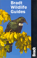
Bradt Wildlife Guides Stanfords
£13.99
Archived Product
Brazil Key Guide Stanfords
£14.99
Archived Product
Brazil Spiral Guide Stanfords
£9.99
Archived Product

Travellers` Wildlife Guides Stanfords
£18.99
Archived Product
Costa Rica Wildlife Guide Stanfords
£12.99
Archived Product

Brazil Cruising Guide Stanfords
£39.50
Archived Product

Brazil Traveler Guide Stanfords
£22.50
Vouchers
No voucher codes found.
Do you know a voucher code for this product or supplier? Add it to Insights for others to use.
Do you know a voucher code for this product or supplier? Add it to Insights for others to use.
 Denmark