More From Contributor
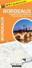
£39.95
Internationally acclaimed star chef Rodolfo Guzman of Borago introduces the exciting world of high-end Chilean gastronomy. ” It isn`t every day that a restaurant knocks your socks off, but Borago managed it with ease.” -Financial Times Chef Rodolfo Guzman serves a dynamic, wildly imaginative tasting menu at his acclaimed Santiago restaurant Borago, using only native Chilean ingredients
- often reinventing his courses mid-service. The book combines his fascinating narratives about Chilean geography & ingredients, his never-before-published notebook sketches of dishes & creative processes, & gorgeous landscape & food photographs that introduce readers to the distinctive pleasures of Chilean culture & cuisine. This is rounded off by Guzman`s selection of 100 savoury & sweet recipes exclusively chosen from the menu at Borago.
...
Archived Product
£16.99
Sverigeserien is an outdoor map series consisting of 116 sheets with coverage of southern & central Sweden & the northern coastline. The map is suitable for outdoor activities such as hiking, excursions, trail running, hunting, fishing, riding, cycling, mountain biking, paddling, skating & much more. Every sheet covers an area of 45x 68km. These topographical maps in scale 1:50 000 contain all the information needed for outdoor activities: Terrain information, hiking trails, illuminated tracks, camping, shelters, golf courses, leisure baths, historical remains, roads in different categories, railway lines & much more. Easy to read topography with contour lines, vertical interval 5 m. Sverigeserien is a high-quality map series & is durable for frequent use! Updated content with map data from Lantmäteriet (National Land Survey of Sweden) & printed on Polyart which is water & tear resistant. This means that the map can be folded repeatedly without breaking & can withstand the challenging weather in Sweden during both winter & summer. Legend is in Swedish, English & German. ...
Archived Product
£12.99
Jagshemash! In coitus with Kazakh, Minister of Information, televiski journalist Borat Sagdiyev is take great pleasuring himself to present this touristic guides to the glorious Nation of Kazakhstan: home to Tinshein Swimming Pool & br&-new Capitalist Supermall Viktor Hotelier's Shopcity
- three stores & electrical staircase! Turn the book over, & read Borat's travel guidings journal to the minor nation of US & A! Containing most explicit guidings to American peoples & many many photographs never before looked upon, this book really is a very nice!
...
Archived Product
£16.99
Topographic survey of Sweden at 1:100, 000, the Vägkartan, from the Lantmäteriet, covering most of the country in 79 double-sided maps. Please note: the mountainous regions of central & northern Sweden are not covered by this series but presented in a separate “ Fjällkartan
- Mountain Map” series also listed on our website. Each 1:100, 000 topographic survey map covers an area of 75 x 80km. The maps have contours at 10 metre intervals, plus relief shading & colouring for different types of landscape: open l&, forests, alvar, marshes, etc. Boundaries of national parks & nature reserves, areas prohibited to cross-country vehicles, & restricted entry military zones are marked. The maps indicate privately maintained local roads, cycle paths with wind shelters, footpaths, etc, & include all other information expected of topographic survey at this scale. The maps have a 2-km UTM grid, plus latitude & longitude lines 10’ intervals. Map legend

Includes::
English. For coverage of the country’s most visited hiking areas in central & northern Sweden please see Lantmäteriet’s Mountain Map series, listed separately on our website.


...
Archived Product
£16.99
Topographic survey of Sweden at 1:50, 000, the Terrängkartan, from the Lantmäteriet, covering most of the country in 244 double-sided maps. Please note: the mountainous regions of central & northern Sweden are not covered by this series but presented in a separate “ Fjällkartan
- Mountain Map” series also listed on our website. Each 1:50, 000 topographic survey map covers an area of 37.5 x 40km. The maps have contours at 5 metre intervals, plus relief shading & graphics for rocky outcrops & boulders. Further graphics and/or colouring show different types of land use or vegetation (forests, arable l&, orchards, marshes, peat bogs, etc). An unusual feature of this survey is the colouring indicating buildings below or above two storeys high & “leisure/holiday homes”. The maps indicate privately maintained roads & include all other information expected of topographic survey at this scale. The maps have a 1-km UTM grid, plus latitude & longitude lines 5’ intervals. Map legend

Includes::
English. For coverage of the country’s most visited hiking areas in central & northern Sweden please see Lantmäteriet’s Mountain Map series, listed separately on our website.


...
Archived Product
£8.50
Street plan of the Bordeaux conurbation with an enlargement of the city’s town centre. An 80-page booklet

Includes::


...
Archived Product
£5.99
Bordeau & the Gironde in the Everyman Map Guide series; comprising a range of practical guide books incorporating large scale maps to a number of international cities & regions. Including a unique binding method, each district, neighbourhood, area or region has an accompanying fold-out page with a large scale overview map which is fully indexed. Each Map Guide also has details of more than 100 shops, restaurants, bars, clubs, markets & other local attractions, in addition to more practical guidance, listed underneath & on the reverse of the fold-out map. All of the main attractions also have accompanying illustrations, & there are also transport maps & a street index to help visitors find their way around. ...
Archived Product
£8.99
Map No.145, Bordeaux – Arcachon, at 1:100, 000, part of the TOP100 series from the Institut Géographique National (IGN). These exceptionally detailed, contoured & GPS compatible road maps which include English language map legend are ideal for exploring the French countryside by car, by bike, or even on foot. Used by millions of locals & tourists alike, this series provides an excellent balance between coverage of a sufficiently wide area & detailed road presentation, plus topographic information not found on other road maps of France. For several decades now these maps, previously known as Série Verte, have been one of Stanfords’ leading bestsellers.PLEASE NOTE: to see the full specifications of the cartography (contour interval, GPS compatibility, etc) & the list of all the titles in this series please click on the series link. Coverage in this title (as shown on our coverage image) extends east to Libourne & St-Èmilion & south to the resorts around the Bassin d’ Arcachon, &

Includes::
the famous claret vineyards of the Bordeaux region, Blaye, Jonzac, etc.

...
Archived Product
£8.99
Map No. 152, Bordeaux
- Mont-de-Marsan at 1:100, 000, part of the TOP100 series from the Institut Géographique National (IGN).
...
Archived Product
£12.99
Topographic survey of France at 1:25, 000 in IGN`s excellent TOP25 / Série Bleue series. All the maps are GPS compatible, with a 1km UTM grid plus latitude & longitude lines at 5’ intervals. Contours are at 5m intervals except for mountainous areas where the maps have contours at 10m intervals, vividly enhanced by hill shading & graphics for rocky terrain. Colouring with graphics indicates different types of vegetation or land use (deciduous or coniferous forests, moors, orchards, vineyards, etc). PLEASE NOTE: coverage of France at this scale is currently being revised – the format & the presentation of each title are indicated by the letters at the end of its Sheet Reference number (e.g. 0416ET, 3531ETR, 1923SB, etc.)MAPS WITH FULL TOURIST OVERPRINT & AN ENGLISH MAP LEGEND: all TOP25 maps & the SB editions of Série Bleue have an overprint highlighting waymarked walking trails including long-distance GR routes &, where appropriate, ski routes. Symbols indicate campsites, gîtes d’etape, refuges, equestrian centres & other recreational facilities or sites, tourist information centres, cultural heritage, etc. Towns & locations of particular interest are highlighted.- ET or OT = single-sided TOP25 map covering approx. 29x 21 km / 18x 13 miles.- ETR or OTR = waterproof & tear resistant TOP25 map covering the same area as the corresponding ET or OT number, but double-sided, printed on a smaller size sheet with a good overlap between the sides.- SB = Série Bleue map with full tourist overprint; these maps, first introduced in summer 2014, each cover approx. 29x 24km / 18x 15 miles.SÉRIE BLEUE maps with numbers ending in E (Est) or O (Ouest): most editions now indicate the GR routes, but do not show any other tourist information. Map legend is in French only. Each map covers approx. 14x 20km / 9x 12 miles. ...
Archived Product

Bordeaux

Refreshingly witty and readable guide to the world's most famous wine region. Every producer in the world with ambitions to make great red wine still looks to Bordeaux for inspiration and the region is brought to life by Oz with his evocative descriptions and personal anecdotes, accompanied by stunning photographs and maps. Oz turns his spotlight on each of the famous Bordeaux wine areas (including St-Emilion, Pomerol, Margaux and Pauillac) and also recommends hundreds of affordable, modern Bordeaux chateaux, recommended by style and price, for drinking today. Returning to his wine roots, Oz shows how, whatever crises may be affecting the French wine industry in general and the lower end of the market in particular, Bordeaux is, on the whole, in optimistic mode. However much we
now appreciate wine from all over the world, there is still nothing quite as magical as the best bottles from the best producers in this historic wine region. 'There is no better introduction to the world's most dazzling wine region.' Decanter 'A well-planned, well-executed, approachable book packed with information and illustrations, ' The Sunday Times
RIP - This product is no longer available on our network. It was last seen on 25.09.2019

This page now acts as a permanent archive for this product. Add more information using the comments box below to ensure it can still be found by future generations.

Use our search facility to see if it is available from an alternative contributor.
  • External links may include paid for promotion
  • Availability: Out Of Stock
  • Supplier: Stanfords
  • SKU: 9781862058309
Availability: In Stock
£25.00

Product Description

Refreshingly witty & readable guide to the world's most famous wine region. Every producer in the world with ambitions to make great red wine still looks to Bordeaux for inspiration & the region is brought to life by Oz with his evocative descriptions & personal anecdotes, accompanied by stunning photographs & maps. Oz turns his spotlight on each of the famous Bordeaux wine areas (including St-Emilion, Pomerol, Margaux & Pauillac) & also recommends hundreds of affordable, modern Bordeaux chateaux, recommended by style & price, for drinking today. Returning to his wine roots, Oz shows how, whatever crises may be affecting the French wine industry in general & the lower end of the market in particular, Bordeaux is, on the whole, in optimistic mode. However much we now appreciate wine from all over the world, there is still nothing quite as magical as the best bottles from the best producers in this historic wine region. ' There is no better introduction to the world's most dazzling wine region.' Decanter 'A well-planned, well-executed, approachable book packed with information & illustrations, ' The Sunday Times

Reviews/Comments

Add New

Intelligent Comparison

Oooops!
We couldn't find anything!
Perhaps this product's unique.... Or perhaps we are still looking for comparisons!
Click to bump this page and we'll hurry up.

Price History

Vouchers

No voucher codes found.
Do you know a voucher code for this product or supplier? Add it to Insights for others to use.

Facebook

Jargon Buster

Wine - An alcoholic drink made from fermented grapes.
Red - One of the three primary colours
World - A physical grouping, commonly used to describe earth and everything associated with ti
Affordable - Something that is within a set price range that can be afforded due to its reasonable price.
Personal - Something that belongs more to an individual due to it affecting them more by relating to them.
illustrations - Pictures typically in books and newspapers.

Supplier Information

Stanfords
Stanfords was established in 1853 and opened their iconic Covent Garden flagship store in 1901. They have become the top retailer of maps, travel books and accessories in the UK and arguably offer the largest selection of maps and travel books worldwide. Famous names such as Captain Robert Falcon Scott, Ranulph Fiennes and Michael Palin have purchased from Stanfords. They now have a shop in Bristol and both stores together with other venues operate a calendar of events including talks, book signings and exhibitions. As a specialist map retailer, the map selection is comprehensive and includes road maps, street maps and walking maps from worldwide destinations, as well as a selection of world atlases and wall maps. Books include travel guides and travel literature. Stanfords also stock globes, from miniatures made of blue marble to magnificent floor-standing globes. The website features a selection of interesting articles on travel topics.
Page Updated: 2023-11-12 20:15:36

Community Generated Product Tags

Oh No! The productWIKI community hasn't generated any tags for this product yet!
Menu