
 United Kingdom
 France
 Germany
 Netherlands
 Sweden
 USA
USA
 Italy
Italy
 Spain
Spain
More From Contributor


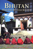
Bhutan
Bhutan at 1:380, 000 on an indexed map from ITMB showing its topography by altitude colouring and highlighting places of interest, plus providing street pland of Thimpu and Paro annotated with useful tourist information.The map has altitude colouring but in rather broad bands for such a mountainous country (in metres: 50, 200, 500, 1000, 2000, 3000, 5000 plus glaciers). National Parks are highlighted. Road network includes selected local track. No driving distances are marked. Symbols indicate various places of interest including campsites, religious temples, etc. Also shown are the country
Product Description
Reviews/Comments
Add New
Intelligent Comparison
Archived Product
Bhutan Stanfords
£12.79
Vouchers
No voucher codes found.
Do you know a voucher code for this product or supplier? Add it to Insights for others to use.
Do you know a voucher code for this product or supplier? Add it to Insights for others to use.
 Denmark