
 United Kingdom
 France
 Germany
 Netherlands
 Sweden
 USA
USA
 Italy
Italy
 Spain
Spain
More From Contributor

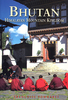
Bhutan Himalaya
Indexed general map of Bhutan, providing a general overview of main trekking routes. Bold hill-shading indicates the general relief, and light green shading highlights the national park areas. Highways, main roads and selected minor routes are marked, and highlighted in different colours are the trekking routes. Selected peaks passes and altitudes are marked, and a few more symbols denote campsites, post offices, fortresses, monasteries, buddhist monuments, places of interest and airports. Margin ticks show latitude and longitude in steps of 1', and the map corner coordinates are stated. Indexed for place names, fortresses, passes and peaks.Inside the map cover are printed some geographical notes on the country and driving and trekking times between selected locations.
Product Description
Reviews/Comments
Add New
Intelligent Comparison
Archived Product

Bhutan Himalaya Stanfords
£24.99
Archived Product

Buddhist Himalayas Stanfords
£18.95
Vouchers
No voucher codes found.
Do you know a voucher code for this product or supplier? Add it to Insights for others to use.
Do you know a voucher code for this product or supplier? Add it to Insights for others to use.
 Denmark