
 United Kingdom
 France
 Germany
 Netherlands
 Sweden
 USA
USA
 Italy
Italy
 Spain
Spain
More From Contributor


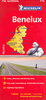


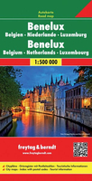
Benelux F&B
Benelux road map at 1:500, 000 from Freytag & Berndt with good coverage of the Eifel and the Rhine Valley in Germany. The index booklet attached to the map cover has street plans of central Amsterdam, The Hague, Brussels and Luxembourg City.Road network is graded into six different types of roads, with driving distances shown on most routes and motorway services clearly marked. Scenic routes are highlighted. The map also shows railway network, local airports, and both internal and international ferry services. Small symbols indicate various places of interest. National parks are highlighted. Latitude and longitude lines are drawn at 30` intervals. Map legend includes English.

Product Description
Reviews/Comments
Add New
Intelligent Comparison
Archived Product
Belgium F&B Stanfords
£10.99
Archived Product
Belarus F&B Stanfords
£10.99
Vouchers
No voucher codes found.
Do you know a voucher code for this product or supplier? Add it to Insights for others to use.
Do you know a voucher code for this product or supplier? Add it to Insights for others to use.
 Denmark