More From Contributor
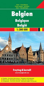
£24.95
Beer Professor Kevin Verstrepen & Beer Doctor Miguel Roncoroni put 250 Belgian beers to the test in their lab, resulting in a complete encyclopaedia with scientific analyses of the taste & aroma profiles & the chemical composition of beer. The beer team of the Flemish Institute for Biotechnology (VIB) went into the laboratory for 2 years to subject 252 Belgian beers to thorough chemical analysis & to a panel of objective guinea pigs. The result is this definitive guide, which finally decomposes the complex composition of our favourite barley into the molecule & illustrates it for every type of beer lover. Get to know which flavour you prefer & search for similar flavours & varieties amongst the huge range of Belgian beers. ...
Archived Product
£9.99
The coast of Belgium at 1:50, 000 in a series from Falk B.V. showing the network of signposted cycling routes on large, double-sided indexed maps with prominent highlighting of long-distance LF routes, symbols indicating accommodation & other tourist services, plus in each title two or more panels with recommended local circuits & additional tourist information. The Falk 50K cycling series, which

Includes::
some adjoining areas in Lower Saxony & has now been extended to cover Flanders, shows the extensive network of sign-posted cycling routes. The network consists of numbered junctions joined by sign-posted connecting routes in either direction. At each junction there is an information panel showing an overview map of the whole network with the junction numbers. A second panel shows all the intersections directly connected to that junction. The system enables cyclists to plan their own routes by preparing a list of junction numbers through which they want to travel. Falk maps give cycling distances between the junctions & indicate which roads, both within the numbered network & outside it, have separate cycling paths. Routes which are part of the LF network of long-distance cycle routes are clearly marked. A wide range of symbols shows various accommodation options, bars & restaurants, & various places of interest. Landscape information is provided by colouring for woodlands, dunes, etc. The maps are indexed & show in the margins latitude & longitude at 1`52” intervals. Map legend

Includes::
English.PLEASE NOTE: to see other titles in the Falk series please click on the series link, where the series description

Includes::
a comparison between the Falk maps & the ANWB cycling series also covering the Netherlands at 1:50, 000.


...
Archived Product
£14.99
Cycling Atlas of the Belgian province of Limburg with an extension to Maastricht & Aachen, a total of 740km of cycling paths, presented by the Verlag Esterbauer in guide with maps at 1:75, 000 showing the routes & their variants. Extensive information is conveyed by symbols, indicating road surface, campsites & other accommodation, repair workshops, recreational facilities, places of interest, etc. A list of various types of accommodation facilities is included.IMPORTANT
- PLEASE NOTE BEFORE ORDERING
- ALL THE TEXT IN THIS TITLE IS GERMAN ONLY. MAP LEGEND

Includes::
ENGLISH (please see our sample image) & the information provided on the maps is sufficient to use this title without any knowledge of German.ABOUT THE BIKELINE SERIES: all the titles have been meticulously researched & are highly regarded in their native Germany. Most titles, as indicated in their individual descriptions, also include a separate section listing selected accommodation, from hotels to campsites, youth hostels & rooms in private houses, all with addresses, telephone numbers & price range. Information on towns along each route

Includes::
a list of places of interest, with opening hours, etc. Several of the guides also have street plans. To see the list of other titles in the Bikeline series please click on the series link.


...
Archived Product
£9.99
The Limburg province of Belgium at 1:50, 000 in a series from Falk B.V. showing the network of signposted cycling routes on large, double-sided indexed maps with prominent highlighting of long-distance LF routes, symbols indicating accommodation & other tourist services, plus in each title two or more panels with recommended local circuits & additional tourist information. The Falk 50K cycling series, which

Includes::
some adjoining areas in Lower Saxony & has now been extended to cover Flanders, shows the extensive network of sign-posted cycling routes. The network consists of numbered junctions joined by sign-posted connecting routes in either direction. At each junction there is an information panel showing an overview map of the whole network with the junction numbers. A second panel shows all the intersections directly connected to that junction. The system enables cyclists to plan their own routes by preparing a list of junction numbers through which they want to travel. Falk maps give cycling distances between the junctions & indicate which roads, both within the numbered network & outside it, have separate cycling paths. Routes which are part of the LF network of long-distance cycle routes are clearly marked. A wide range of symbols shows various accommodation options, bars & restaurants, & various places of interest. Landscape information is provided by colouring for woodlands, dunes, etc. The maps are indexed & show in the margins latitude & longitude at 1`52” intervals. Map legend

Includes::
English.PLEASE NOTE: to see other titles in the Falk series please click on the series link, where the series description

Includes::
a comparison between the Falk maps & the ANWB cycling series also covering the Netherlands at 1:50, 000.


...
Archived Product
£55.00
This book offers a complete overview of all thirty Belgian abbey beers. Where is the rich patrimony of Belgian abbey beers rooted? What are the remarkable stories about this authentic, labour-intensive product. In which way are Trappist beers different from the others? In Belgian Trappist & Abbey Beers, Jef Van den Steen unravels the different stages in the production process of the beers & talks very passionately about the origin & development of the various breweries within the walls or under the license of the abbey. Each brewery is presented with practical information, different types of beer, & the author always

Includes::
tips for tourists. Photographer Andrew Verschetze magnificently captures the beers from the barrel to the glass.

...
Archived Product
£15.99
Belgium in the Blue Guides series focuses primarily on cultural tourism for the visitor who wishes to understand more of what they might see &, as such, the title provides thorough & objective reference information covering art, history & architecture. The guide features illustrations aimed to inform rather than just decorate, such as maps, diagrams, floor plans, architectural details & photographs. Cross referenced indexing means information is accessible & layout navigable. Selective listings of restaurants & accommodation are chosen in the belief that good, practical recommendations will contribute to the enjoyment of good art & culture. ...
Archived Product
£10.99
Belgium on a double-sided road map at 1:250, 000 from the Nationaal Geografisch Instituut / Institut Geographique National, the country’s national survey organization, with an index of place names in a separate booklet. The map has topographic base with contours at 50m intervals, but without relief shading to emphasise more hilly regions such as the Ardennes. Colouring shows woodlands, orchards, etc. Road network is graded according to widths & the number of lanes; motorway junctions are clearly numbered & service or rest areas are marked. Railway lines are shown with stations. Some places of tourist interest are also indicated. Within Flanders some place names are given in their bilingual version (Mesen / Messines), others only in Flemish, so Ieper & not Ypres. The map has latitude & longitude margin ticks at 1’ intervals. Map legend

Includes::
English.

...
Archived Product
£11.99
Belgium & Luxembourg in the Countries, Regions & Cities series from Rough Guides; comprehensively detailed guidebooks specifically designed for independent travellers & serving a range of worldwide destinations. Widely recognised for their free editorial style, Rough Guide authors are allowed to express their personal opinions on a range of subjects. Although sometimes controversial, this editorial stance allows readers to experience more detailed & personal takes on each destination, a feature often more limited in other guidebooks. Cultural & historical nuances are explored in significant depth throughout the text & descriptions on the ambience of individual settings alongside personal recommendations, particularly in cities, are notably prevalent. Each Rough Guide in the Countries, Regions & Cities series has a similar layout. A ...
Archived Product
£14.99
The DK Eyewitness Belgium & Luxembourg Travel Guide is your indispensable guide to this beautiful part of the world. The fully updated guide

Includes::
unique cutaways, floorplans & reconstructions of the must-see sites, plus street-by-street maps of all the fascinating cities & towns. The new-look guide is also packed with photographs & illustrations leading you straight to the best attractions on offer. The uniquely visual DK Eyewitness Travel guide will help you to discover everything region-by-region; from local festivals & markets to day trips around the countryside. Detailed listings will guide you to the best hotels, restaurants, bars & shops for all budgets, whilst detailed practical information will help you to get around, whether by train, bus or car. DK Eyewitness Travel Guides
- showing you what others only tell you.


...
Archived Product
£14.99
The DK Eyewitness Travel Guide Belgium & Luxembourg will lead you straight to the best attractions Belgium & Luxembourg has to offer. The guide

Includes::
unique cutaways, floorplans & reconstructions of the city`s stunning architecture, plus 3D aerial views of the key districts to explore on foot. You`ll find detailed listings of the best hotels, restaurants, bars & shops for all budgets in this fully updated & expanded guide, plus insider tips on everything from where to find the best markets & nightspots to great attractions for children. The uniquely visual DK Eyewitness Travel Guide also

Includes::
in-depth coverage of all the unforgettable sights & comes complete with a free pull-out city map, clearly marked with sights from the guidebook & an easy-to-use street index. The map has detailed street views of all the key areas, plus there are transport maps & information on how to get around the city, & there`s even a chart showing the distances between major sights for walkers. The DK Eyewitness Travel Guide Belgium & Luxembourg shows you what others only tell you.


...
Archived Product

Belgium

Double-sided topographic map of the country from Belgium's national survey organisation. Detail includes minor roads, railways, airports, power transmission lines, waterways, woods, orchards, sand dunes, regional & provincial boundaries. Intermediate driving distances are marked on main roads. Symbols denote landmarks such as castles, forts, power stations and lighthouses. Relief is indicated by spot heights and contours at 50-metres intervals. Bathymetric contours are also drawn.Margin ticks at 1' intervals show latitude and longitude. Index for inhabited places is on a separate index.Map legend includes English.
RIP - This product is no longer available on our network. It was last seen on 25.09.2019

This page now acts as a permanent archive for this product. Add more information using the comments box below to ensure it can still be found by future generations.

Use our search facility to see if it is available from an alternative contributor.
  • External links may include paid for promotion
  • Availability: Out Of Stock
  • Supplier: Stanfords
  • SKU: 9789059341111
Availability: In Stock
£10.95

Product Description

Double-sided topographic map of the country from Belgium's national survey organisation. Detail

Includes::
minor roads, railways, airports, power transmission lines, waterways, woods, orchards, sand dunes, regional & provincial boundaries. Intermediate driving distances are marked on main roads. Symbols denote landmarks such as castles, forts, power stations & lighthouses. Relief is indicated by spot heights & contours at 50-metres intervals. Bathymetric contours are also drawn. Margin ticks at 1' intervals show latitude & longitude. Index for inhabited places is on a separate index. Map legend

Includes::
English.

Reviews/Comments

Add New

Price History

Vouchers

No voucher codes found.
Do you know a voucher code for this product or supplier? Add it to Insights for others to use.

Facebook

Jargon Buster

Metres - A unit of measure, one metre equals 100 centimetres
Railways - A set of tracks that have been laid for the purpose of trains to travel up and down them
Regional - An adjective to describe a set geographic area.

Supplier Information

Stanfords
Stanfords was established in 1853 and opened their iconic Covent Garden flagship store in 1901. They have become the top retailer of maps, travel books and accessories in the UK and arguably offer the largest selection of maps and travel books worldwide. Famous names such as Captain Robert Falcon Scott, Ranulph Fiennes and Michael Palin have purchased from Stanfords. They now have a shop in Bristol and both stores together with other venues operate a calendar of events including talks, book signings and exhibitions. As a specialist map retailer, the map selection is comprehensive and includes road maps, street maps and walking maps from worldwide destinations, as well as a selection of world atlases and wall maps. Books include travel guides and travel literature. Stanfords also stock globes, from miniatures made of blue marble to magnificent floor-standing globes. The website features a selection of interesting articles on travel topics.
Page Updated: 2023-11-12 20:15:36

Community Generated Product Tags

Oh No! The productWIKI community hasn't generated any tags for this product yet!
Menu