
 United Kingdom
 France
 Germany
 Netherlands
 Sweden
 USA
USA
 Italy
Italy
 Spain
Spain
More From Contributor


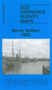


Belfast Shankill 1901
Belfast Shankill in 1901 in a fascinating series of reproductions of old Ordnance Survey plans in the Alan Godfrey Editions, ideal for anyone interested in the history of their neighbourhood or family. The map covers a busy area of north west Belfast, including the Crumlin Road, Shankill Road and Woodvale Road area. Coverage stretches from Agnes Street westward to Ballygomartin Road, and from Ardilea Street southward to Conway Street and Cupar Street Factory. Features include Lawnbrook Weaving Factory, Glenwood Mill, Cupar Street Factory, Springfield School, Springfield Bleach Works, Forth River Brick Works, bleach greens, Springhill, Brookfield Weaving Factory, Woodvale Park, Edenderry Mill, Belfast Foundry, Crumlin Road, Parkview Brick Works, Ballygomartin Road,
Glenview, Glencairn, Crumlin Road Flax Mill, Brookfield Flax Spinning Mill, Rosebank Factory, Holy Cross RC Chapel, Edenderry House, Ardoyne house, St Mary`s church, Manor Hall, etc. On the reverse are street directory entries for Argyle Street, Beresford Street, Berlin Street and Shankill Road.About the Alan Godfrey Editions of the 25” OS Series:Selected towns in Great Britain and Ireland are covered by maps showing the extent of urban development in the last decades of the 19th and early 20th century. The plans have been taken from the Ordnance Survey mapping and reprinted at about 15 inches to one mile (1:4, 340). On the reverse most maps have historical notes and many also include extracts from contemporary directories. Most maps cover about one mile (1.6kms) north/south,
one and a half miles (2.4kms) across; adjoining sheets can be combined to provide wider coverage.FOR MORE INFORMATION AND A COMPLETE LIST OF ALL AVAILABLE TITLES PLEASE CLICK ON THE SERIES LINK.

Product Description
Reviews/Comments
Add New
Intelligent Comparison
Archived Product
Belfast Skegoneill 1901 Stanfords
£2.95
Archived Product

Belfast Skegoneill 1901 Stanfords
£3.50
Archived Product
Belfast The Falls 1931 Stanfords
£2.95
Archived Product

Belfast The Falls 1931 Stanfords
£3.50
Archived Product
Belfast South 1920 Stanfords
£2.95
Vouchers
No voucher codes found.
Do you know a voucher code for this product or supplier? Add it to Insights for others to use.
Do you know a voucher code for this product or supplier? Add it to Insights for others to use.
 Denmark