
 United Kingdom
 France
 Germany
 Netherlands
 Sweden
 USA
USA
 Italy
Italy
 Spain
Spain
More From Contributor


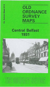
Belfast Central 1931
Belfast Central in 1931 in a fascinating series of reproductions of old Ordnance Survey plans in the Alan Godfrey Editions, ideal for anyone interested in the history of their neighbourhood or family. The central area of Belfast, with coverage stretching from Distillery Street eastward to Albert Bridge, and from Smithfield southward to Cromwell Road. Note that the Co Down area east of the Lagan is left blank. Features include City Hall, Donegall Place, Donegall Square, Great Victoria Street area, Great Victoria Street terminus with sidings and goods sheds, Belfast Central Branch, Queen`s Bridge station, tramways, Ulster Hall, Royal Belfast Academical Institution, Crescent Presbyterian Church, Linfield Factory, Ulster Linen Works, weaving factories, gas works, Mays Market,
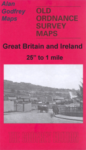
St George`s Market, other markets, Royal Courts of Justice, Victoria Square, cinemas, Shaftesbury Square area, Sandy Row area, Grand Opera House, Cromac Square, etc.About the Alan Godfrey Editions of the 25” OS Series:Selected towns in Great Britain and Ireland are covered by maps showing the extent of urban development in the last decades of the 19th and early 20th century. The plans have been taken from the Ordnance Survey mapping and reprinted at about 15 inches to one mile (1:4, 340). On the reverse most maps have historical notes and many also include extracts from contemporary directories. Most maps cover about one mile (1.6kms) north/south, one and a half miles (2.4kms) across; adjoining sheets can be combined to provide wider coverage.FOR MORE INFORMATION AND A
COMPLETE LIST OF ALL AVAILABLE TITLES PLEASE CLICK ON THE SERIES LINK.

Product Description
Reviews/Comments
Add New
Intelligent Comparison
Archived Product

Newcastle Central 1914 Stanfords
£3.50
Archived Product
Belfast The Falls 1931 Stanfords
£2.95
Archived Product

Belfast The Falls 1931 Stanfords
£3.50
Archived Product

Glasgow Central 1934 Stanfords
£3.50
Archived Product
Glasgow Central 1893 Stanfords
£3.50
Archived Product

Newcastle Central 1894 Stanfords
£3.50
Vouchers
No voucher codes found.
Do you know a voucher code for this product or supplier? Add it to Insights for others to use.
Do you know a voucher code for this product or supplier? Add it to Insights for others to use.
 Denmark