
 United Kingdom
 France
 Germany
 Netherlands
 Sweden
 USA
USA
 Italy
Italy
 Spain
Spain
More From Contributor


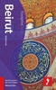

Beirut And Beyond Street Atlas
Beirut and Beyond Street Atlas from Zawarib in an A5, paperback format, covering the city itself on very detailed mapping at 1:4, 500, plus its environs at 1:9, 000. Extensive index also lists institutions, facilities, services and other places of interest marked on the plan.Detailed mapping covering the city at 1:4, 500 indicates and, where appropriate names numerous institutions, facilities and services, including government buildings, educational institutions, culture and entertainment, religious establishments, petrol stations and car parks, etc, as well as hotels, banks, restaurants and bars. All are colour-coded for easier identification. One way streets are marked.Similarly annotated maps but at a less detailed scale of 1:9, 000 cover the city
Product Description
Reviews/Comments
Add New
Intelligent Comparison
Archived Product

Bolton And Bury Street Atlas Stanfords
£5.50
Archived Product
Bradford Street Atlas Stanfords
£4.95
Archived Product

Saarland Region Street Atlas Stanfords
£19.95
Archived Product

Saarland Region Street Atlas Stanfords
£25.99
Archived Product
Swindon Street Atlas Stanfords
£4.50
Archived Product
Chichester And Bognor Street Atlas Stanfords
£4.50
Archived Product
Southend Street Atlas Stanfords
£4.95
Vouchers
No voucher codes found.
Do you know a voucher code for this product or supplier? Add it to Insights for others to use.
Do you know a voucher code for this product or supplier? Add it to Insights for others to use.
 Denmark