
 United Kingdom
 France
 Germany
 Netherlands
 Sweden
 USA
USA
 Italy
Italy
 Spain
Spain
More From Contributor


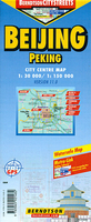
Beijing
City map of Beijing with two inset maps of the outlying region, and a map of the Beijing Subway.The cartography shows all main roads and thoroughfares, with one-streets and pedestrian zones all clearly marked. Transport links are comprehensively indexed, with railways, bus routes, underground and even trolley-bus routes all shown. Built-up areas and vegetation are displayed with colour grading, and points of interest are marked, such as churches, synagogues, temples; as well as this, police stations, hospitals, and public buildings are indicated.The reverse contains the full map index, with a small index of phone numbers and addresses for embassies and foreign representatives, information centres and youth hostels.
Product Description
Reviews/Comments
Add New
Intelligent Comparison
Archived Product
Beijing Stanfords
£8.50
Archived Product
Beijing Stanfords
£10.39
Archived Product
Beijing Stanfords
£11.99
Archived Product

Beijing Stanfords
£17.50
Archived Product

Beijing Stanfords
£14.95
Archived Product
Beijing Stanfords
£8.99
Archived Product

Beijing Stanfords
£7.99
Archived Product
Beijing Blur Stanfords
£9.99
Vouchers
No voucher codes found.
Do you know a voucher code for this product or supplier? Add it to Insights for others to use.
Do you know a voucher code for this product or supplier? Add it to Insights for others to use.
 Denmark