More From Contributor
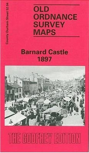
£3.50
Barmouth in 1900 in a fascinating series of reproductions of old Ordnance Survey plans in the Alan Godfrey Editions, ideal for anyone interested in the history of their neighbourhood or family. Points of interest include St Margarets School, St Tudwals RC Church, Orielton Hall & St Johns Church, Orielton Wood, Barmouth Bridge, Aber-Amffra Harbour & the Cambrian Railway. On the reverse is a map of the area to the north of Barmouth, including Parsel. About the Alan Godfrey Editions of the 25” OS Series: Selected towns in Great Britain & Ireland are covered by maps showing the extent of urban development in the last decades of the 19th & early 20th century. The plans have been taken from the Ordnance Survey mapping & reprinted at about 15 inches to one mile (1:4, 340). On the reverse most maps have historical notes & many also include extracts from contemporary directories. Most maps cover about one mile (1.6kms) north/south, one & a half miles (2.4kms) across; adjoining sheets can be combined to provide wider coverage.FOR MORE INFORMATION & A COMPLETE LIST OF ALL AVAILABLE TITLES PLEASE CLICK ON THE SERIES LINK. ...
Archived Product
£12.99
The sight of a ghostly Barn Owl quartering a field at dusk is not one that is easily forgotten, but the day-to-day lives of these captivating birds are little known to most people. In this book, insightful text coupled with rarely seen images of the species` life & behaviour introduces the reader to some of the most fascinating aspects of a remarkable nocturnal existence. There are chapters on subjects such as hunting, courtship & survival. The owls are further brought to life through a series of personal anecdotes from the author & photographer, which are woven into the text. The book is part of a series that also

Includes::
titles on the Kingfisher & Peregrine Falcon. Birdwatchers
- there are more than 1 million RSPB members in the UK & the pastime is growing in popularity in many countries around the world. It will have strong appeal to a wide readership encompassing general nature enthusiasts.


...
Archived Product
£10.00
Renowned nature writer Jim Crumley gets up close & personal with some of Britain`s most iconic & loved animals
- here, the barn
...
Archived Product
£8.99
The OS Landranger Map series covers Great Britain with 204 detailed maps, perfect for day trips & short breaks. Each map provides all the information you need to get to know your local area &

Includes::
places of interest, tourist information, picnic areas & camp sites, plus Rights of Way information for England & Wales. OS Landranger now

Includes::
a digital version of the paper map, accessed through the OS smartphone app, OS Maps.


...
Archived Product
£14.99
Waterproof & tear-resistant OS Active version of map No. 92 from the Ordnance Survey’s Landranger series at 1:50, 000, with contoured & GPS compatible topographic mapping plus tourist information.MOBILE DOWNLOADS: As well as the physical edition of the map, each Landranger title now

Includes::
a code for downloading after purchase its digital version onto your smartphone or tablet for viewing on the OS smartphone app.OS LANDRANGER SERIES: to see the list of all the titles in the OS Landranger series, both paper & waterproof versions, please click on the series link. Maps in the Landranger series provide plenty of recreational & tourist information, indicating the traditional public right of way paths (except in Scotland where different laws apply), including bridleways & byways restricted or open to motorized traffic. National Trails & selected other long-distance paths are marked, as well as on-road & traffic-free cycle routes with their National/ Regional Cycle Network numbers. National Trust/ National Trust for Scotland & Forestry Commission land is clearly marked, indicating open or restricted access. A range of symbols highlights camping & caravanning sites, youth hostels, tourist information offices & visitors’ centres, parking & picnicking places, World Heritage sites, sport & recreational facilities, etc. The maps provide detailed presentation of topography with contours at 10m intervals, numerous spot heights & additional colouring and/or graphics for different types of woodlands, orchards or parkl&, rock features including scree & cliffs, water features inland & along the sea shore with marshl&, dunes, s&, mud, shingle & the high water mark. All the standard information expected of survey mapping at this scale is included: finely graded road network, railway lines with stations, cuttings, embankments, etc; individual isolated buildings; archaeological & historical sites, etc. For GPS users the British National Grid is shown at 1km intervals, with latitude & longitude given by margin ticks at 1` & cross hairs on the map at 5`. Each map covers an area of 40 x 40km, (approx. 25 x 25 miles).

...
Archived Product
£5.59
Map No. 92, Barnard Castle & Richmond, in the Ordnance Survey Landranger series at 1:50, 000, including Ravenseat, Keld, Marske, Washfold, Gilling West, Gayles, Ravensworth, Barningham, Eppleby, Whorlton, Boldron, Bowes, Scargill, South Stainmore, North Stainmore, Huty, Cotherstone, Gainford, Staindrop, Bolam, Cockfield, Eggleston, Woodl&, High Etherley, Hunwick, Hamsterley, Middleton-in-Teesdale, Newbiggin, Langdon Beck, Harwood, St John ...
Archived Product
£9.99
Map No. 92, Barnard Castle & Richmond 1860-1866, in the Cassini Historical Series of old Ordnance Survey mapping of England & Wales at 1:50, 000 in a format designed to offer a convenient comparison with the present day coverage from the OS, & most locations in three different editions. Old historical maps have been combined so that the sheet lines correspond to the current Landranger series & reproduced with the scale changed from one inch to one mile to 1:50, 000. Most locations are covered by three separate maps, showing how the area has changed over the decades, with selected major cities also presented in a fourth edition. * Old Series: the first detailed survey mapping dating for most areas from the first half of the 19th century, in black & white & with relief shown by hachuring.* Revised New Series from 1880s/1900s, with some colouring & a mixture of hachuring & contour lines.* Popular Edition from the inter-war years, with contour lines & colouring to indicate woodlands, parks, etc.* New Popular Edition from the late 1940s, reproduced in the Cassini series for the major cities. Each map

Includes::
notes on the development of Ordnance Survey & the various series produced by them. For those interested in maps & cartography in general, the Cassini series also provides a fascinating insight into how Ordnance Survey cartographic style has developed over a period of over 100 years. Coverage

Includes::
present day Ravenseat, Keld, Marske, Washfold, Gilling West, Gayles, Ravensworth, Barningham, Eppleby, Whorlton, Boldron, Bowes, Scargill, South Stainmore, North Stainmore, Huty, Cotherstone, Gainford, Staindrop, Bolam, Cockfield, Eggleston, Woodl&, High Etherley, Hunwick, Hamsterley, Middleton-in-Teesdale, Newbiggin, Langdon Beck, Harwood, St John’s Chapel, Wearhead, Frosterley, Stanhope, Wolsingham, Crook & Tow Low, with part of the Yorkshire Dales National Park; Arkengarthdale, Teesdale, Weardale; the peaks of Nine Standards Rigg, Arndale Hill, Iron B&, Bink Moss, Swonhope Hill & Five Pikes; Cow Green, Selset, Hury & Balderhead Reservoirs; & the Pennine Way.* PLEASE NOTE: Stanfords can also print on request mapping from all four series *centring the map on a location of your choice.* For more information please click on the link below.


...
Archived Product
£14.99
Map No. 92, Barnard Castle & Richmond 1860-1925 (3-map set), in the Cassini Historical Series of old Ordnance Survey mapping of England & Wales at 1:50, 000 in a format designed to offer a convenient comparison with the present day coverage from the OS, & most locations in three different editions. Old historical maps have been combined so that the sheet lines correspond to the current Landranger series & reproduced with the scale changed from one inch to one mile to 1:50, 000. Most locations are covered by three separate maps, showing how the area has changed over the decades, with selected major cities also presented in a fourth edition. Old Series: the first detailed survey mapping dating for most areas from the first half of the 19th century, in black & white & with relief shown by hachuring. Revised New Series from 1880s/1900s, with some colouring & a mixture of hachuring & contour lines. Popular Edition from the inter-war years, with contour lines & colouring to indicate woodlands, parks, etc. New Popular Edition from the late 1940s, reproduced in the Cassini series for the major cities. Each map

Includes::
notes on the development of Ordnance Survey & the various series produced by them. For those interested in maps & cartography in general, the Cassini series also provides a fascinating insight into how Ordnance Survey cartographic style has developed over a period of over 100 years. Coverage

Includes::
present day Ravenseat, Keld, Marske, Washfold, Gilling West, Gayles, Ravensworth, Barningham, Eppleby, Whorlton, Boldron, Bowes, Scargill, South Stainmore, North Stainmore, Huty, Cotherstone, Gainford, Staindrop, Bolam, Cockfield, Eggleston, Woodl&, High Etherley, Hunwick, Hamsterley, Middleton-in-Teesdale, Newbiggin, Langdon Beck, Harwood, St John


...
Archived Product
£7.99
Map No. 92, Barnard Castle & Richmond 1903-1904, in the Cassini Historical Series of old Ordnance Survey mapping of England & Wales at 1:50, 000 in a format designed to offer a convenient comparison with the present day coverage from the OS, & most locations in three different editions. Old historical maps have been combined so that the sheet lines correspond to the current Landranger series & reproduced with the scale changed from one inch to one mile to 1:50, 000. Most locations are covered by three separate maps, showing how the area has changed over the decades, with selected major cities also presented in a fourth edition. Old Series: the first detailed survey mapping dating for most areas from the first half of the 19th century, in black & white & with relief shown by hachuring. Revised New Series from 1880s/1900s, with some colouring & a mixture of hachuring & contour lines. Popular Edition from the inter-war years, with contour lines & colouring to indicate woodlands, parks, etc. New Popular Edition from the late 1940s, reproduced in the Cassini series for the major cities. Each map

Includes::
notes on the development of Ordnance Survey & the various series produced by them. For those interested in maps & cartography in general, the Cassini series also provides a fascinating insight into how Ordnance Survey cartographic style has developed over a period of over 100 years. Coverage

Includes::
present day Ravenseat, Keld, Marske, Washfold, Gilling West, Gayles, Ravensworth, Barningham, Eppleby, Whorlton, Boldron, Bowes, Scargill, South Stainmore, North Stainmore, Huty, Cotherstone, Gainford, Staindrop, Bolam, Cockfield, Eggleston, Woodl&, High Etherley, Hunwick, Hamsterley, Middleton-in-Teesdale, Newbiggin, Langdon Beck, Harwood, St John


...
Archived Product
£9.99
Map No. 92, Barnard Castle & Richmond 1925, in the Cassini Historical Series of old Ordnance Survey mapping of England & Wales at 1:50, 000 in a format designed to offer a convenient comparison with the present day coverage from the OS, & most locations in three different editions. Old historical maps have been combined so that the sheet lines correspond to the current Landranger series & reproduced with the scale changed from one inch to one mile to 1:50, 000. Most locations are covered by three separate maps, showing how the area has changed over the decades, with selected major cities also presented in a fourth edition. * Old Series: the first detailed survey mapping dating for most areas from the first half of the 19th century, in black & white & with relief shown by hachuring.* Revised New Series from 1880s/1900s, with some colouring & a mixture of hachuring & contour lines.* Popular Edition from the inter-war years, with contour lines & colouring to indicate woodlands, parks, etc.* New Popular Edition from the late 1940s, reproduced in the Cassini series for the major cities. Each map

Includes::
notes on the development of Ordnance Survey & the various series produced by them. For those interested in maps & cartography in general, the Cassini series also provides a fascinating insight into how Ordnance Survey cartographic style has developed over a period of over 100 years. Coverage

Includes::
present day Ravenseat, Keld, Marske, Washfold, Gilling West, Gayles, Ravensworth, Barningham, Eppleby, Whorlton, Boldron, Bowes, Scargill, South Stainmore, North Stainmore, Huty, Cotherstone, Gainford, Staindrop, Bolam, Cockfield, Eggleston, Woodl&, High Etherley, Hunwick, Hamsterley, Middleton-in-Teesdale, Newbiggin, Langdon Beck, Harwood, St John’s Chapel, Wearhead, Frosterley, Stanhope, Wolsingham, Crook & Tow Low, with part of the Yorkshire Dales National Park; Arkengarthdale, Teesdale, Weardale; the peaks of Nine Standards Rigg, Arndale Hill, Iron B&, Bink Moss, Swonhope Hill & Five Pikes; Cow Green, Selset, Hury & Balderhead Reservoirs; & the Pennine Way.* PLEASE NOTE: Stanfords can also print on request mapping from all four series *centring the map on a location of your choice.* For more information please click on the link below.


...
Archived Product

Barnard Castle 1897

Barnard Castle in 1897 in a fascinating series of reproductions of old Ordnance Survey plans in the Alan Godfrey Editions, ideal for anyone interested in the history of their neighbourhood or family. Most of the town is covered and features include The Bank, Market Place, Horse Market, Galgate, Station Road with NER goods station (but not passenger station), Castle, St Mary`s church, Cattle Market, Wool House, Teesdale Workhouse, Bowes Museum, North Eastern County School, etc. The small area of Yorkshire across the River Tees includes Bridge End, Low Startforth, High Startforth and Holy Trinity church. A directory of private residents is on the reverse.About the Alan Godfrey Editions of the 25” OS Series:Selected towns in Great Britain and Ireland are covered by maps
showing the extent of urban development in the last decades of the 19th and early 20th century. The plans have been taken from the Ordnance Survey mapping and reprinted at about 15 inches to one mile (1:4, 340). On the reverse most maps have historical notes and many also include extracts from contemporary directories. Most maps cover about one mile (1.6kms) north/south, one and a half miles (2.4kms) across; adjoining sheets can be combined to provide wider coverage.FOR MORE INFORMATION AND A COMPLETE LIST OF ALL AVAILABLE TITLES PLEASE CLICK ON THE SERIES LINK.
RIP - This product is no longer available on our network. It was last seen on 25.09.2019

This page now acts as a permanent archive for this product. Add more information using the comments box below to ensure it can still be found by future generations.

Use our search facility to see if it is available from an alternative contributor.
  • External links may include paid for promotion
  • Availability: Out Of Stock
  • Supplier: Stanfords
  • SKU: 9780850546071
Availability: In Stock
£3.50

Product Description

Barnard Castle in 1897 in a fascinating series of reproductions of old Ordnance Survey plans in the Alan Godfrey Editions, ideal for anyone interested in the history of their neighbourhood or family. Most of the town is covered & features include The Bank, Market Place, Horse Market, Galgate, Station Road with NER goods station (but not passenger station), Castle, St Mary`s church, Cattle Market, Wool House, Teesdale Workhouse, Bowes Museum, North Eastern County School, etc. The small area of Yorkshire across the River Tees

Includes::
Bridge End, Low Startforth, High Startforth & Holy Trinity church. A directory of private residents is on the reverse. About the Alan Godfrey Editions of the 25” OS Series: Selected towns in Great Britain & Ireland are covered by maps showing the extent of urban development in the last decades of the 19th & early 20th century. The plans have been taken from the Ordnance Survey mapping & reprinted at about 15 inches to one mile (1:4, 340). On the reverse most maps have historical notes & many also include extracts from contemporary directories. Most maps cover about one mile (1.6kms) north/south, one & a half miles (2.4kms) across; adjoining sheets can be combined to provide wider coverage.FOR MORE INFORMATION & A COMPLETE LIST OF ALL AVAILABLE TITLES PLEASE CLICK ON THE SERIES LINK.

Reviews/Comments

Add New

Price History

Vouchers

No voucher codes found.
Do you know a voucher code for this product or supplier? Add it to Insights for others to use.

Facebook

Jargon Buster

Wool - A natural fibre from Sheep
Contemporary - Modern era design
Contemporary - A design reference to indicate post war modern design
History - Anything that happens in the past. An acedemic subject.
Small - something that takes up less space than normal.
Road - a manmade lane or a path that is used to speed up travel.
Horse - A large animal with four legs that tends to be ridden.
Contemporary - An object that is living in the same time.
Museum - A building which exhibits old artefacts for viewing of people who show interest.
Ideal - Something that satisfies a perfect criteria.
Family - A group of people that live together made up from parents and children.

Supplier Information

Stanfords
Stanfords was established in 1853 and opened their iconic Covent Garden flagship store in 1901. They have become the top retailer of maps, travel books and accessories in the UK and arguably offer the largest selection of maps and travel books worldwide. Famous names such as Captain Robert Falcon Scott, Ranulph Fiennes and Michael Palin have purchased from Stanfords. They now have a shop in Bristol and both stores together with other venues operate a calendar of events including talks, book signings and exhibitions. As a specialist map retailer, the map selection is comprehensive and includes road maps, street maps and walking maps from worldwide destinations, as well as a selection of world atlases and wall maps. Books include travel guides and travel literature. Stanfords also stock globes, from miniatures made of blue marble to magnificent floor-standing globes. The website features a selection of interesting articles on travel topics.
Page Updated: 2023-11-12 20:15:36

Community Generated Product Tags

Oh No! The productWIKI community hasn't generated any tags for this product yet!
Menu