
 United Kingdom
 France
 Germany
 Netherlands
 Sweden
 USA
USA
 Italy
Italy
 Spain
Spain
More From Contributor


Banbury 1881
Banbury in 1881 in a fascinating series of reproductions of old Ordnance Survey plans in the Alan Godfrey Editions, ideal for anyone interested in the history of their neighbourhood or family. Selected towns in Great Britain and Ireland are covered by maps showing the extent of urban development in the last decades of the 19th and early 20th century.In this title: two maps for Banbury have been published, showing how the town changed across the years. These detailed maps cover the centre and eastern side of Banbury. Coverage stretches from St Mary's church, the High Street and Dashwood House eastward to Grimsbury, and beyond that open fields and the county boundary. Features include the GWR and LNWR stations, Britannia Works, Oxford Canal, Market Place, Bridge Street, Town Hall,
Broad Street, Cherwell Works, corn mill, tweed manufactory. In Grimsbury features include St Leonard's church, Middleton Road, Causeway, West Street, Railway Terrace. The 1881 version is double-sided and includes part of adjacent sheet 5.12, covering the western part of the town, including Banbury Cross, Horse Fair, South Bar Street, Wood GFreen, Neithrop, Workhouse etc. About the Alan Godfrey Editions of the 25
Broad Street, Cherwell Works, corn mill, tweed manufactory. In Grimsbury features include St Leonard's church, Middleton Road, Causeway, West Street, Railway Terrace. The 1881 version is double-sided and includes part of adjacent sheet 5.12, covering the western part of the town, including Banbury Cross, Horse Fair, South Bar Street, Wood GFreen, Neithrop, Workhouse etc. About the Alan Godfrey Editions of the 25
Product Description
Reviews/Comments
Add New
Intelligent Comparison
Archived Product

Banbury 1881 Stanfords
£3.50
Archived Product

Banbury 1900 Stanfords
£3.50
Archived Product
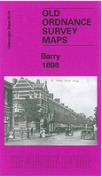
Barry 1898 Stanfords
£3.50
Vouchers
No voucher codes found.
Do you know a voucher code for this product or supplier? Add it to Insights for others to use.
Do you know a voucher code for this product or supplier? Add it to Insights for others to use.
 Denmark