More From Contributor

£8.99
Meet Angel Tungaraza, professional cake-baker, amateur matchmaker, an ear to listen & a shoulder to cry on. A uniquely charming, funny & touching novel of life, life & food set in Rwanda, a country recovers from unimaginable terror & violence. Angel Tungazara has recently moved to Rwanda from her native Tanzania. With her husb&, Pius, & the five orphaned children of their late son & daughter, she is hardly short of things to do. But she still finds time to pursue her hobby & her passion, her small but increasingly successful business, baking individually-designed cakes for the parties & celebrations of her neighbours & their friends. Angel is entirely aware that many of the Rwandans around her have witnessed & survived horrors she can barely imagine. But she also knows that their lives continue, that they also have reasons to celebrate, to be joyous & to be happy. As she gets to know her neighbours & as they tell her their stories, she comes to realise how much each of them has to mourn as well as how much they have to celebrate. &, finally, she comes to accept how much that is true of her too. ...
Archived Product
£9.99
This attractive planner will soon become an invaluable help in the kitchen. Every keen cook likes to have somewhere to record favourite baking recipes
- from weekend cakes & sweet pies, to celebration cakes & cookies for the kids. With plenty of lined pages to write down or stick in your most treasured recipes, you`ll never again have to search through kitchen drawers for photocopied recipes or scribbled notes.
...
Archived Product
£13.50
Bakony & Somló Mountains Atlas from the Budapest-based Cartographia with detailed, contoured & GPS compatible mapping at 1:25, 000, plus an extensive, Hungarian language guide section providing descriptions of numerous places of interest. The guide has detailed topographic maps at 1:40, 000 with contours at 10m intervals enhanced by relief shading, plus colouring & graphics for different types of vegetation & land use, e.g. vineyards, orchards, meadows, woodlands, etc. An overprint highlights local and/or long-distance hiking trails, indicating their waymarking signage. Also marked are recommended cycling routes. Local roads indicate bus routes & stops, & railway lines are shown with stations. Symbols mark various facilities & places of interests including campsites, hostels & other tourist accommodation, restaurants & cafes, etc. The maps have margin ticks with latitude & longitude at 1’ intervals. Map legend

Includes::
English. Extensive text, illustrated with colour photos, is in Hungarian only – a challenge indeed! – but a lot of useful information, including telephone numbers for tourist offices, can be deciphered with help from a pocket dictionary. To see other titles in this series please click on the series link.

...
Archived Product
£8.99
Kati Hirschel, in her thirties, is the proud owner of Istanbul`s only crime bookshop. She has learned the corrupt ways of her adored city & soon takes possession of an apartment obtained with the help of a generous bribe to a government official. All is well until a man is found murdered in her dream apartment & Kati becomes the police`s primary suspect. In her second novel Esmahan Aykol takes us to the alleys & boulevards of cosmopolitan Istanbul, to posh villas & seedy basement flats, to the property agents & lawyers, to Islamist leaders & city officials
- in fact everywhere that baksheesh helps move things along.
...
Archived Product
£22.95
Baku on a double-sided map with an indexed street plan of its central districts (Yasamal, Nasimi, Narimanov, Khatai & Sabayil), plus the centre including the Old Town in greater detail highlighting 57 places of interest. The main plan is at 1;8, 000 & shows one way streets, locations of petrol station, as well various public buildings & facilities, etc. On most streets selected street numbers are provided for easy location of addresses. On the reverse a city centre, the Old Town & surrounding area, is shown in greater detail at 1:4, 000, annotated with 57 various places of interest, cross-referenced to a panel with brief descriptions. All place names are in the Latin alphabet & all the text is in English. ...
Archived Product
£5.99
A handy, compact guide to Baku with an indexed, pull-out map. About this series: Pocket-sized guide books of essential information, usually written by residents of the destination. Covering sights, culture, history, activities, the best places for eating & drinking, & much more. Illustrated with full-colour photographs, the mini-guides also contain detailed area maps & dedicated pull-out map attached to the inside cover. ...
Archived Product
£3.50
Bala in 1899 in a fascinating series of reproductions of old Ordnance Survey plans in the Alan Godfrey Editions, ideal for anyone interested in the history of their neighbourhood or family. The map covers Bala with the village of Llanfor at the top right hand side, & the Bala & Ffestiniog Railway running diagonally across the map between the two. Other features include Christ Church, County School, Bala Union Workhouse, Victoria Hall & Bala Junction Station. On the reverse is a historical introduction by Derrick Pratt & a directory. About the Alan Godfrey Editions of the 25” OS Series: Selected towns in Great Britain & Ireland are covered by maps showing the extent of urban development in the last decades of the 19th & early 20th century. The plans have been taken from the Ordnance Survey mapping & reprinted at about 15 inches to one mile (1:4, 340). On the reverse most maps have historical notes & many also include extracts from contemporary directories. Most maps cover about one mile (1.6kms) north/south, one & a half miles (2.4kms) across; adjoining sheets can be combined to provide wider coverage.FOR MORE INFORMATION & A COMPLETE LIST OF ALL AVAILABLE TITLES PLEASE CLICK ON THE SERIES LINK. ...
Archived Product
£5.59
Map No. 125, Bala & Lake Vyrnwy / Y Bala a Llyn Efyrnwy, in the Ordnance Survey Landranger series at 1:50, 000, including Llangwm, Meardy, Corwen, Carrog, Glyndyfrdwy, Ciltalgarth, Llandderfel, Llandrillo, Llanarmon Dyffryn Ceiriog, Parc, Dolhendre, Llanuwchllyn, Llangunog, Llanrhaeadr-ym-Mochnant, Moelfre, Llangedwyn, Llanfechain, Llanwyddyn, Llanfyllin, Meifod, Dolanog, Foel, Llangadfan, Llanfair Caereinion, Cemmaes, Aberangell, Mallwydd, Dinas-Mawddwy, Llanymawddwy & Rhydmain, with the eastern part of the Snowdonia National Park/ Parc Cenedlaethol Eryri, Berwyn, Dyfnant Forest & lakes Celyn & Tegid. Edition C2; Revised for selected changes 2006; Copyright date 2006 This title is also available on our website in a waterproof & tear-resistant version. Maps in this series are only published folded. Stanfords can also print flat versions of Ordnance Survey maps through the OS Select system, centring the map on a location of your choice & with a picture provided by you on the cover. For more information please click on the link at the bottom of this description. About Ordnance Survey ...
Archived Product
£9.99
Map No. 125, Bala & Lake Vyrnwy / Y Bala a Llyn Efyrnwy 1836-1840, in the Cassini Historical Series of old Ordnance Survey mapping of England & Wales at 1:50, 000 in a format designed to offer a convenient comparison with the present day coverage from the OS, & most locations in three different editions. Old historical maps have been combined so that the sheet lines correspond to the current Landranger series & reproduced with the scale changed from one inch to one mile to 1:50, 000. Most locations are covered by three separate maps, showing how the area has changed over the decades, with selected major cities also presented in a fourth edition. * Old Series: the first detailed survey mapping dating for most areas from the first half of the 19th century, in black & white & with relief shown by hachuring.* Revised New Series from 1880s/1900s, with some colouring & a mixture of hachuring & contour lines.* Popular Edition from the inter-war years, with contour lines & colouring to indicate woodlands, parks, etc.* New Popular Edition from the late 1940s, reproduced in the Cassini series for the major cities. Each map

Includes::
notes on the development of Ordnance Survey & the various series produced by them. For those interested in maps & cartography in general, the Cassini series also provides a fascinating insight into how Ordnance Survey cartographic style has developed over a period of over 100 years. Coverage in this title

Includes::
present day Llangwm, Meardy, Corwen, Carrog, Glyndyfrdwy, Ciltalgarth, Llandderfel, Llandrillo, Llanarmon Dyffryn Ceiriog, Parc, Dolhendre, Llanuwchllyn, Llangunog, Llanrhaeadr-ym-Mochnant, Moelfre, Llangedwyn, Llanfechain, Llanwyddyn, Llanfyllin, Meifod, Dolanog, Foel, Llangadfan, Llanfair Caereinion, Cemmaes, Aberangell, Mallwydd, Dinas-Mawddwy, Llanymawddwy & Rhydmain, with the eastern part of the Snowdonia National Park/ Parc Cenedlaethol Eryri, Berwyn, Dyfnant Forest & lakes Celyn & Tegid.* PLEASE NOTE: Stanfords can also print on request mapping from all four series *centring the map on a location of your choice.* For more information please click on the link below.


...
Archived Product
£14.99
Map No. 125, Bala & Lake Vyrnwy / Y Bala a Llyn Efyrnwy 1836-1922 (3-map set), in the Cassini Historical Series of old Ordnance Survey mapping of England & Wales at 1:50, 000 in a format designed to offer a convenient comparison with the present day coverage from the OS, & most locations in three different editions. Old historical maps have been combined so that the sheet lines correspond to the current Landranger series & reproduced with the scale changed from one inch to one mile to 1:50, 000. Most locations are covered by three separate maps, showing how the area has changed over the decades, with selected major cities also presented in a fourth edition. Old Series: the first detailed survey mapping dating for most areas from the first half of the 19th century, in black & white & with relief shown by hachuring. Revised New Series from 1880s/1900s, with some colouring & a mixture of hachuring & contour lines. Popular Edition from the inter-war years, with contour lines & colouring to indicate woodlands, parks, etc. New Popular Edition from the late 1940s, reproduced in the Cassini series for the major cities. Each map

Includes::
notes on the development of Ordnance Survey & the various series produced by them. For those interested in maps & cartography in general, the Cassini series also provides a fascinating insight into how Ordnance Survey cartographic style has developed over a period of over 100 years. Coverage in this title

Includes::
present day Llangwm, Meardy, Corwen, Carrog, Glyndyfrdwy, Ciltalgarth, Llandderfel, Llandrillo, Llanarmon Dyffryn Ceiriog, Parc, Dolhendre, Llanuwchllyn, Llangunog, Llanrhaeadr-ym-Mochnant, Moelfre, Llangedwyn, Llanfechain, Llanwyddyn, Llanfyllin, Meifod, Dolanog, Foel, Llangadfan, Llanfair Caereinion, Cemmaes, Aberangell, Mallwydd, Dinas-Mawddwy, Llanymawddwy & Rhydmain, with the eastern part of the Snowdonia National Park/ Parc Cenedlaethol Eryri, Berwyn, Dyfnant Forest & lakes Celyn & Tegid. PLEASE NOTE: Stanfords can also print on request mapping from all four series centring the map on a location of your choice. For more information please click on the link below.


...
Archived Product

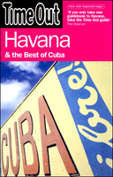
Baku & The Best Of Azerbaijan Time Out Guide

Baku & The Best of Azerbaijan in the City and Regions series from Time Out; comprehensive guides to a range of cities and their surrounding regions and including some of the most detailed listings and directories of places to eat and drink and things to do and see. Time Out guides are strongly focussed on local entertainment and nightlife, in addition to principal sights and attractions, with expert local writers providing an encyclopaedic knowledge of each city. This unique quality has ensured that the guides have won a reputation for their accuracy and reliability. The surrounding region is also incorporated in some guides, with information on the principal attractions, sites, landscapes and the best way of exploring them. Each of the Time Out city and region guides has a similar
layout, allowing visitors to explore their destination easily. An
RIP - This product is no longer available on our network. It was last seen on 25.09.2019

This page now acts as a permanent archive for this product. Add more information using the comments box below to ensure it can still be found by future generations.

Use our search facility to see if it is available from an alternative contributor.
  • Availability: Out Of Stock
  • Supplier: Stanfords
  • SKU: 9781846702464
Availability: In Stock
£12.99

Product Description

Baku & The Best of Azerbaijan in the City & Regions series from Time Out; comprehensive guides to a range of cities & their surrounding regions & including some of the most detailed listings & directories of places to eat & drink & things to do & see. Time Out guides are strongly focussed on local entertainment & nightlife, in addition to principal sights & attractions, with expert local writers providing an encyclopaedic knowledge of each city. This unique quality has ensured that the guides have won a reputation for their accuracy & reliability. The surrounding region is also incorporated in some guides, with information on the principal attractions, sites, landscapes & the best way of exploring them. Each of the Time Out city & region guides has a similar layout, allowing visitors to explore their destination easily. An

Reviews/Comments

Add New

Price History

Vouchers

No voucher codes found.
Do you know a voucher code for this product or supplier? Add it to Insights for others to use.

Facebook

Jargon Buster

Entertainment - Something that provides amusement
Quality - An object that has quality is superior in function and finish than a less quality object.

Supplier Information

Stanfords
Stanfords was established in 1853 and opened their iconic Covent Garden flagship store in 1901. They have become the top retailer of maps, travel books and accessories in the UK and arguably offer the largest selection of maps and travel books worldwide. Famous names such as Captain Robert Falcon Scott, Ranulph Fiennes and Michael Palin have purchased from Stanfords. They now have a shop in Bristol and both stores together with other venues operate a calendar of events including talks, book signings and exhibitions. As a specialist map retailer, the map selection is comprehensive and includes road maps, street maps and walking maps from worldwide destinations, as well as a selection of world atlases and wall maps. Books include travel guides and travel literature. Stanfords also stock globes, from miniatures made of blue marble to magnificent floor-standing globes. The website features a selection of interesting articles on travel topics.
Page Updated: 2023-11-12 20:15:36

Community Generated Product Tags

Oh No! The productWIKI community hasn't generated any tags for this product yet!
Menu