More From Contributor

£10.50
German state of Baden-Württemberg at 1:250, 000 on a GPS compatible road map from its survey organization, showing the road network with its official numbers at all levels, railways, airports & internal administrative divisions. The map presents the state’s road network in colours indicating the official classification & all the sections, as appropriate, show their official road numbers. Small, unnumbered country roads are included. On autobahns distances are marked at 10km intervals, various facilities are marked & interchanges are shown with both their numbers & their names. Railway lines are shown with station & stops. The map also indicates locations of airports, aerodromes & helicopter landing pads. Three levels of internal administrative boundaries are also marked. The map has no contours or relief shading to indicate topography, just colouring showing forested areas. The state’s various protected areas are not marked. Latitude & longitude lines are at 6’ & 10’ respectively to correspond to the German national grid. The numbering in the margin enables the users to work sheet numbers for the 1:25, 000 standard topographic mapping of the state. The map is not indexed. Map legend is in German only. ...
Archived Product
£9.99
German state of Baden-Württemberg on a double-sided, indexed road map at 1:200, 000 in the Mair Dumont’s Marco Polo series, prominently highlighting interesting locations & protected areas. The map divides the region north/south with a very generous overlap; Stuttgart & Strasburg are included on both sides & the whole of the Black Forest Natural Park is on the southern side of the map. A 143-page index booklet

Includes::
city centre street plans plus enlargements at 1:100, 000 showing in greater detail the environs & road access to Freiburg, Friedrichshafen, Heidelberg, Heilbronn, Karlsruhe, Mannheim, Reutlingen
- Tübingen area with plans of both cities, Stuttgart & Ulm
- Neu Ulm. Also included are plans of terminals at the Stuttgart, Friedrichshafen & Karlsruhe airports, plus plans of the Messe exhibition grounds in Stuttgart & Friedriechshafen. Maps in this Mair Dumont Marco Polo series indicate topography by light relief shading & the series is particularly good for identifying geographical

Features:
mountain & hill chains, valleys, national/natural parks, etc. The maps boldly stress main roads & motorways in strong colours & selected towns in large letters, but also show minor roads & villages in considerable detail. Road information

Includes::
toll roads, traffic restrictions & seasonal closures, gradient marking for steep roads, etc. Motorway services clearly indicate types of facilities available there, & driving distances are marked on many small local roads. Scenic roads & special tourist routes are highlighted. Railway network

Includes::
narrow gauge & tourist lines, cable car lines, & chair lifts. Where appropriate, ferry connections are shown. Locations worth visiting, both town/villages & natural sites, are highlighted & graded; 15 best sites are prominently marked & cross-referenced to their descriptions in the accompanying booklet. Other tourist information

Includes::
campsites & youth hostels, landmarks, recreational facilities etc. Latitude & longitude grid is drawn at intervals of 10`. Each title comes with a booklet attached to the map cover containing street plans & maps at 1:100, 000 showing in greater detail road access to main cities. The booklet also provides an index listing towns/villages with their postcodes as well as rivers & landscape features, plus a table with distances/travelling times, & for route planning an overview of the whole area covered by the main map indicating the 15 special places of interest. Map legend & the descriptions include English. To see the list of titles in this series please click on the series link.


...
Archived Product
£6.39
A detailed topographic map of Badenoch & Upper Strathspey from the Ordnance Survey Explorer series, covering Kingussie & Newtonmore. Edition A1; Publication date July 2007 About this series: These highly detailed maps show all the administrative boundaries, settlements as small as isolated farms, the road network down to unfenced roads & country tracks, & field boundaries (hedges & drystone walls) which make navigation across the countryside much easier. Steep gradients on roads are indicated. Various landmarks, e.g. powerlines, archaeological sites, windmills, churches & lighthouses are shown & additional graphics indicate natural terrain features such as cliffs, scree, mud & vegetation variations. The contour interval is 5 metres in the lower parts of the country & 10 metres in the uplands, & spot heights are marked. Each map covers an area of 30 x 20km (i.e. approx. 19 x 12 miles), with some double-sided maps covering more, as indicated in the individual descriptions. The maps are fully GPS compatible, with the National Grid shown at 1km intervals & latitude & longitude indicated by margin ticks at 1'. The Explorer series has replaced the earlier, green-cover Pathfinder maps. The Explorer series is now complete & covers all of Engl&, Wales & Scotl&. Some sheets for popular areas like the National Parks are still branded as Outdoor Leisure (OL) maps, but are now included in this series as the cartography is the same as that in the Explorer Maps. The Explorer maps offer a substantial improvement on the Pathfinder series, with greater use of colour, larger area per map, & stronger emphasis on information for ramblers & tourists. This series is ideal for walking & other outdoor pursuits & each map shows a large amount of information for ramblers & tourists. Public rights of way are shown (except in Scotland), together with other routes with public access: National Trails & Recreational Paths, permitted paths & bridleways, & selected cycle routes. Open access land created under the Countryside & Rights of Way Act 2000 is marked. Tourist information

Includes::
caravan & camp sites, Park & Ride locations, recreation/leisure/sport centres, museums, historic buildings, English Heritage & National Trust sites, rural pubs, etc. The map legend is in English only, except for the tourist information content which is also in French & German.

...
Archived Product
£14.99
Badenoch & Upper Strathspey area of the Cairmgorms National Park on a detailed topographic & GPS compatible map OL56, waterproof version, from the Ordnance Survey’s 1:25, 000 Explorer series. Coverage

Includes::
Kingussie, Newtonmore, three Munro peaks including A’ Chailleach, Monadhliath Mountains, etc.MOBILE DOWNLOADS: this title & all the other OS Explorer maps include a code for downloading after purchase the digital version onto your smartphone or tablet for viewing on the OS smartphone app.OS EXPLORER SERIES: to see the list of all the titles in the OS Explorer series, both paper & waterproof versions, please click on the series link. The Explorer series, Ordnance Survey’s most detailed maps recommended for anyone enjoying outdoor activities, provides topographic coverage of Great Britain at 1:25, 000 on GPS compatible maps with hiking trails, cycling routes & extensive tourist information. Each printed map is available either on paper or as a waterproof & tear-resistant OS Active Map, as indicated in its title. Britain’s National Parks & other areas of particular tourist interest are presented on often double-sided OL (Outdoor Leisure) maps, whilst most standard format Explorers cover an area of 30 x 20km (approx. 19 x 12 miles). All three versions (paper, waterproof & digital) are the same & provide plenty of recreational & tourist information, indicating the traditional public right of way paths (except in Scotland where different laws apply), including bridleways & byways. National Trails & other long-distance paths are marked, as well as permissive footpaths or bridleways & on-road or traffic-free cycle routes with, where appropriate, their National/ Regional Cycle Network numbers. Boundaries of access land are clearly marked. A wide range of symbols provides additional tourist information, highlighting camping & caravanning sites, information offices & visitors’ centres, parking & picnicking places, country pubs, sport & recreational facilities including cycle hire locations & mountain biking trails, historic buildings & museums, etc. Exceptionally clear presentation of the landscape is provided by contours at 5m or in the uplands at 10m intervals, with additional spot heights plus colouring and/or graphics for different types of woodlands, orchards, heath, marshl&, scree or boulders, & other topographic features. For GPS users the maps have British National Grid lines at 1km intervals, with latitude & longitude given by margin ticks at 1`. Clearly laid out map legend

Includes::
French & German translations for the tourist information symbols.


...
Archived Product
£8.99
Badenoch & Upper Strathspey area of the Cairmgorms National Park on a detailed topographic & GPS compatible map OL56, paper version, from the Ordnance Survey’s 1:25, 000 Explorer series. Coverage

Includes::
Kingussie, Newtonmore, three Munro peaks including A’ Chailleach, Monadhliath Mountains, etc.MOBILE DOWNLOADS: this title & all the other OS Explorer maps include a code for downloading after purchase the digital version onto your smartphone or tablet for viewing on the OS smartphone app.OS EXPLORER SERIES: to see the list of all the titles in the OS Explorer series, both paper & waterproof versions, please click on the series link. The Explorer series, Ordnance Survey’s most detailed maps recommended for anyone enjoying outdoor activities, provides topographic coverage of Great Britain at 1:25, 000 on GPS compatible maps with hiking trails, cycling routes & extensive tourist information. Each printed map is available either on paper or as a waterproof & tear-resistant OS Active Map, as indicated in its title. Britain’s National Parks & other areas of particular tourist interest are presented on often double-sided OL (Outdoor Leisure) maps, whilst most standard format Explorers cover an area of 30 x 20km (approx. 19 x 12 miles). All three versions (paper, waterproof & digital) are the same & provide plenty of recreational & tourist information, indicating the traditional public right of way paths (except in Scotland where different laws apply), including bridleways & byways. National Trails & other long-distance paths are marked, as well as permissive footpaths or bridleways & on-road or traffic-free cycle routes with, where appropriate, their National/ Regional Cycle Network numbers. Boundaries of access land are clearly marked. A wide range of symbols provides additional tourist information, highlighting camping & caravanning sites, information offices & visitors’ centres, parking & picnicking places, country pubs, sport & recreational facilities including cycle hire locations & mountain biking trails, historic buildings & museums, etc. Exceptionally clear presentation of the landscape is provided by contours at 5m or in the uplands at 10m intervals, with additional spot heights plus colouring and/or graphics for different types of woodlands, orchards, heath, marshl&, scree or boulders, & other topographic features. For GPS users the maps have British National Grid lines at 1km intervals, with latitude & longitude given by margin ticks at 1`. Clearly laid out map legend

Includes::
French & German translations for the tourist information symbols.


...
Archived Product
£9.99
Baderdreieck – Passau area on a waterproof, tear-resistant, GPS compatible cycling map at 1:75, 000 from the ADFC (Allgemeiner Deutscher Fahrrad-Club
- the official German cycling federation), in a series of maps with extensive overprint for long-distance & local cycling routes. GPS waypoints, route profiles, details of online links for information about accommodation etc. are also provided. Maps included in this series are contoured & the interval varies according to the type of the terrain. Steep sections are annotated with gradient markings. Colouring and/or graphics show various types of landscape: woods, vineyards, etc. An overprint highlights both the national long-distance cycling routes & the shorter local cycling trails, each clearly identified by a symbol and/or an abbreviation of its name. Sections with heavy traffic and/or poor road surface are clearly marked. Symbols indicate various facilities, such as railway stations with cycle hire, cycle repair shops, campsites, youth hostels, shelters, country restaurants/bars, sport & leisure facilities. Maps have a UTM grid for measuring distances & for determining location using GPS device & they are printed on weather resistant & tear-resistant paper. Each map covers an area of Approx. 87 x 130 km & the map legend is in German only. To see all the titles in this series please click on the series link.
...
Archived Product
£8.99
Under cover of darkness, an American family moves into a villa in Cholong-sur-Avre in Normandy. Fred Blake, the father, tells everyone he is there to write a history of the Allied landings. His wife Maggie gets involved in a local charity; their teenage children enrol in the lycee. At first glance a family like any other. But Fred`s real name is Giovanni Manzoni
- an ex-Mafia boss who has grassed & is now part of the FBI`s witness-protection program. & his record in other locations would indicate that his cover is not likely to last very long.
...
Archived Product
£50.00
A comprehensive natural history of one of Britain, s favourite animals The badger has for many years occupied a unique place in the British consciousness. Despite the fact that most people have never seen one, the badger has become one of Britain`s best-loved animals. The number of organisations that use the badger as a logo, the number of websites featuring information about badgers, & the number of voluntary badger protection societies that exist are testament to this popularity. In fact, the attitude of most ordinary people towards badgers is complex & contradictory, involving a combination of familiarity & ignorance, concern & indifference. For an increasing number of people, badgers constitute an important source of interest & pleasure, be it through watching them in their gardens or in the wild, sharing badger-related knowledge & experiences with others via the internet, or defending badgers against threats to their welfare. For others, on the other h&, badgers are a problem species that requires active management. In this highly anticipated new study, Prof Tim Roper explores every aspects of the biology & behaviour of these fascinating animals. In doing so, he reveals the complexities of a lifestyle that allows badgers to build communities in an astonishing variety of habitats, ranging from pristine forests to city centres. He also reveals the facts behind the controversy surrounding the badgers` role in transmitting tuberculosis to cattle, shedding new light on an issue that has resulted in one of the most extensive wildlife research programmes ever carried out. ...
Archived Product
£10.00
” An utter delight”
- Jennifer Tetlow. In the Encounters in the Wild series, renowned nature writer Jim Crumley gets up close
...
Archived Product
£6.99
Badger & friends are enjoying a glorious day in the warm summer sun when they discover the stream has run dry! Badger has a plan to find water, but the journey will be long, hot & hard. Can the friends find water before it`s too late? Badger & the Great Journey is an exciting adventure about friendship, courage & water conservation. Fans of Badger & the Great Storm & Badger & the Great Rescue will love this charming sequel, featuring the bright & heart-warming illustrations of Caroline Pedler (Don`t Wake the Bear, Hare! & A Mouse So Small). ...
Archived Product

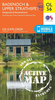
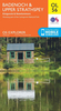
Badenoch & Upper Strathspey OS ACTIVE Map

Laminated waterproof edition of a detailed topographic map of Badenoch & Upper Strathspey from the Ordnance Survey Explorer series, covering Kingussie & Newtonmore.Edition A1; Publication date July 2007About this series:These highly detailed maps show all the administrative boundaries, settlements as small as isolated farms, the road network down to unfenced roads and country tracks, and field boundaries (hedges and drystone walls) which make navigation across the countryside much easier. Steep gradients on roads are indicated. Various landmarks, e.g. powerlines, archaeological sites, windmills, churches and lighthouses are shown and additional graphics indicate natural terrain features such as cliffs, scree, mud and vegetation variations. The contour interval is 5 metres in the
lower parts of the country and 10 metres in the uplands, and spot heights are marked. Each map covers an area of 30 x 20km (i.e. approx. 19 x 12 miles), with some double-sided maps covering more, as indicated in the individual descriptions. The maps are fully GPS compatible, with the National Grid shown at 1km intervals and latitude and longitude indicated by margin ticks at 1'.The Explorer series has replaced the earlier, green-cover Pathfinder maps. The Explorer series is now complete and covers all of England, Wales & Scotland. Some sheets for popular areas like the National Parks are still branded as Outdoor Leisure (OL) maps, but are now included in this series as the cartography is the same as that in the Explorer Maps. The Explorer maps offer a substantial improvement on the
Pathfinder series, with greater use of colour, larger area per map, and stronger emphasis on information for ramblers and tourists.This series is ideal for walking and other outdoor pursuits and each map shows a large amount of information for ramblers and tourists. Public rights of way are shown (except in Scotland), together with other routes with public access: National Trails and Recreational Paths, permitted paths and bridleways, and selected cycle routes. Open access land created under the Countryside and Rights of Way Act 2000 is marked. Tourist information includes caravan and camp sites, Park & Ride locations, recreation/leisure/sport centres, museums, historic buildings, English Heritage and National Trust sites, rural pubs, etc. The map legend is in English only,
except for the tourist information content which is also in French and German.
RIP - This product is no longer available on our network. It was last seen on 25.09.2019

This page now acts as a permanent archive for this product. Add more information using the comments box below to ensure it can still be found by future generations.

Use our search facility to see if it is available from an alternative contributor.
  • Availability: Out Of Stock
  • Supplier: Stanfords
  • SKU: 9780319466285
Availability: In Stock
£11.19

Product Description

Laminated waterproof edition of a detailed topographic map of Badenoch & Upper Strathspey from the Ordnance Survey Explorer series, covering Kingussie & Newtonmore. Edition A1; Publication date July 2007 About this series: These highly detailed maps show all the administrative boundaries, settlements as small as isolated farms, the road network down to unfenced roads & country tracks, & field boundaries (hedges & drystone walls) which make navigation across the countryside much easier. Steep gradients on roads are indicated. Various landmarks, e.g. powerlines, archaeological sites, windmills, churches & lighthouses are shown & additional graphics indicate natural terrain features such as cliffs, scree, mud & vegetation variations. The contour interval is 5 metres in the lower parts of the country & 10 metres in the uplands, & spot heights are marked. Each map covers an area of 30 x 20km (i.e. approx. 19 x 12 miles), with some double-sided maps covering more, as indicated in the individual descriptions. The maps are fully GPS compatible, with the National Grid shown at 1km intervals & latitude & longitude indicated by margin ticks at 1'. The Explorer series has replaced the earlier, green-cover Pathfinder maps. The Explorer series is now complete & covers all of Engl&, Wales & Scotl&. Some sheets for popular areas like the National Parks are still branded as Outdoor Leisure (OL) maps, but are now included in this series as the cartography is the same as that in the Explorer Maps. The Explorer maps offer a substantial improvement on the Pathfinder series, with greater use of colour, larger area per map, & stronger emphasis on information for ramblers & tourists. This series is ideal for walking & other outdoor pursuits & each map shows a large amount of information for ramblers & tourists. Public rights of way are shown (except in Scotland), together with other routes with public access: National Trails & Recreational Paths, permitted paths & bridleways, & selected cycle routes. Open access land created under the Countryside & Rights of Way Act 2000 is marked. Tourist information

Includes::
caravan & camp sites, Park & Ride locations, recreation/leisure/sport centres, museums, historic buildings, English Heritage & National Trust sites, rural pubs, etc. The map legend is in English only, except for the tourist information content which is also in French & German.

Reviews/Comments

Add New

Price History

Vouchers

No voucher codes found.
Do you know a voucher code for this product or supplier? Add it to Insights for others to use.

Facebook

Jargon Buster

GPS - Global Positioning System - Global position using satellites
Metres - A unit of measure, one metre equals 100 centimetres
Date - A day on a calendar
Date - A social activity whith a current or potential partner
England - A country within the United Kingdom.
Graphics - A general term for visual aspects of an item/display
Waterproof - Resistant to water, usualy specified by depth in metres
Mud - A combination of water and soil/clay/silt. Oftern brown in colour
Colour - The categorised spectrum of light visable to humans
Natural - not manmade
Network - A link and communication between things. Often computers or people.
Large - something that takes up more space than normal.
Small - something that takes up less space than normal.
Road - a manmade lane or a path that is used to speed up travel.
Popular - Something that is admired and liked by many people.
Laminated - A thin layer of plastic that gives a coating and shine to a material.
Individual - A single separate item or person.
Ideal - Something that satisfies a perfect criteria.

Supplier Information

Stanfords
Stanfords was established in 1853 and opened their iconic Covent Garden flagship store in 1901. They have become the top retailer of maps, travel books and accessories in the UK and arguably offer the largest selection of maps and travel books worldwide. Famous names such as Captain Robert Falcon Scott, Ranulph Fiennes and Michael Palin have purchased from Stanfords. They now have a shop in Bristol and both stores together with other venues operate a calendar of events including talks, book signings and exhibitions. As a specialist map retailer, the map selection is comprehensive and includes road maps, street maps and walking maps from worldwide destinations, as well as a selection of world atlases and wall maps. Books include travel guides and travel literature. Stanfords also stock globes, from miniatures made of blue marble to magnificent floor-standing globes. The website features a selection of interesting articles on travel topics.
Page Updated: 2023-11-12 20:15:36

Community Generated Product Tags

Oh No! The productWIKI community hasn't generated any tags for this product yet!
Menu