More From Contributor

£17.99
Topographic survey of Portugal at 1:50, 000 from the Instituto Geográfico Português, the country’s civilian survey organisation. The maps have contours at 25m intervals & in addition to the standard features shown on topographic mapping at this scale also indicate various types of vegetation (vineyards, olive groves, etc). Each sheet covers an area of 32 x 20km (20 x 12.5miles approx). The maps have latitude & longitude margin ticks at 1’ intervals & UTM coordinates for the map corners – each sheet also shows conversion details from BBLx (Bessel-Bonnie system, Datum Lisbon) to UTM. Map legend is in Portuguese only.EDITION DATES: most titles in this series have now been updated in the 1990s or later. To see all the titles in this series please click on the series link. ...
Archived Product
£17.99
Topographic survey of Portugal at 1:100, 000 from the Instituto Geográfico Português, the country’s civilian survey organisation. The maps have contours at 50m intervals & in addition to the standard features shown on topographic mapping at this scale also indicate various types of vegetation (vineyards, olive groves, etc). Each sheet covers an area of 64 x 40km (40 x 25 miles approx). The maps have latitude & longitude margin ticks at 1’ intervals, plus show UTM coordinates for the map corners. Map legend is in Portuguese only.PLEASE NOTE
- EDITION DATES: some sheets at this scale date back to the 1950s or 1960s. For more recent editions please see IGP’s 1:25, 000 series where each 50K map is divided into four quarters. To see all the titles in the 1:100, 000 series please click on the series link.
...
Archived Product
£12.99
Avellino Province at 1:100, 000 in a series of handy size provincial road maps from Litografia Artistica Cartografica (LAC) with more minor local roads & country tracks than can be found on most regional maps from other publishers. This title is now available in a digitally produced edition.LAC’s provincial series is gradually being changed to a new style of digitally derived cartography, so presentation of adjoining titles may vary. All the maps have hill shading to represent the general relief with spot heights for selected peaks, & show a few more local roads & rough tracks than the other road map series. Intermediate road distances are indicated. Regional, provincial & communal borders are marked, & railways, funiculars, airports, sea ferry links & campsites are shown. The legend is in Italian only. The new, digitally produced editions are indexed & have enhanced, more finely drawn cartography: the hill-shading is less bold, motorway service areas are marked, natural parks are highlighted & an expanded range of symbols indicates various landmarks & sites, e.g. antiquities, churches, etc. Two styles of the new cartography are produced, differing only in the colour of the predominant background shading: grey or yellow/green. Some of the new editions include geographical coordinates for the map corners. The index of localities is on the reverse. To see all the titles in this series please click on the series link. ...
Archived Product
£7.95
Avellino Province in a series of handy size road maps from Litografia Artistica Cartografica (LAC) with more minor local roads & tracks than can be found on most regional maps. The series is gradually being changed to a new style of digitally derived cartography, so presentation of adjoining titles may vary. All the maps have hill shading to represent the general relief with spot heights for selected peaks, & show a few more local roads & rough tracks than the other road map series. Intermediate road distances are indicated. Regional, provincial & communal borders are marked, & railways, funiculars, airports, sea ferry links & campsites are shown. The legend is in Italian only. The new, digitally produced editions are indexed & have enhanced, more finely drawn cartography: the hill-shading is less bold, motorway service areas are marked, natural parks are highlighted & an expanded range of symbols indicates various landmarks & sites, e.g. antiquities, churches, etc. Two styles of the new cartography are produced, differing only in the colour of the predominant background shading: grey or yellow/green. Some of the new editions include geographical coordinates for the map corners. The index of localities is on the reverse. This title is still produced in the traditional cartographic style. ...
Archived Product
£12.99
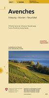
Avenches, map No. 242, in the standard topographic survey of Switzerland at 1:50, 000 from Swisstopo, i.e. without the special overprint highlighting walking trails, local bus stops, etc, presented in Swisstopo’s hiking editions of the 50K survey. Highly regarded for their superb use of graphic relief & hill shading, the maps give an almost 3-D picture of Switzerland`s mountainous terrain. Contours are at 20m intervals. All the maps have a 1-km grid with the Swiss national coordinates. This standard version of the 50K survey covers the whole country on 78 small format sheets, with special larger format maps published for several popular tourist destinations. Small format sheets cover an area of 35 x 24 km (21 x 15 miles approx) & have map legend in the language of the area covered by the map. The special larger sheets cover 50 x 35 km (31 x 22 miles approx) & have no map legend, but a separate leaflet can be provided instead.PLEASE NOTE: the hiking editions of the 1:50, 000 Swisstopo survey are listed on our website in a separate series. ...
Archived Product
£20.95
The first & only successful slave revolution in the Americas began in 1791 when thousands of brutally exploited slaves rose up against their masters on Saint-Domingue, the most profitable colony in the 18th Century Atlantic world. The slave insurgents forced the French administrators of the colony to emancipate them, a decision ratified by revolutionary Paris in 1794. This victory was a stunning challenge to the order of master/slave relations throughout the Americas, including the southern United States. ...
Archived Product
£9.99
The girls came from every corner of the U.S.S.R. They were factory workers, domestic servants, teachers & clerks, & few were older than twenty. Though many had led hard lives before the war, nothing could have prepared them for the brutal facts of their new existence: with their country on its knees, & millions of its men already dead, grievously wounded or in captivity, from 1942 onwards thousands of Soviet women were trained as snipers. Thrown into the midst of some of the fiercest fighting of the Second World War they would soon learn what it was like to spend hour upon hour hunting German soldiers in the bleak expanses of no-man`s-land; they would become familiar with the awful power that comes with taking another person`s life; & in turn they would discover how it feels to see your closest friends torn away from you by an enemy shell or bullet. In a narrative that travels from the sinister catacombs beneath the Kerch Peninsula to Byelorussia`s primeval forests &, finally, to the smoking ruins of the Third Reich, Lyuba Vinogradova recounts the untold stories of these brave young women. Drawing on diaries, letters & interviews with survivors, as well as previously unpublished material from the military archives, she offers a moving & unforgettable record of their experiences: the rigorous training, the squalid living quarters, the blood & chaos of the Eastern Front, & those moments of laughter & happiness that occasionally allowed the girls to forget, for a second or two, their horrifying circumstances. Avenging Angels is a masterful account of an all-too-often overlooked chapter of history, & an unparalleled account of these women`s lives. Translated from the Russian by Arch Tait ...
Archived Product
£8.99
Juan Diego`s little sister is a mind reader. As a teenager, he struggles to keep anything secret
- Lupe knows all the worst things
...
Archived Product
£20.00
As we grow older
- most of all, in what we remember & what we dream
- we live in the past. Sometimes, we live more vividly

...
Archived Product
£40.00
Tillim`s earlier photographs documented war-torn Africa & the people whose lives have been shaped by years of conflict & hardship. In this book he focuses on the structures that dot the urban landscape of these troubled countries. The eighty images in this book from Angola, Mozambique, Madagascar & the Democratic Republic of Congo, reveal modern buildings constructed with illusions of prosperity & peace & then left to decay. This collection reflects the intuitive brilliance that is Guy Tillim`s hallmark, tells Africa`s story of failure & atrophy, & points to the intersection of present-day Africa with its colonial past in countries that were forsaken in the name of progress & the perpetual quest for power. ...
Archived Product

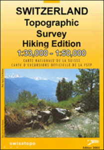
Avenches Swisstopo Hiking 242T

Avenches area, map No. 242T, at 1:50, 000 in a special hiking edition of the country’s topographic survey, published by Swisstopo in cooperation with the Swiss Hiking Federation. Cartography, identical to the standard version of the survey, is highly regarded for its superb use of graphic relief and hill shading to provide an almost 3-D picture of Switzerland`s mountainous terrain. Contours are at 20m intervals. An overprint highlights routes maintained by the SHF, distinguishing between hiking routes, mountain routes requiring proper footwear, and alpine routes where equipment is needed. Paths which are part of the national or regional network of long-distance hiking routes are specially marked and in the more recent editions are annotated with their official numbers. The maps
show mountain huts, refuges and in remote areas also inns, plus roads with bus service and the positions of bus stops. All the maps have a 1-km grid of the Swiss national coordinates.For a list of all the titles in this series, please click on the series link.
RIP - This product is no longer available on our network. It was last seen on 25.09.2019

This page now acts as a permanent archive for this product. Add more information using the comments box below to ensure it can still be found by future generations.

Use our search facility to see if it is available from an alternative contributor.
  • External links may include paid for promotion
  • Availability: Out Of Stock
  • Supplier: Stanfords
  • SKU: 9783302302423
Availability: In Stock
£18.99

Product Description

Avenches area, map No. 242T, at 1:50, 000 in a special hiking edition of the country’s topographic survey, published by Swisstopo in cooperation with the Swiss Hiking Federation. Cartography, identical to the standard version of the survey, is highly regarded for its superb use of graphic relief & hill shading to provide an almost 3-D picture of Switzerland`s mountainous terrain. Contours are at 20m intervals. An overprint highlights routes maintained by the SHF, distinguishing between hiking routes, mountain routes requiring proper footwear, & alpine routes where equipment is needed. Paths which are part of the national or regional network of long-distance hiking routes are specially marked & in the more recent editions are annotated with their official numbers. The maps show mountain huts, refuges & in remote areas also inns, plus roads with bus service & the positions of bus stops. All the maps have a 1-km grid of the Swiss national coordinates. For a list of all the titles in this series, please click on the series link.

Reviews/Comments

Add New

Price History

Vouchers

No voucher codes found.
Do you know a voucher code for this product or supplier? Add it to Insights for others to use.

Facebook

Jargon Buster

Hiking - An outdoor activity envolving walking in nature
swiss - Short for Switzerland, one of the richest countries in the world
switzerland - A landlocked country in western Europe. One of the richest countries in the world
Network - A link and communication between things. Often computers or people.
Km - Kilometre. A unit of measurement equal to 1000 metres.
Equipment - A product or good that is tactile.
Regional - An adjective to describe a set geographic area.

Supplier Information

Stanfords
Stanfords was established in 1853 and opened their iconic Covent Garden flagship store in 1901. They have become the top retailer of maps, travel books and accessories in the UK and arguably offer the largest selection of maps and travel books worldwide. Famous names such as Captain Robert Falcon Scott, Ranulph Fiennes and Michael Palin have purchased from Stanfords. They now have a shop in Bristol and both stores together with other venues operate a calendar of events including talks, book signings and exhibitions. As a specialist map retailer, the map selection is comprehensive and includes road maps, street maps and walking maps from worldwide destinations, as well as a selection of world atlases and wall maps. Books include travel guides and travel literature. Stanfords also stock globes, from miniatures made of blue marble to magnificent floor-standing globes. The website features a selection of interesting articles on travel topics.
Page Updated: 2023-11-12 20:15:36

Community Generated Product Tags

Oh No! The productWIKI community hasn't generated any tags for this product yet!
Menu