More From Contributor

£9.95
Appennino Bolognese
- Mugello at 1:50, 000 in a series of hiking maps from Edizioni Multigraphic covering Tuscany, parts of Umbria,
...
Archived Product
£11.99
Appennino Bolognese e Pistoiese, map no. 21, in a series of walking maps covering the Ligurian Alps & the coast, the crest of the Apennines along the border of Tuscany with its neighbouring regions, & parts of Tuscany itself. Most maps have contours at 25-metre intervals, with colouring for forests & some relief shading. The cartography is rather old fashioned & sometimes not as clear as in other map series but for many areas, especially for parts of Tuscany, these are the only hiking maps available. An overprint highlights hiking paths, including all the popular long-distance routes such as Garfagnana Trekking, Alta Via dei Monti Liguri & the GEA, Grande Escursione Appenninica, the main path over the crests of the Apennines. The overprint also shows campsites &, where appropriate, mountain refuges & other types of alpine accommodation. Most of the maps are double-sided, as indicated by the map number. Each map covers Approx. 26 x 17km / 16 x 11 miles per side. Some of the maps indicate latitude & longitude at the map corners, but with longitude sometimes based on Rome rather than Greenwich. Map legends vary, most maps include English. * In this title:* contours at 25m intervals & longitude at the map corners based on Greenwich. Map legend

Includes::
English.

...
Archived Product
£11.99
Appennino Bolognese e Pratese, map no. 24, in a series of walking maps covering the Ligurian Alps & the coast, the crest of the Apennines along the border of Tuscany with its neighbouring regions, & parts of Tuscany itself. Most maps have contours at 25-metre intervals, with colouring for forests & some relief shading. The cartography is rather old fashioned & sometimes not as clear as in other map series but for many areas, especially for parts of Tuscany, these are the only hiking maps available. An overprint highlights hiking paths, including all the popular long-distance routes such as Garfagnana Trekking, Alta Via dei Monti Liguri & the GEA, Grande Escursione Appenninica, the main path over the crests of the Apennines. The overprint also shows campsites &, where appropriate, mountain refuges & other types of alpine accommodation. Most of the maps are double-sided, as indicated by the map number. Each map covers Approx. 26 x 17km / 16 x 11 miles per side. Some of the maps indicate latitude & longitude at the map corners, but with longitude sometimes based on Rome rather than Greenwich. Map legends vary, most maps include English. ...
Archived Product
£12.99
Appennino Cesenate
- Val Tiberina, map no. 34/36, in a series of walking maps covering the Ligurian Alps & the coast, the crest
...
Archived Product
£9.95
Appennino Faentino at 1:50, 000 in a series of contoured, GPS compatible maps at 1:50, 000 published by Selca together with the Emilia-Romagna branch of the Club Alpino Italiano (CAI). Each map has a list of local waymarked routes. Cartographic style of maps in this series differs according to the publication date, but all the maps are contoured (interval is either 25m or 40m), with additional relief shading on most sheets & plenty of spot heights. The overprint highlights waymarked hiking trails, showing their route numbers & indicating difficult passages. The overprint also shows which paths form part of the GEA ...
Archived Product
£12.99
Appennino Modenese e Pistoiese, map no. 19, in a series of walking maps covering the Ligurian Alps & the coast, the crest of the Apennines along the border of Tuscany with its neighbouring regions, & parts of Tuscany itself. Most maps have contours at 25-metre intervals, with colouring for forests & some relief shading. The cartography is rather old fashioned & sometimes not as clear as in other map series but for many areas, especially for parts of Tuscany, these are the only hiking maps available. An overprint highlights hiking paths, including all the popular long-distance routes such as Garfagnana Trekking, Alta Via dei Monti Liguri & the GEA, Grande Escursione Appenninica, the main path over the crests of the Apennines. The overprint also shows campsites &, where appropriate, mountain refuges & other types of alpine accommodation. Most of the maps are double-sided, as indicated by the map number. Each map covers Approx. 26 x 17km / 16 x 11 miles per side. Some of the maps indicate latitude & longitude at the map corners, but with longitude sometimes based on Rome rather than Greenwich. Map legends vary, most maps include English. ...
Archived Product
£12.99
Appennino Parmense
- Alta Lunigiana: Berceto
- Pontremoli, map no. 13, in a series of walking maps covering the Ligurian Alps

...
Archived Product
£11.99
Appennino Parmense
- Alta Lunigiana: Bedonia
- Pontremoli, map no. 9, in a series of walking maps covering the Ligurian Alps

...
Archived Product
£9.95
Appennino Piacentino at 1:50, 000 in a series of contoured, GPS compatible maps at 1:50, 000 published by Selca together with the Emilia-Romagna branch of the Club Alpino Italiano (CAI). Each map has a list of local waymarked routes. Cartographic style of maps in this series differs according to the publication date, but all the maps are contoured (interval is either 25m or 40m), with additional relief shading on most sheets & plenty of spot heights. The overprint highlights waymarked hiking trails, showing their route numbers & indicating difficult passages. The overprint also shows which paths form part of the GEA ...
Archived Product
£11.99
Appennino Pistoiese
- Monti Pesciatini, map no. 22, in a series of walking maps covering the Ligurian Alps & the coast, the
...
Archived Product

Appennino Modenese - Garfagnana 25K Ed. Multigraphic Map No. 18

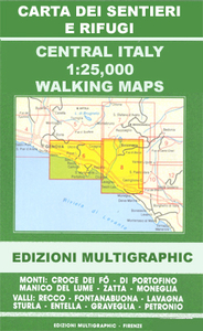
Appennino Modenese - Garfagnana, map no. 18, in a series of walking maps covering the Ligurian Alps and the coast, the crest of the Apennines along the border of Tuscany with its neighbouring regions, and parts of Tuscany itself. Most maps have contours at 25-metre intervals, with colouring for forests and some relief shading. The cartography is rather old fashioned and sometimes not as clear as in other map series but for many areas, especially for parts of Tuscany, these are the only hiking maps available.An overprint highlights hiking paths, including all the popular long-distance routes such as Garfagnana Trekking, Alta Via dei Monti Liguri and the GEA, Grande Escursione Appenninica, the main path over the crests of the Apennines. The overprint also shows campsites and,
where appropriate, mountain refuges and other types of alpine accommodation. Most of the maps are double-sided, as indicated by the map number. Each map covers approximately 26 x 17km / 16 x 11 miles per side. Some of the maps indicate latitude and longitude at the map corners, but with longitude sometimes based on Rome rather than Greenwich. Map legends vary, most maps include English.
RIP - This product is no longer available on our network. It was last seen on 25.09.2019

This page now acts as a permanent archive for this product. Add more information using the comments box below to ensure it can still be found by future generations.

Use our search facility to see if it is available from an alternative contributor.
  • Availability: Out Of Stock
  • Supplier: Stanfords
  • SKU: 9788874651177
Availability: In Stock
£11.99

Product Description

Appennino Modenese
- Garfagnana, map no. 18, in a series of walking maps covering the Ligurian Alps & the coast, the crest of the Apennines along the border of Tuscany with its neighbouring regions, & parts of Tuscany itself. Most maps have contours at 25-metre intervals, with colouring for forests & some relief shading. The cartography is rather old fashioned & sometimes not as clear as in other map series but for many areas, especially for parts of Tuscany, these are the only hiking maps available. An overprint highlights hiking paths, including all the popular long-distance routes such as Garfagnana Trekking, Alta Via dei Monti Liguri & the GEA, Grande Escursione Appenninica, the main path over the crests of the Apennines. The overprint also shows campsites &, where appropriate, mountain refuges & other types of alpine accommodation. Most of the maps are double-sided, as indicated by the map number. Each map covers Approx. 26 x 17km / 16 x 11 miles per side. Some of the maps indicate latitude & longitude at the map corners, but with longitude sometimes based on Rome rather than Greenwich. Map legends vary, most maps include English.

Reviews/Comments

Add New

Price History

Vouchers

No voucher codes found.
Do you know a voucher code for this product or supplier? Add it to Insights for others to use.

Facebook

Jargon Buster

Hiking - An outdoor activity envolving walking in nature
Metre - 100cm. A unit of length.
Greenwich - A southern borough in London.
Accommodation - A room in which someone can live in, for example in a hotel
Popular - Something that is admired and liked by many people.

Supplier Information

Stanfords
Stanfords was established in 1853 and opened their iconic Covent Garden flagship store in 1901. They have become the top retailer of maps, travel books and accessories in the UK and arguably offer the largest selection of maps and travel books worldwide. Famous names such as Captain Robert Falcon Scott, Ranulph Fiennes and Michael Palin have purchased from Stanfords. They now have a shop in Bristol and both stores together with other venues operate a calendar of events including talks, book signings and exhibitions. As a specialist map retailer, the map selection is comprehensive and includes road maps, street maps and walking maps from worldwide destinations, as well as a selection of world atlases and wall maps. Books include travel guides and travel literature. Stanfords also stock globes, from miniatures made of blue marble to magnificent floor-standing globes. The website features a selection of interesting articles on travel topics.
Page Updated: 2023-11-12 20:15:36

Community Generated Product Tags

Oh No! The productWIKI community hasn't generated any tags for this product yet!
Menu