More From Contributor
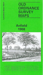
£11.50
Topographic survey of France at 1:25, 000 in IGN`s excellent TOP25 / Série Bleue series. All the maps are GPS compatible, with a 1km UTM grid plus latitude & longitude lines at 5’ intervals. Contours are at 5m intervals except for mountainous areas where the maps have contours at 10m intervals, vividly enhanced by hill shading & graphics for rocky terrain. Colouring with graphics indicates different types of vegetation or land use (deciduous or coniferous forests, moors, orchards, vineyards, etc). PLEASE NOTE: coverage of France at this scale is currently being revised – the format & the presentation of each title are indicated by the letters at the end of its Sheet Reference number (e.g. 0416ET, 3531ETR, 1923SB, etc.)MAPS WITH FULL TOURIST OVERPRINT & AN ENGLISH MAP LEGEND: all TOP25 maps & the SB editions of Série Bleue have an overprint highlighting waymarked walking trails including long-distance GR routes &, where appropriate, ski routes. Symbols indicate campsites, gîtes d’etape, refuges, equestrian centres & other recreational facilities or sites, tourist information centres, cultural heritage, etc. Towns & locations of particular interest are highlighted.- ET or OT = single-sided TOP25 map covering approx. 29x 21 km / 18x 13 miles.- ETR or OTR = waterproof & tear resistant TOP25 map covering the same area as the corresponding ET or OT number, but double-sided, printed on a smaller size sheet with a good overlap between the sides.- SB = Série Bleue map with full tourist overprint; these maps, first introduced in summer 2014, each cover approx. 29x 24km / 18x 15 miles.SÉRIE BLEUE maps with numbers ending in E (Est) or O (Ouest): most editions now indicate the GR routes, but do not show any other tourist information. Map legend is in French only. Each map covers approx. 14x 20km / 9x 12 miles. ...
Archived Product
£13.99
Pick a Weekend, Pick a City, & Go! This book picks up where crowdsourcing leaves off, covering the flashpacker skills you need for spur-of-the-moment trips to Europe`s top destinations. Master digital tools. Book cheap flights online, find rooms at Air Bn B, & catch a ride with Uber. Connect with other travelers. Head to the most popular hostels for a ready-made, real-life social network. Follow three-day plans to explore each city. Learn which cities match your interests & which can be easily combined for a longer trip. See iconic sights. Check the Eiffel Tower, the London Eye, & the Colosseum off your bucket list--and use Andy`s tips to save time & skip lines. Hit the local hot spots. Chill at Amsterdam`s coffeeshops, study mixology at London`s speakeasies, & bust moves at Barcelona`s beach clubs. Enjoy the best--and cheapest--local cuisine. Graze at creperies in Paris, pubs in Dublin, & aperitivo in Rome. Become a temporary local. Adapt to the culture to enjoy authentic, unforgettable experiences. ANDY STEVES was born into a traveling family, heading to Europe each year while his father, Rick Steves, researched his guidebooks & filmed his TV shows. Today, Andy introduces young travelers to Europe through his own company, Weekend Student Adventures (wsaeurope.com). ...
Archived Product
£3.50
Anerley & Penge in 1868 in a fascinating series of reproductions of old Ordnance Survey plans in the Alan Godfrey Editions, ideal for anyone interested in the history of their neighbourhood or family. The map covers the southern part of Penge, together with the area now known as Anerley. To the west it also

Includes::
portions of Upper & Lower Norwood. Coverage extends from the Watermen & Lightermens Almshouses at Penge westward to Church Road & The Park at Upper Norwood, & southward to the southern boundary of Penge/ Anerley. The Brighton line runs north-south through the map, including Anerley station, joined at the foot of the map by the West End & Crystal Palace line. Anerley Road crosses the railway & other features include stretches of the old canal, Anerley Bridge, Norwood Reservoir, Holy Trinity church, St Paul`s church, North Surrey District Schools, Infirmary. Many streets are shown half built up, especially off Penge Road. Elsewhere the picture is of villas with leafy gardens but with more modest surburban expansion at the north of the map. On the reverse are street directories for Anerley Road, Croydon Road, Derwernt Road, Maple Road, Oakfield Road, Woodbine Groive from an early Penge directory. About the Alan Godfrey Editions of the 25” OS Series: Selected towns in Great Britain & Ireland are covered by maps showing the extent of urban development in the last decades of the 19th & early 20th century. The plans have been taken from the Ordnance Survey mapping & reprinted at about 15 inches to one mile (1:4, 340). On the reverse most maps have historical notes & many also include extracts from contemporary directories. Most maps cover about one mile (1.6kms) north/south, one & a half miles (2.4kms) across; adjoining sheets can be combined to provide wider coverage.FOR MORE INFORMATION & A COMPLETE LIST OF ALL AVAILABLE TITLES PLEASE CLICK ON THE SERIES LINK.

...
Archived Product
£13.99
The highest part of the Spanish Pyrenees, the Maladeta massif with Pico de Aneto including the surrounding valleys of Benasque & Barraves, at 1:25, 000 on a contoured & GPS compatible map from Editorial Alpina, accompanied by a booklet with English language descriptions of recommended walks & climbs, accommodation details, etc. Vivid presentation of the topography is provided by contours at 10m intervals enhanced by numerous spot heights, relief shading & colouring to indicate vegetation. Local & long-distance waymarked trails & ascents are highlighted. Symbols indicate various types of accommodation (refuges, campsites & camping areas, gîtes, summer camps, hotels, etc), restaurants, tourist information centres, sites for skiing, climbing & canyoning, viewpoints, etc. Road network indicates locations of petrol stations & car parks. The map has a 1km UTM grid, plus margin ticks for latitude & longitude at 1’ intervals. Map legend

Includes::
English. The accompanying booklet has 29 pages in English with descriptions of 9 hikes & 10 ascents. General information about the area is supplemented by a list of 21 local caves for potholing, advice for other adventure sports, plus contact details for local accommodation options & other useful numbers & web addresses. To see the list of titles in this Editorial Alpina series which provides coverage of most popular hiking areas of Spain please click on the series link.

...
Archived Product
£13.95
Aneto
- Maladeta: Valles de Benasque & Barraves in an extensive & very popular series of walking maps from Editorial Alpina covering
...
Archived Product
£16.99
Sverigeserien is an outdoor map series consisting of 116 sheets with coverage of southern & central Sweden & the northern coastline. The map is suitable for outdoor activities such as hiking, excursions, trail running, hunting, fishing, riding, cycling, mountain biking, paddling, skating & much more. Every sheet covers an area of 45x 68km. These topographical maps in scale 1:50 000 contain all the information needed for outdoor activities: Terrain information, hiking trails, illuminated tracks, camping, shelters, golf courses, leisure baths, historical remains, roads in different categories, railway lines & much more. Easy to read topography with contour lines, vertical interval 5 m. Sverigeserien is a high-quality map series & is durable for frequent use! Updated content with map data from Lantmäteriet (National Land Survey of Sweden) & printed on Polyart which is water & tear resistant. This means that the map can be folded repeatedly without breaking & can withstand the challenging weather in Sweden during both winter & summer. Legend is in Swedish, English & German. ...
Archived Product
£5.99
A gentle Christmas rhyme tells the story of the angel who is sent to Nazareth. There the angel sees four animals
- a horse, a
...
Archived Product
£12.99
Once upon a time fairy tales weren`t meant just for children, & neither is Angela Carter`s Book of Fairy Tales. This stunning ...
Archived Product
£8.99
This bestselling collection of stories extols the female virtues of discontent, sexual disruptiveness & bad manners Here are subversive tales
- by Ama Ata Aidoo, Jane Bowles, Angela Carter, Colette, Bessie Head, Jamaica Kincaid & Katherine Mansfield among others
- all have one thing in common: the wish to restore adventuresses & revolutionaries to their rightful position as models for all women Reflecting the wide-ranging intelligence & deliciously anarchic taste of Angela Carter, some of these stories celebrate toughness & resilience, some of them low cunning: all of them are about not being nice.

...
Archived Product
£10.99
Printmaker & Painter Angela Harding has been working in the arts for over 30 years. Based in Rutl&, she is inspired by the wealth of natural wildlife around her to create her stunning prints. The animals she depicts _ from a blackbird stealing redcurrants to seals in coastal waves _ are always featured in atmospheric locations which pull the viewer into the artwork. Informative text accompanies each work & the datepad features previous & next months views. ...
Archived Product

Anfield 1908

Anfield in 1908 in a fascinating series of reproductions of old Ordnance Survey plans in the Alan Godfrey Editions, ideal for anyone interested in the history of their neighbourhood or family. The map covers the Anfield area on the north side of Liverpool, stretching from the Liverpool football ground eastward to Lisburn Lane, and from New Hall Lane southward to Esmond Street. Features include Belmont Road Workhouse, part of Stanley Park, south part of Liverpool Cemetery, Holy Trinity church, fever hospital, Advent Church, Hydraulic Engineering Works, Clubmoor, Tue Brook, St John the Baptist church, Tue Brook House, Lisburn Farm, etc. On the reverse are street directory entries for Anfield Road, Breck Road, July Road, Lower Breck Road, Marlborough Road, Pendennis Street
and St Domingo Vale. About the Alan Godfrey Editions of the 25” OS Series:Selected towns in Great Britain and Ireland are covered by maps showing the extent of urban development in the last decades of the 19th and early 20th century. The plans have been taken from the Ordnance Survey mapping and reprinted at about 15 inches to one mile (1:4, 340). On the reverse most maps have historical notes and many also include extracts from contemporary directories. Most maps cover about one mile (1.6kms) north/south, one and a half miles (2.4kms) across; adjoining sheets can be combined to provide wider coverage.FOR MORE INFORMATION AND A COMPLETE LIST OF ALL AVAILABLE TITLES PLEASE CLICK ON THE SERIES LINK.
RIP - This product is no longer available on our network. It was last seen on 25.09.2019

This page now acts as a permanent archive for this product. Add more information using the comments box below to ensure it can still be found by future generations.

Use our search facility to see if it is available from an alternative contributor.
  • External links may include paid for promotion
  • Availability: Out Of Stock
  • Supplier: Stanfords
  • SKU: 9780850546729
Availability: In Stock
£3.50

Product Description

Anfield in 1908 in a fascinating series of reproductions of old Ordnance Survey plans in the Alan Godfrey Editions, ideal for anyone interested in the history of their neighbourhood or family. The map covers the Anfield area on the north side of Liverpool, stretching from the Liverpool football ground eastward to Lisburn Lane, & from New Hall Lane southward to Esmond Street. Features include Belmont Road Workhouse, part of Stanley Park, south part of Liverpool Cemetery, Holy Trinity church, fever hospital, Advent Church, Hydraulic Engineering Works, Clubmoor, Tue Brook, St John the Baptist church, Tue Brook House, Lisburn Farm, etc. On the reverse are street directory entries for Anfield Road, Breck Road, July Road, Lower Breck Road, Marlborough Road, Pendennis Street & St Domingo Vale. About the Alan Godfrey Editions of the 25” OS Series: Selected towns in Great Britain & Ireland are covered by maps showing the extent of urban development in the last decades of the 19th & early 20th century. The plans have been taken from the Ordnance Survey mapping & reprinted at about 15 inches to one mile (1:4, 340). On the reverse most maps have historical notes & many also include extracts from contemporary directories. Most maps cover about one mile (1.6kms) north/south, one & a half miles (2.4kms) across; adjoining sheets can be combined to provide wider coverage.FOR MORE INFORMATION & A COMPLETE LIST OF ALL AVAILABLE TITLES PLEASE CLICK ON THE SERIES LINK.

Reviews/Comments

Add New

Price History

Vouchers

No voucher codes found.
Do you know a voucher code for this product or supplier? Add it to Insights for others to use.

Facebook

Jargon Buster

Contemporary - Modern era design
Contemporary - A design reference to indicate post war modern design
Football - A sport involving kicking a ball and trying to score a goal
Liverpool - A UK city on the east coast of England
History - Anything that happens in the past. An acedemic subject.
Road - a manmade lane or a path that is used to speed up travel.
Contemporary - An object that is living in the same time.
Hall - A room at the inside of an entrance of a house.
Ideal - Something that satisfies a perfect criteria.
Family - A group of people that live together made up from parents and children.

Supplier Information

Stanfords
Stanfords was established in 1853 and opened their iconic Covent Garden flagship store in 1901. They have become the top retailer of maps, travel books and accessories in the UK and arguably offer the largest selection of maps and travel books worldwide. Famous names such as Captain Robert Falcon Scott, Ranulph Fiennes and Michael Palin have purchased from Stanfords. They now have a shop in Bristol and both stores together with other venues operate a calendar of events including talks, book signings and exhibitions. As a specialist map retailer, the map selection is comprehensive and includes road maps, street maps and walking maps from worldwide destinations, as well as a selection of world atlases and wall maps. Books include travel guides and travel literature. Stanfords also stock globes, from miniatures made of blue marble to magnificent floor-standing globes. The website features a selection of interesting articles on travel topics.
Page Updated: 2023-11-12 20:15:36

Community Generated Product Tags

Oh No! The productWIKI community hasn't generated any tags for this product yet!
Menu