
 United Kingdom
 France
 Germany
 Netherlands
 Sweden
 USA
USA
 Italy
Italy
 Spain
Spain
More From Contributor


Alnwick 1897
Alnwick in 1897 in a fascinating series of reproductions of old Ordnance Survey plans in the Alan Godfrey Editions, ideal for anyone interested in the history of their neighbourhood or family. The map of Alnwick is double-sided for maximum coverage; the main map covers the town centre, including the great Castle, Market Place, Clayport Street, Pottergate, Fenkle Street, Bondgate, Narrowgate, Bailifgate, St Michael`s church, St Paul`s church, castle gardens and Canongate. The coverage extends north to the remains of St Leonard`s hospital, east to Allerburn House and Waterside House, with part of the village of Denwick in the top right corner. The River Aln runs through the map. On the reverse is part of the adjacent sheet 32.13 extending coverage south to include the station,
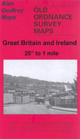
Alnwick Workhouse, cemetery, Auction Mart, Swansfield House and Willoughby`s Bank.About the Alan Godfrey Editions of the 25” OS Series:Selected towns in Great Britain and Ireland are covered by maps showing the extent of urban development in the last decades of the 19th and early 20th century. The plans have been taken from the Ordnance Survey mapping and reprinted at about 15 inches to one mile (1:4, 340). On the reverse most maps have historical notes and many also include extracts from contemporary directories. Most maps cover about one mile (1.6kms) north/south, one and a half miles (2.4kms) across; adjoining sheets can be combined to provide wider coverage.FOR MORE INFORMATION AND A COMPLETE LIST OF ALL AVAILABLE TITLES PLEASE CLICK ON THE SERIES LINK.
Alnwick Workhouse, cemetery, Auction Mart, Swansfield House and Willoughby`s Bank.About the Alan Godfrey Editions of the 25” OS Series:Selected towns in Great Britain and Ireland are covered by maps showing the extent of urban development in the last decades of the 19th and early 20th century. The plans have been taken from the Ordnance Survey mapping and reprinted at about 15 inches to one mile (1:4, 340). On the reverse most maps have historical notes and many also include extracts from contemporary directories. Most maps cover about one mile (1.6kms) north/south, one and a half miles (2.4kms) across; adjoining sheets can be combined to provide wider coverage.FOR MORE INFORMATION AND A COMPLETE LIST OF ALL AVAILABLE TITLES PLEASE CLICK ON THE SERIES LINK.

Product Description
Reviews/Comments
Add New
Intelligent Comparison
Archived Product
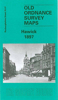
Hawick 1897 Stanfords
£3.50
Archived Product
Elswick 1894 Stanfords
£3.50
Vouchers
No voucher codes found.
Do you know a voucher code for this product or supplier? Add it to Insights for others to use.
Do you know a voucher code for this product or supplier? Add it to Insights for others to use.
 Denmark