
 United Kingdom
 France
 Germany
 Netherlands
 Sweden
 USA
USA
 Italy
Italy
 Spain
Spain
More From Contributor


Abingdon 1910
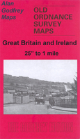
Abingdon in 1910 in a fascinating series of reproductions of old Ordnance Survey plans in the Alan Godfrey Editions, ideal for anyone interested in the history of their neighbourhood or family. Selected towns in Great Britain and Ireland are covered by maps showing the extent of urban development in the last decades of the 19th and early 20th century.In this title: Abingdon was the county town of Berkshire until 1867; today, however, since reorganisation in 1874, it is regarded as part of Oxfordshire. This map captures the town in detail. The town centre, with a group of streets around the Market Place, is in the centre of the map. Coverage extends west along Ock Street and Marcham Road to the Isolation Hospital, north along Bath Street and Faringdon Road to St Helen's School;
north-east along Vineyard Street to the Workhouse; south-east across Abingdon Bridge to Andersey Island; south-west to Caldecott Bridge. Other features include the River Ock, River Thames or Isis, Tower Brewery, Albert Park, Spring Grove parchment works, cemetery, railway terminus, High Street, malthouses, Grammar School, Abbey House. On the reverse is a directory of Abingdon in 1891, plus a GWR timetable for the Abingdon Branch. About the Alan Godfrey Editions of the 25
north-east along Vineyard Street to the Workhouse; south-east across Abingdon Bridge to Andersey Island; south-west to Caldecott Bridge. Other features include the River Ock, River Thames or Isis, Tower Brewery, Albert Park, Spring Grove parchment works, cemetery, railway terminus, High Street, malthouses, Grammar School, Abbey House. On the reverse is a directory of Abingdon in 1891, plus a GWR timetable for the Abingdon Branch. About the Alan Godfrey Editions of the 25
Product Description
Reviews/Comments
Add New
Intelligent Comparison
Archived Product
Abingdon 1910 Stanfords
£3.50
Archived Product

Accrington 1909 Stanfords
£3.50
Vouchers
No voucher codes found.
Do you know a voucher code for this product or supplier? Add it to Insights for others to use.
Do you know a voucher code for this product or supplier? Add it to Insights for others to use.
 Denmark