-
Home
-
Contributors
-
International
-
Account
-
Information
More From Contributor
£24.99
In ” The Routledge Atlas of the Second World War”, Martin Gilbert graphically charts the war`s political, military, economic & social history through 247 maps. Each map has been specially drawn for this atlas, many of them covering topics that have not previously been mapped. The atlas covers all the major events from the German invasion of Poland in September 1939 to the defeat of Japan in August 1945, including the Blitz, the Fall of France, Pearl Harbor, the naval Battles of the Atlantic, the Indian Ocean & the Pacific, Dieppe, Stalingrad, Midway, the Normandy Landings, the bombing of Warsaw, London, Coventry, Hamburg, Dresden, Tokyo, Hiroshima & Nagasaki, the Burma Railway, concentration camps & slave labor camps, & prisoner-of-war camps in Europe, the Americas & the Far East. Focusing on the human
- & inhuman
- aspects of the war, ” The Routledge Atlas of the Second World War”
Includes:: examination of: Military, naval & air campaigns on all the war fronts; The war on l&, at sea & in the air; The economic & social aspects of the war; The global nature of the war, in armed combat & in suffering; The impact of the war on civilians, both under occupation, & as deportees & refugees; The aftermath of the war: the post-war political & national boundaries; war graves, & the human cost of the war on every continent. ...
Archived Product
£30.00
The Southern Railway was one of the ` Big Four` companies which constituted Britain`s railways following the Grouping in 1923 until their nationalisation in 1948. It operated in the southern counties of England from Kent in the east across to Devon & Cornwall in the west, with major termini in London, but in the south west & western home counties was in competition with the Great Western Railway. This detailed atlas of the entire Southern network is based on original track diagrams of the three consituent companies of the Southern Railway
- the London & South Western Railway, The South Eastern & Chatham Railway & the London, Brighton & South Coast Railway. The fullest extent of the SR 1923-1947 is shown & the mapping also
Includes:: industrial lines. Lines are distinguished singled or doubled, & sidings, stations (including platforms), tunnels, signalboxes, level crossings, bridges & viaducts are also shown. ...
Archived Product
£20.00
In 45 beautiful, unique maps & with evocative photography, Atlas of the Unexpected is a journey to far-off lands, obscure discoveries & unimaginable locations. From the fortuitous discovery of the Dead Sea scrolls by a stray goat, to the wonderfully bizarre beginnings that led to the aptly named Just Enough Room Island & even the royal romance that led shipwrecked lovers to discover Madeira, Travis Elborough takes you on a voyage to some of the world`s most wondrous, improbable &
- most of all
- unexpected of places. ...
- most of all
- unexpected of places. ...
Archived Product
£12.99
Inside this remarkable guide to space, you will find everything from detailed planetary topography to the most current facts & figures about our amazing Universe. In addition to extensive maps of outer space, this atlas also
Includes:: constellation charts, diagrams & cross sections of space objects like asteroids & meteorites, the latest information on space shuttles & missions & stunning, oversize images that capture exploding supernovas & distant galaxies. Designed for the next generation of space enthusiasts, ” Atlas of the Universe” contains everything you will need to navigate the night sky
- & the farthest reaches of the cosmos. This book features a metallic embossing on the cover. It contains over 800 photos & illustrations, star maps & fact files. It
Includes:: a poster & a CD containing download able images. ...
Archived Product
£25.00
The “ Philip’s Atlas of the Universe” is a classic work, a fantastic reference to the stars, the planets & the Universe. It contains hundreds of photographs from the very best ground-based telescopes & the Hubble & Spitzer space telescopes, along with fascinating images from five decades of robotic exploration of the planets. As well as being a beautiful & informative portrait of the cosmos, the book provides superb star maps & sound advice on practical observing, making it a highly suitable guide for those who wish to discover the richness of astronomy themselves. The book is divided into seven sections:- Exploring the Universe: the history of astronomy & space exploration.- The Solar System: the Earth & all the planets.- The Sun: information on the astrophysical & visible phenomena.- The Stars: movements & life cycles & everything in between!- Into the Universe: a fascinating look at the structure of the Universe- Star Maps: complete atlas of the constellations in 22 maps.- The Practical Astronomer: packed with useful information for the aspiring astronomer. This is a truly fantastic reference tool, & comes recommended by the Journal of the British Astronomical Association & a foreword by Sir Patrick Moore himself just to prove the point. ...
Archived Product
£9.99
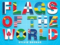
A fantastic atlas to help children learn about the countries of the world, the most famous & interesting sites, & also each country`s flag & fascinating world records. A brilliant introduction to geography, capital cities & world landmarks ranging from the statue of the Little Mermaid in Copenhagen to the Kennedy Space Center in Florida. ...
Archived Product
£525.00
Before the first appearance of the ” Atlas of the World`s Languages” in 1993, all the world`s languages had never been accurately & completely mapped. The ” Atlas” depicts the location of every known living language, including languages on the point of extinction. This fully revised edition of the ” Atlas” offers: up-to-date research, some from fieldwork in early 2006; a general linguistic history of each section; an overview of the genetic relations of the languages in each section; statistical & sociolinguistic information; a large number of new or completely updated maps; further reading & a bibliography for each section; &, a cross-referenced language index of over 6, 000 languages. Presenting contributions from international scholars, covering over 6, 000 languages & containing over 150 full-colour maps, the ” Atlas of the World`s Languages” is the definitive reference resource for every linguistic & reference library. ...
Archived Product
£14.99
The continuing evolution of the railway industry over the past six years has rendered the original volume redundant. This new & fully revised edition reflects the state of the railway industry as it exists in mid-2006 & has been enhanced in the light of comments received following the publication of the first edition, most notably in the more accurate delineation of stations served by individual TOCs, & will become a standard reference work for both professionals & enthusiasts alike on Britain's contemporary railway industry. ...
Archived Product
£20.00
Shortlisted for a 2018 Edward Stanford Travel Writing Award. In a world that has increasingly become tamed by human activity, the true wild holds a growing mysticism. Rugged landscapes with unspoilt scenery invoke romantic visions of paradise, but there are also intense & powerful wildernesses that produce fear & awe alike & unexplored zones where feral wildlife roams in the shadows. Chris Fitch takes you on a journey through the world’s wildest places, visiting immensely diverse floral kingdoms, remote jungles abundant with exotic birds, & both freezing cold & scorching hot inhospitable environments. From these natural havens we travel to the extreme & the incredible: lightening inducing lakes, acidic mud baths, & man-eating tiger kingdoms. As well as those wildernesses being reclaimed by nature, such as Chernobyl, that after being left abandoned for years has returned to a natural wild habitat, free from human intervention. Not forgetting those most bizarre of destinations, such as the tidal surges of the Qiantang River, the bridge to Modo Island that emerges from the sea, & the strange magnetic pull of Jubuka rock. With beautiful maps & stunning photography, Atlas of Untamed Places is an intrepid voyage to nature’s most unusual, unpredictable, & extraordinarily wild destinations. ...
Archived Product
£24.99
The economic, social & environmental systems of the world remain in turmoil. Recent years have seen possibly irrevocable change in the politics of Europe, Asia, Africa & Latin America. Entirely revised & updated, the 11th edition describes the people, factions, & events that have shaped the modern world from the Second World War to the present day. International issues & conflicts are placed in their geographical contexts through the integration of over one hundred maps. The political context provided for current events will be invaluable to all those uncertain about the changing map of Europe & Africa, conflicts in the Middle East, & the appearances in the headlines & on our television screens by al-Qaeda, Chechnya, the Taliban, Mercosur, Somalil&, Kosovo, AIDS, OPEC, & Schengenl&. Critical new issues are covered including the war on terrorism, nuclear proliferation, European Union expansion, & the pressing environmental concerns faced by many sovereign states. This edition provides guidance through all these recent changes (and many more). This book offers up-to-date coverage of all regions in great detail. It contains an objective & concise explanation of current events, combining maps with their geopolitical background. It provides a clear context for events in the news, covering the Middle East, Korea, China, the European Union, east Africa, & every other part of the world. Revised & in print since 1957, ” An Atlas of World Affairs” continues to provide a valuable guide for the student, teacher, journalist & all those interested in current affairs & post-war political history. ...
Archived Product

Atlas Of The World
This superb high-quality atlas is printed in hardback format with a luxurious slipcase for protection. Continental, Political and Physical maps are included. Useful facts, statistics and flags are provided for each country and there is an informative introductory section covering a wide range of topics from the solar system to the history of mankind and from plate-tectonics to the population explosion. There are more than 100 pages of reference mapping providing accurate, accessible and attractive coverage of the whole world.
RIP - This product is no longer available on our network. It was last seen on 25.09.2019
This page now acts as a permanent archive for this product. Add more information using the comments box below to ensure it can still be found by future generations.
Use our search facility to see if it is available from an alternative contributor.
This page now acts as a permanent archive for this product. Add more information using the comments box below to ensure it can still be found by future generations.
Use our search facility to see if it is available from an alternative contributor.
- Availability: Out Of Stock
- Supplier: Stanfords
- SKU: 9780749567262
Availability: In Stock
£14.99
Product Description
This superb high-quality atlas is printed in hardback format with a luxurious slipcase for protection. Continental, Political & Physical maps are included. Useful facts, statistics & flags are provided for each country & there is an informative introductory section covering a wide range of topics from the solar system to the history of mankind & from plate-tectonics to the population explosion. There are more than 100 pages of reference mapping providing accurate, accessible & attractive coverage of the whole world.
Reviews/Comments
Add New
Intelligent Comparison
Price History
Vouchers
No voucher codes found.
Do you know a voucher code for this product or supplier? Add it to Insights for others to use.
Facebook
Do you know a voucher code for this product or supplier? Add it to Insights for others to use.
Jargon Buster
Physical - Used to describe strength or visual properties of an item
History - Anything that happens in the past. An acedemic subject.
World - A physical grouping, commonly used to describe earth and everything associated with ti
Quality - An object that has quality is superior in function and finish than a less quality object.
Solar - the sun and the energy from the sun.
Hardback - Referring to books something that is made from thick stiff card
Accurate - A measurement of precision when all elements are correct.
Wide - Something with a large width.
Reference - To prove evidence with a back up source.
Supplier Information
Stanfords
Stanfords was established in 1853 and opened their iconic Covent Garden flagship store in 1901. They have become the top retailer of maps, travel books and accessories in the UK and arguably offer the largest selection of maps and travel books worldwide. Famous names such as Captain Robert Falcon Scott, Ranulph Fiennes and Michael Palin have purchased from Stanfords. They now have a shop in Bristol and both stores together with other venues operate a calendar of events including talks, book signings and exhibitions. As a specialist map retailer, the map selection is comprehensive and includes road maps, street maps and walking maps from worldwide destinations, as well as a selection of world atlases and wall maps. Books include travel guides and travel literature. Stanfords also stock globes, from miniatures made of blue marble to magnificent floor-standing globes. The website features a selection of interesting articles on travel topics.
Page Updated: 2023-11-12 20:15:36
Community Generated Product Tags
Oh No! The productWIKI community hasn't generated any tags for this product yet!


 United Kingdom
 France
 Germany
 Netherlands
 Sweden
 USA
USA
 Italy
Italy
 Spain
Spain


 Denmark