More From Contributor
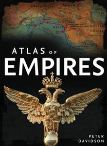
£34.95
More than half the world`s population lives in cities, & that proportion is expected to rise to three-quarters by 2050. Urbanization is a global phenomenon, but the way cities are developing, the experience of city life, & the prospects for the future of cities vary widely from region to region. The Atlas of Cities presents a unique taxonomy of cities that looks at different aspects of their physical, economic, social, & political structures; their interactions with each other & with their hinterlands; the challenges & opportunities they present; & where cities might be going in the future. Each chapter explores a particular type of city--from the foundational cities of Greece & Rome & the networked cities of the Hanseatic League, through the nineteenth-century modernization of Paris & the industrialization of Manchester, to the green & ”smart” cities of today. Expert contributors explore how the development of these cities reflects one or more of the common themes of urban development: the mobilizing function (transport, communication, & infrastructure); the generative function (innovation & technology); the decision-making capacity (governance, economics, & institutions); & the transformative capacity (society, lifestyle, & culture). Using stunning info-graphics, maps, charts, tables, & photographs, the Atlas of Cities is a comprehensive overview of the patterns of production, consumption, generation, & decay of the twenty-first century`s defining form. Presents a one-of-a-kind taxonomy of cities that looks at their origins, development, & future prospects Features core case studies of particular types of cities, from the foundational cities of Greece & Rome to the ”smart” cities of today Explores common themes of urban development, from transport & communication to lifestyle & culture

Includes::
stunning info-graphics, maps, charts, tables, & photos Additional material for this book: Cities Featured: Abuja, Alexandria, Amsterdam, Athens, Augsburg, Babylon, Beijing, Berlin, Brasilia, Bruges, Budapest, Cairo, Canberra, Chandigarh, Chicago, Constantinople, Curitiba, Detroit, Dubai, Dublin, Dusseldorf, Florence, Frankfurt, Freiburg, Geneva, Ghent, Glasgow, Gussing, Hong Kong, Innsbruck, Istanbul, Jakarta, Karachi, Knossos, Las Vegas, London, Los Angeles, Lubeck, Manchester, Marseille, Masdar City, Mexico City, Miami, Milan, Mumba, Mumbai, Nairobi, New York, Paris, Pella, Portl&, Rome, San Francisco, Santorini, Sao Paulo, Seoul, Shanghai, Sheffield, Singapore, Sparta, St. Petersburg, Stockholm, Sydney, Syracuse, Tokyo, Vancouver, Venice, Vienna, Washington, D.C., Wildpoldsried

...
Archived Product
£18.99
This alluring read

Includes::
40 locations that are rife with disaster, chaos, paranormal activity, & death.

...
Archived Product
£20.00
From the team behind the best-selling Atlas of Adventures comes this prehistoric journey of discovery. Travel back in time to lock horns with a triceratops, stalk prey with a T-Rex, & learn to fly with a baby Pteranodon. With hundreds of things to spot & facts to learn, this is the biggest Atlas adventure yet! ...
Archived Product
£23.99
Written by renowned author & diver Fiona Mc Intosh, Dive Sites of South Africa & Mozambique is a comprehensive atlas & guide to some of the top dive spots in Southern Africa. With over 157 detailed dive descriptions accompanied by 50 pages of topside & underwater maps, this guide is a useful reference for both advanced & novice divers. All dive sites highlighted in the book are featured with location maps, access points, difficulty ratings, maximum & average depths, water temperatures, dive conditions & other area-specific adventure & marine activities to name but a few. The book also

Includes::
a marine species identification guide with detailed information displaying full-colour photographs, scientific names & brief descriptions of each of the 150 different species identified.

...
Archived Product
£26.99
An invaluable guide to a complex subject, this atlas: * gives a general introduction to the physical, ethnic & religious composition of the region *

Includes::
summary maps of Eastern Europe in 1900, 1923, & 1945 * charts the ebb & flow of the first & second world wars in Eastern Europe * presents detailed information relating to consituent territories, elections, economic developments & land holding patterns for key individual countries in the inter-war years * provides crucial social & economic data, evidencing changes under communist domination * gives maps of the new states of the post-communist years with details of elections & economic indicators for Belarus, Bosnia-Hercegovina, Croatia, The Czech Republic, Estonia, Latvia, Lithuania, Macedonia, Moldova, Slovakia & others. * contains an extensive glossary listing the major towns of the area under their linguistic variants

...
Archived Product
£12.99
Navigate the world like never before. Featuring over 50 maps of the world
- one on every page
- this unique atlas


...
Archived Product
£10.99
These exciting, illustrated atlases present a dramatic insight into what the world was like during key historical periods. Packed with information about civilizations, empires, religions, kingdoms & famous figures, these books are the perfect pictorial guides to the past. The Kingfisher Atlas of Exploration & Empires recreates the world between 1450 & 1800, examining the themes of exploration, trade, conquest & intellectual discovery. Each map in the book focuses on a major empire, region, civilization, religious or social movement. The subjects are arranged chronologically, & all major regions of the globe are covered. ...
Archived Product
£16.99
Why is there a maple leaf in the centre of the Canadian flag? What is the eagle on the white background of the Mexican flag carrying in its beak? Is it just by chance that the Middle Eastern countries all have flags in the same colours? These & many other questions about national flags are answered in this richly illustrated volume, which gives historical information & geographical notions, but also many curiosities about the specific characteristics of the various flags & the nations they represent. The colours, the symbols & the patterns on the flags conceal ancient legends that have been told since the start of time. The reader will be taken on a journey that goes beyond the continents & the nations & delves into myth & history, to discover much more about the world we live in. ...
Archived Product
£14.99
The world can be seen from many different viewpoints, but one of the most interesting is certainly food. Don`t we always say, ”we are what we eat”? Therefore, a particular food will reflect the culture, the tradition & the relation to nature of the people who created it. This book travels thecountries of the world to tell the secrets of the typical dishes. The reader will discover that the tapas, the typical finger food of Spain is called that because they were used to plug a glass of wine (tapar in Spanish), or that the first pizza was given the name of the Italian Queen Margherita. The drawings of the dishes on the maps take the reader on a journey through the flavours of the world, enriching their understanding of traditions &, why not, stirring the appetite. ...
Archived Product
£9.99
Grab your football boots & get ready for the 2018 World Cup in this incredible journey around the globe! Football is enjoyed in every nation of the world by millions & millions of different people. This unbelievable round-the-world adventure is a celebration of the beautiful game that will take you through all of the planet`s continents. Discover fascinating facts & stats
- from record-breaking goals to famous football mascots
- & learn about the funny & extraordinary moments that make football such a beautiful game. The illustrated maps feature key aspects, such as borders, capital cities & major rivers, combined with amazing football facts
- perfect for engaging young readers & football fans. An absorbing gift for avid football fans aged 7+ years, perfect for the next David Beckham. Kick off your footballing journey & see the world in a whole new light! Clive Gifford started writing books at the age of 16 & hasn`t stopped since! He has had over 150 books published, most of which are for children. His books have been nominated for, or won, Royal Society, School Library Association, Blue Peter, Smithsonian & TES awards. Clive lives in Manchester. Tracy Worrall creates her artwork using both digital & traditional media. She produced animations for an award-winning educational television series for the Discovery Channel. Tracy lives in Liverpool.


...
Archived Product

Atlas Of Empires

Atlas of Empires tells the story of how and why the great empires of history came into being, operated and ultimately declined, and discusses the future of the empire in today`s globalized world. Featuring 60 beautiful and detailed maps of the empires` territories at different stages of their existence and organized thematically to reflect the different driving forces behind empires throughout history (such as faith, nomadic culture, nationhood and capitalism), each section discusses the rise and fall of the empires that existed in a region: their government and society, wealth and technology, war and military force, and religious beliefs. From the earliest empires of the Sumerians and the Pharoahs to the modern `empires` of the USA and the European Union, this is a story that
reveals how empires are created and organized, how later empires resolve the problems of governance faced by earlier empires, and how the political and cultural legacies of ancient empires are still felt today. It is the story of how humanity`s drive to bring peace and prosperity to a region vied with people`s itch to dominate, exploit and exterminate. Fascinating and informative, ”Atlas of Empires” is an essential resource. It is suitable for those interested in the history of civilizations and world politics. It is also suitable for students of history looking for a clear, visually rich guide to how empires operated and interacted.
RIP - This product is no longer available on our network. It was last seen on 25.09.2019

This page now acts as a permanent archive for this product. Add more information using the comments box below to ensure it can still be found by future generations.

Use our search facility to see if it is available from an alternative contributor.
  • Availability: Out Of Stock
  • Supplier: Stanfords
  • SKU: 9781847730640
Availability: In Stock
£17.99

Product Description

Atlas of Empires tells the story of how & why the great empires of history came into being, operated & ultimately declined, & discusses the future of the empire in today`s globalized world. Featuring 60 beautiful & detailed maps of the empires` territories at different stages of their existence & organized thematically to reflect the different driving forces behind empires throughout history (such as faith, nomadic culture, nationhood & capitalism), each section discusses the rise & fall of the empires that existed in a region: their government & society, wealth & technology, war & military force, & religious beliefs. From the earliest empires of the Sumerians & the Pharoahs to the modern `empires` of the USA & the European Union, this is a story that reveals how empires are created & organized, how later empires resolve the problems of governance faced by earlier empires, & how the political & cultural legacies of ancient empires are still felt today. It is the story of how humanity`s drive to bring peace & prosperity to a region vied with people`s itch to dominate, exploit & exterminate. Fascinating & informative, ” Atlas of Empires” is an essential resource. It is suitable for those interested in the history of civilizations & world politics. It is also suitable for students of history looking for a clear, visually rich guide to how empires operated & interacted.

Reviews/Comments

Add New

Price History

Vouchers

No voucher codes found.
Do you know a voucher code for this product or supplier? Add it to Insights for others to use.

Facebook

Jargon Buster

Students - A group of humans who are still in full time education
History - Anything that happens in the past. An acedemic subject.
World - A physical grouping, commonly used to describe earth and everything associated with ti
Felt - A non woven cloth made from compressed wool

Supplier Information

Stanfords
Stanfords was established in 1853 and opened their iconic Covent Garden flagship store in 1901. They have become the top retailer of maps, travel books and accessories in the UK and arguably offer the largest selection of maps and travel books worldwide. Famous names such as Captain Robert Falcon Scott, Ranulph Fiennes and Michael Palin have purchased from Stanfords. They now have a shop in Bristol and both stores together with other venues operate a calendar of events including talks, book signings and exhibitions. As a specialist map retailer, the map selection is comprehensive and includes road maps, street maps and walking maps from worldwide destinations, as well as a selection of world atlases and wall maps. Books include travel guides and travel literature. Stanfords also stock globes, from miniatures made of blue marble to magnificent floor-standing globes. The website features a selection of interesting articles on travel topics.
Page Updated: 2023-11-12 20:15:36

Community Generated Product Tags

Oh No! The productWIKI community hasn't generated any tags for this product yet!
Menu