More From Contributor

£7.99
Those gallus Gauls & glaikit Romans are at it again. After the groundbreaking success of the first Scots Asterix translation, Asterix & the Pechts, Matthew Fitt is going back to the very first Asterix adventure. Asterix the Gaul is now getting the same treatment as Itchy Coo publish Asterix the Gallus, the original tale of menhirs & mayhem retold in entertaining easy-to-read Scots. ...
Archived Product
£7.99
Gaul was divided into three parts. No, four parts
- for one small village of indomitable Gauls still held out against the Roman
...
Archived Product
£7.99
The next action-packed adventure from Asterix & Obelix! The roads across Italy are in disrepair. Defending his name, & to prove Rome`s greatness, Senator Lactus Bifidus announces a special one-off chariot race. Julius Caesar insists a Roman must win, or Bifidus will pay. Open to anyone from the known world, competitors arrive from far & wide, including Asterix & Obelix. With Bifidus secretly scheming, who will win this almighty chariot race? ...
Archived Product
£10.99
Asti at 1:10, 000 on indexed street plan from Litografia Artistica Cartografica in their Globalmap imprint, with a detailed enlargement of the city’s historic centre at 1:6, 000. 38 monuments including historic buildings & churches, cultural or educational institutions, & important municipal buildings or facilities are numbered & listed next to the plan. Car parks in & around the city’s historic centre are prominently marked. Street index is next to the plan. Litografia Artistica Cartografica (LAC) are Italy’s leading publishers of street plans with an extensive range of titles. Where appropriate, the plans include an enlargement showing the historic centre in greater detail. On each plan monuments including historic buildings & churches, archaeological sites, cultural or educational institutions, & important municipal buildings or facilities are numbered & listed next to the plan. Unless indicated to the contrary in the individual description, one way streets are not marked. Street index is on the reverse. ...
Archived Product
£10.95
Asti
- Alba
- Acqui Terme, map no. 19, in a series contoured hiking maps at 1:50, 000 with local trails, long-distance footpaths,

...
Archived Product
£7.95
Asti Province in a series of handy size road maps from Litografia Artistica Cartografica (LAC) with more minor local roads & tracks than can be found on most regional maps. The series is gradually being changed to a new style of digitally derived cartography, so presentation of adjoining titles may vary. All the maps have hill shading to represent the general relief with spot heights for selected peaks, & show a few more local roads & rough tracks than the other road map series. Intermediate road distances are indicated. Regional, provincial & communal borders are marked, & railways, funiculars, airports, sea ferry links & campsites are shown. The legend is in Italian only. The new, digitally produced editions are indexed & have enhanced, more finely drawn cartography: the hill-shading is less bold, motorway service areas are marked, natural parks are highlighted & an expanded range of symbols indicates various landmarks & sites, e.g. antiquities, churches, etc. Two styles of the new cartography are produced, differing only in the colour of the predominant background shading: grey or yellow/green. Some of the new editions include geographical coordinates for the map corners. The index of localities is on the reverse. This title is now published with digital cartography. ...
Archived Product
£12.99
Asti Province at 1:100, 000 in a series of handy size provincial road maps from Litografia Artistica Cartografica (LAC) with more minor local roads & country tracks than can be found on most regional maps from other publishers. This title is now available in a digitally produced edition.LAC’s provincial series is gradually being changed to a new style of digitally derived cartography, so presentation of adjoining titles may vary. All the maps have hill shading to represent the general relief with spot heights for selected peaks, & show a few more local roads & rough tracks than the other road map series. Intermediate road distances are indicated. Regional, provincial & communal borders are marked, & railways, funiculars, airports, sea ferry links & campsites are shown. The legend is in Italian only. The new, digitally produced editions are indexed & have enhanced, more finely drawn cartography: the hill-shading is less bold, motorway service areas are marked, natural parks are highlighted & an expanded range of symbols indicates various landmarks & sites, e.g. antiquities, churches, etc. Two styles of the new cartography are produced, differing only in the colour of the predominant background shading: grey or yellow/green. Some of the new editions include geographical coordinates for the map corners. The index of localities is on the reverse. To see all the titles in this series please click on the series link. ...
Archived Product
£7.95
Asti Province in a series of handy size road maps from Litografia Artistica Cartografica (LAC) with more minor local roads & tracks than can be found on most regional maps. The series is gradually being changed to a new style of digitally derived cartography, so presentation of adjoining titles may vary. All the maps have hill shading to represent the general relief with spot heights for selected peaks, & show a few more local roads & rough tracks than the other road map series. Intermediate road distances are indicated. Regional, provincial & communal borders are marked, & railways, funiculars, airports, sea ferry links & campsites are shown. The legend is in Italian only. The new, digitally produced editions are indexed & have enhanced, more finely drawn cartography: the hill-shading is less bold, motorway service areas are marked, natural parks are highlighted & an expanded range of symbols indicates various landmarks & sites, e.g. antiquities, churches, etc. Two styles of the new cartography are produced, differing only in the colour of the predominant background shading: grey or yellow/green. Some of the new editions include geographical coordinates for the map corners. The index of localities is on the reverse. This title is now published with digital cartography. ...
Archived Product
£3.50
Aston Manor in 1913 in a fascinating series of reproductions of old Ordnance Survey plans in the Alan Godfrey Editions, ideal for anyone interested in the history of their neighbourhood or family. The map covers the heart of the large Aston Manor, including parts of Aston, Handsworth & Lozells Wards, as well as the area known as Birchfield. Coverage stretches from Stamford Road eastward to Beales Street & Electric Avenue, & from Deykin Avenue southward to Clifton Road. Features include Aston Hall, Aston Park, Villa Park, LNWR line with Witton station, St Peter & St Paul`s church, Bathurst Works, Howard Chandelier Works, tramways & depot, St Paul`s church Lozells, Holy Trinity church Birchfield, St James church, Lozells Picture House, Holte Almshouses, Pavilion Electric Theatre, Grammar School, police station, etc. On the reverse is a selection of street directory entries, including Birchfield Road, Frederick Road, Queen`s Road, Witton Lane & Witton Road. About the Alan Godfrey Editions of the 25” OS Series: Selected towns in Great Britain & Ireland are covered by maps showing the extent of urban development in the last decades of the 19th & early 20th century. The plans have been taken from the Ordnance Survey mapping & reprinted at about 15 inches to one mile (1:4, 340). On the reverse most maps have historical notes & many also include extracts from contemporary directories. Most maps cover about one mile (1.6kms) north/south, one & a half miles (2.4kms) across; adjoining sheets can be combined to provide wider coverage.FOR MORE INFORMATION & A COMPLETE LIST OF ALL AVAILABLE TITLES PLEASE CLICK ON THE SERIES LINK. ...
Archived Product
£6.99
From Booker Prize-winner Ben Okri: a deceptively simple modern fable with an ancient origin. A young man finds himself living among invisible beings who have built a utopia based on one principle: that we must repeat or suffer every experience until we experience it properly & fully for the first time. ` The hero of this novel finds what he did not seek, & goes where he did not intend to go. As I did in writing it.` BEN OKRI. ...
Archived Product

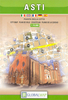
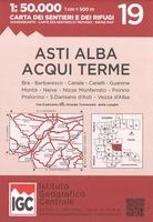
Asti - Alba - Acqui Terme IGC 19

Asti - Alba - Acqui Terme area in a series contoured hiking maps at 1:50, 000 with local trails, long-distance footpaths, mountain accommodation, etc. from the Turin based Istituto Geografico Centrale.Maps in this series have contours at 50m intervals, enhanced by shading and graphic relief. An overprint highlights local footpaths and long-distance routes, including the GTA (Grande Traversata delle Alpi), Via Alpina, Tour Monte Rosa, and Alta Via del Monti Liguri - the high level route along the Ligurian Alps. Difficult sections of the routes and the Via Ferrata passages are indicated. New editions now also include an overprint highlighting cycling routes, where indicated in the map’s individual description. The maps also show various types of alpine accommodation: refuges,
shelters, hostels, campsites, etc. Cable car lines, chair lifts, and mountain railways are marked, as well as, for road users, entry restrictions on local tracks. Each map covers approximately 50 x 40 km / 30 x 25 miles. The maps have no geographical coordinates. Map legend includes English.To see the other titles in this series please click on the series grid.
RIP - This product is no longer available on our network. It was last seen on 25.09.2019

This page now acts as a permanent archive for this product. Add more information using the comments box below to ensure it can still be found by future generations.

Use our search facility to see if it is available from an alternative contributor.
  • Availability: Out Of Stock
  • Supplier: Stanfords
  • SKU: 9788896455661
Availability: In Stock
£13.99

Product Description

Asti
- Alba
- Acqui Terme area in a series contoured hiking maps at 1:50, 000 with local trails, long-distance footpaths, mountain accommodation, etc. from the Turin based Istituto Geografico Centrale. Maps in this series have contours at 50m intervals, enhanced by shading & graphic relief. An overprint highlights local footpaths & long-distance routes, including the GTA (Grande Traversata delle Alpi), Via Alpina, Tour Monte Rosa, & Alta Via del Monti Liguri
- the high level route along the Ligurian Alps. Difficult sections of the routes & the Via Ferrata passages are indicated. New editions now also include an overprint highlighting cycling routes, where indicated in the map’s individual description. The maps also show various types of alpine accommodation: refuges, shelters, hostels, campsites, etc. Cable car lines, chair lifts, & mountain railways are marked, as well as, for road users, entry restrictions on local tracks. Each map covers Approx. 50 x 40 km / 30 x 25 miles. The maps have no geographical coordinates. Map legend

Includes::
English. To see the other titles in this series please click on the series grid.

Reviews/Comments

Add New

Intelligent Comparison

Oooops!
We couldn't find anything!
Perhaps this product's unique.... Or perhaps we are still looking for comparisons!
Click to bump this page and we'll hurry up.

Price History

Vouchers

No voucher codes found.
Do you know a voucher code for this product or supplier? Add it to Insights for others to use.

Facebook

Jargon Buster

Hiking - An outdoor activity envolving walking in nature
Cable - A series of wires bonded to form a single thread
Railways - A set of tracks that have been laid for the purpose of trains to travel up and down them
Car - A machine used for transport which runs on roads
Km - Kilometre. A unit of measurement equal to 1000 metres.
Road - a manmade lane or a path that is used to speed up travel.
Accommodation - A room in which someone can live in, for example in a hotel
Individual - A single separate item or person.

Supplier Information

Stanfords
Stanfords was established in 1853 and opened their iconic Covent Garden flagship store in 1901. They have become the top retailer of maps, travel books and accessories in the UK and arguably offer the largest selection of maps and travel books worldwide. Famous names such as Captain Robert Falcon Scott, Ranulph Fiennes and Michael Palin have purchased from Stanfords. They now have a shop in Bristol and both stores together with other venues operate a calendar of events including talks, book signings and exhibitions. As a specialist map retailer, the map selection is comprehensive and includes road maps, street maps and walking maps from worldwide destinations, as well as a selection of world atlases and wall maps. Books include travel guides and travel literature. Stanfords also stock globes, from miniatures made of blue marble to magnificent floor-standing globes. The website features a selection of interesting articles on travel topics.
Page Updated: 2023-11-12 20:15:36

Community Generated Product Tags

Oh No! The productWIKI community hasn't generated any tags for this product yet!
Menu