
 United Kingdom
 France
 Germany
 Netherlands
 Sweden
 USA
USA
 Italy
Italy
 Spain
Spain
More From Contributor


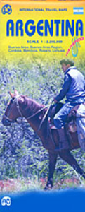
Argentina ITMB
Double-sided, indexed map of Argentina at 1:2, 200, 000 from ITMB, printed on waterproof and tear-resistant synthetic paper, with a large street plan of central Buenos Aires, city centre street plans of Córdoba, Rosario, Mendoza and Ushuaia, plus an enlargement of the environs of the capital.The map divides the country north-south with a tiny overlap between the two sides. Altitude colouring with spot heights and marking for swamps, salt pans and glaciers presents the country’s topography. National parks and other protected areas are highlighted. Road detail distinguishes between paved and unpaved roads and includes selected tracks. Driving distances are shown on main routes. Railways, airports/airfields, major ferries and provincial boundaries are marked. Symbols highlight
various places of interest including selected campsites, historical sites, beaches, etc. Latitude and longitude lines are drawn at 1º intervals. Each side of the map has a separate index. The map also includes a large, clear street plan of central Buenos Aires, clearly showing the city’s metro connections, with smaller panels providing plans of central Córdoba, Rosario, Mendoza and Ushuaia. All the plans are annotates with selected accommodation, places of interest, etc. Another inset shows the environs of Buenos Aires in greater detail.
various places of interest including selected campsites, historical sites, beaches, etc. Latitude and longitude lines are drawn at 1º intervals. Each side of the map has a separate index. The map also includes a large, clear street plan of central Buenos Aires, clearly showing the city’s metro connections, with smaller panels providing plans of central Córdoba, Rosario, Mendoza and Ushuaia. All the plans are annotates with selected accommodation, places of interest, etc. Another inset shows the environs of Buenos Aires in greater detail.

Product Description
Reviews/Comments
Add New
Vouchers
No voucher codes found.
Do you know a voucher code for this product or supplier? Add it to Insights for others to use.
Do you know a voucher code for this product or supplier? Add it to Insights for others to use.
 Denmark