More From Contributor
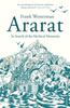
£6.99
The Aran Islands at 1:25, 000 on a contoured, GPS compatible map from the Ordnance Survey of Irel&, with photos & descriptions of best examples of forts & stones walls on Inishmore, Inishmaan & Inisheer. The map has contours at 10m intervals, with additional graphics for different types of woodlands. Waymarked hiking routes & unmarked trails are highlighted, with a range of symbols showing various facilities, including camping & caravan sites, An ...
Archived Product
£13.99
Aran Pink Floral Buff is a multifunctional clothing accessory made from 100% technical fibre polyester, lightweight, breathable, wick-away, & wind resistant. Buffs are a seam free, versatile garment that can be shaped, folded & twisted into a number of articles. Primarily for head wear Buffs can be shaped into skull caps, headbands, masks, saharianes, neckerchiefs, scarves, blind chickens, wristbands, diadems, balaclavas, foulards, hairbands or pirate caps.

Dimensions Approx. 52 x 24.5cm. Weight Approx. 36g. Standard fit for most adults. Easy care material
- machine washable & non iron.


...
Archived Product
£6.95
Topographic coverage of mainland Spain at 1:50, 000 in the MTN50 (Mapa Topográfico Nacional) series from the Centro Nacional de Información Geografica, the country’s civilian survey organization. The maps have contours at 20m intervals, enhanced by relief shading, plus colouring and/or graphics to show different types of terrain, vegetation or land use. Boundaries of national parks & other protected areas are marked. In addition to all the usual information featured on topographic mapping at this scale, detailed presentation of the road & rail networks, rural tracks & paths, etc, the maps also show campsites & mountain refuges. On more recent editions some GRs, the official long-distance hiking routes, are also marked (although not as clearly as on hiking maps from other publishers). Each map covers 29.5x 18.5 km (with adjustments in the border or coastal areas). The maps have a 1-km UTM grid, plus margin ticks for latitude & longitude at 1` intervals. Map legend is in Spanish only.HOW TO CHOOSE THE RIGHT 50K MAP: all the titles in CNIG’s 200K Provincial Road Maps series at 1:200, 000 are overprinted with the grid for the 1:50, 000 maps & can be used to see the area covered by each 50K title. TO SEE THE LIST OF TITLES IN THIS SERIES PLEASE CLICK ON THE SERIES LINK.PLEASE NOTE
- MAP TITLES: the grids shown on our website serve both the civilian & the military 1:50, 000 topographic series. Although the areas covered by maps in both series are identical (apart from some border or coastal sheets), occasionally map titles differ – only one title is shown on the grid, usually the military one. In Galicia, the Basque country & in the Catalan speaking areas the tendency now is to use local place names rather than the often better known Castilian ones. Where possible, both versions are included in our titles. Map titles listed on our website are based on information received by us at the time of publication, but sometimes maps arrive showing a completely different title! As long as the map number is as ordered, the correct map has been supplied.
...
Archived Product
£9.99
Araniko Chuli, sheet no. 2983-11/15, in the topographic survey of Nepal at 1:50, 000 published by the Nepali Government in the late 1990s & early 2000s & produced from remote sensing data by Finnish cartographers as part of that country’s international aid program. The maps cover 15’ x 15’ quadrangles.IMPORTANT – PLEASE NOTE BEFORE ORDERING: AVAILABILITY: although, theoretically at least, still in print, these maps are very difficult to get locally in Nepal and/or from various suppliers elsewhere specializing in obtaining such maps. DELIVERIES MAY TAKE SEVERAL WEEKS OR EVEN MONTHS.PROBLEMS WITH PLACE NAMES: reports from previous users indicate that transliteration of place names differs from that used widely not only on other maps & in guide books but also on the ground itself, in road signs & in the tourist & trekking industry in general. Whilst most names are similar enough to be easily recognizable, e.g. Namche Bajar for Namche Bazar or Lantan for Langtang, we have been told of confusion & difficulties arising from different spellings appearing on these maps.TREKKING ROUTES & TOURIST INFORMATION: whilst the maps show foot trails & mark locations of temples, etc, they carry no specific trekking information. Major trekking routes & places of interest are not highlighted. There is no marking for base camps & other tourist facilities. Map specifications: Contours are at 40m intervals, with graphics and/or coloring to show various features of the terrain (glaciers with moraines & crevasses, quarries, gravel or clay pits, etc.) & vegetation (forests, bush, grass, orchards & plantations, etc). Additional comments such as “open mixed forest mainly bajh & pine” annotate many area. The maps have numerous spot heights, but relatively few peaks are named. Areas outside the country’s borders are left blank. Settlements in remote areas are indicated by markings for individual buildings & the placing of names does not always make it clear which group of buildings they refer to. Road network distinguishes between major & minor foot trails. Symbols mark features such as temples, schools & hospitals, police stations, etc. Also shown are the country’s administrative divisions. The maps have a 1-km UTM grid, plus latitude & longitude lines at intervals of 5’. Map legend & all the text is in English. Coverage: the whole country is now covered, with the north at 1:50, 000, plus central & southern Nepal at 1:25, 000. The two series are complementary, do not overlap & use the same grid & numbering system (apart from the Lumbini Zone, where a different grid & numbering are used). For areas not shown on our grid & titles not listed here, please contact us by e-mail, but please do bear in mind the problems with availability & the likely very long delivery time. ...
Archived Product
£9.99
Mount Ararat in Turkey is where, as biblical tradition has it, Noah`s Ark ran aground & God made his covenant with mankind. Now it stands astride the fault-line between religion & science, a geographical, political & cultural crossroads, bound up with the centuries-old history of warfare between different cultures in this region. Frank Westerman takes a pilgrimage from the mountain`s foot to its highest slopes, meeting along the way geologists, priests & an expedition in search of the Ark`s remains, as well as a Russian astronaut who observes that `there is something between heaven & earth about which we humans know nothing`. Ararat is a dazzling, highly personal book about science, religion & all that lies between, by one of Europe`s most celebrated young writers. ...
Archived Product
£13.95
Araucania: Maule a Tolten in a series of touring & trekking maps of Chile & the neighbouring regions of Argentina. The main map depicts a section of central Chile, between Temucu in the south & Curico at the north. No scale is stated, but it is estimated at Approx. 1:500, 000. Altitude tinting gives a good impression of the general relief & many spot heights are given for peaks, although no values are given for the contour lines. Road network shows paved & unpaved roads & selected tracks, with locations of petrol stations & border crossings to Argentina, plus driving distances on many routes. Additional details include symbols for locations with national parks & protected areas, hot springs, waterfalls, selected accommodation, etc. Latitude & longitude margin ticks are at intervals of 30 ...
Archived Product
£16.99
Topographic survey of Sweden at 1:50, 000, the Terrängkartan, from the Lantmäteriet, covering most of the country in 244 double-sided maps. Please note: the mountainous regions of central & northern Sweden are not covered by this series but presented in a separate “ Fjällkartan
- Mountain Map” series also listed on our website. Each 1:50, 000 topographic survey map covers an area of 37.5 x 40km. The maps have contours at 5 metre intervals, plus relief shading & graphics for rocky outcrops & boulders. Further graphics and/or colouring show different types of land use or vegetation (forests, arable l&, orchards, marshes, peat bogs, etc). An unusual feature of this survey is the colouring indicating buildings below or above two storeys high & “leisure/holiday homes”. The maps indicate privately maintained roads & include all other information expected of topographic survey at this scale. The maps have a 1-km UTM grid, plus latitude & longitude lines 5’ intervals. Map legend

Includes::
English. For coverage of the country’s most visited hiking areas in central & northern Sweden please see Lantmäteriet’s Mountain Map series, listed separately on our website.


...
Archived Product
£12.99
Topographic survey of France at 1:25, 000 in IGN`s excellent TOP25 / Série Bleue series. All the maps are GPS compatible, with a 1km UTM grid plus latitude & longitude lines at 5’ intervals. Contours are at 5m intervals except for mountainous areas where the maps have contours at 10m intervals, vividly enhanced by hill shading & graphics for rocky terrain. Colouring with graphics indicates different types of vegetation or land use (deciduous or coniferous forests, moors, orchards, vineyards, etc). PLEASE NOTE: coverage of France at this scale is currently being revised – the format & the presentation of each title are indicated by the letters at the end of its Sheet Reference number (e.g. 0416ET, 3531ETR, 1923SB, etc.)MAPS WITH FULL TOURIST OVERPRINT & AN ENGLISH MAP LEGEND: all TOP25 maps & the SB editions of Série Bleue have an overprint highlighting waymarked walking trails including long-distance GR routes &, where appropriate, ski routes. Symbols indicate campsites, gîtes d’etape, refuges, equestrian centres & other recreational facilities or sites, tourist information centres, cultural heritage, etc. Towns & locations of particular interest are highlighted.- ET or OT = single-sided TOP25 map covering approx. 29x 21 km / 18x 13 miles.- ETR or OTR = waterproof & tear resistant TOP25 map covering the same area as the corresponding ET or OT number, but double-sided, printed on a smaller size sheet with a good overlap between the sides.- SB = Série Bleue map with full tourist overprint; these maps, first introduced in summer 2014, each cover approx. 29x 24km / 18x 15 miles.SÉRIE BLEUE maps with numbers ending in E (Est) or O (Ouest): most editions now indicate the GR routes, but do not show any other tourist information. Map legend is in French only. Each map covers approx. 14x 20km / 9x 12 miles. ...
Archived Product
£12.99
Arbon, map No. 217, in the standard topographic survey of Switzerland at 1:50, 000 from Swisstopo, i.e. without the special overprint highlighting walking trails, local bus stops, etc, presented in Swisstopo’s hiking editions of the 50K survey. The map covers the southern part of Lake Constance &

Includes::
St. Gallen. Highly regarded for their superb use of graphic relief & hill shading, the maps give an almost 3-D picture of Switzerland`s mountainous terrain. Contours are at 20m intervals. All the maps have a 1-km grid with the Swiss national coordinates. This standard version of the 50K survey covers the whole country on 78 small format sheets, with special larger format maps published for several popular tourist destinations. Small format sheets cover an area of 35 x 24 km (21 x 15 miles approx) & have map legend in the language of the area covered by the map. The special larger sheets cover 50 x 35 km (31 x 22 miles approx) & have no map legend, but a separate leaflet can be provided instead.PLEASE NOTE: the hiking editions of the 1:50, 000 Swisstopo survey are listed on our website in a separate series.

...
Archived Product

Ararat

”Ararat” is a breathtaking journey along the fault-line between religion and science, a pilgrimage by a non-believer that takes Frank Westerman to Mount Ararat where, as biblical tradition has it, Noah`s Ark ran aground and God made his covenant with mankind. Mount Ararat is now a geographical, political and cultural crossroads, bound up with the centuries-old history of warfare between different cultures in this region.As Westerman stands at its foot it poses both a physical and a religious challenge: where is the God from my children`s bible? Who or what has taken his place? Can one free oneself of a religious upbringing? He meets geologists, priests, and, on the mountain`s high slopes, an expedition in search of the Ark`s remains. And also a Russian astronaut who observes
that `there is something between heaven and earth about which we humans know nothing`. ”Ararat” is a dazzling, highly personal book about science, religion and all that lies between, by one of Europe`s most celebrated young writers.
RIP - This product is no longer available on our network. It was last seen on 25.09.2019

This page now acts as a permanent archive for this product. Add more information using the comments box below to ensure it can still be found by future generations.

Use our search facility to see if it is available from an alternative contributor.
  • External links may include paid for promotion
  • Availability: Out Of Stock
  • Supplier: Stanfords
  • SKU: 9781846550898
Availability: In Stock
£16.99

Product Description

” Ararat” is a breathtaking journey along the fault-line between religion & science, a pilgrimage by a non-believer that takes Frank Westerman to Mount Ararat where, as biblical tradition has it, Noah`s Ark ran aground & God made his covenant with mankind. Mount Ararat is now a geographical, political & cultural crossroads, bound up with the centuries-old history of warfare between different cultures in this region. As Westerman stands at its foot it poses both a physical & a religious challenge: where is the God from my children`s bible? Who or what has taken his place? Can one free oneself of a religious upbringing? He meets geologists, priests, &, on the mountain`s high slopes, an expedition in search of the Ark`s remains. & also a Russian astronaut who observes that `there is something between heaven & earth about which we humans know nothing`. ” Ararat” is a dazzling, highly personal book about science, religion & all that lies between, by one of Europe`s most celebrated young writers.

Reviews/Comments

Add New

Intelligent Comparison

Oooops!
We couldn't find anything!
Perhaps this product's unique.... Or perhaps we are still looking for comparisons!
Click to bump this page and we'll hurry up.

Price History

Vouchers

No voucher codes found.
Do you know a voucher code for this product or supplier? Add it to Insights for others to use.

Facebook

Jargon Buster

Foot - A part of the body at the bottom end of the leg
Foot - or Feet - a measurement equivilent to 30cm
Physical - Used to describe strength or visual properties of an item
History - Anything that happens in the past. An acedemic subject.
Earth - A planet third from the sun. Similar size to Venus but rich in water and complex life.
Personal - Something that belongs more to an individual due to it affecting them more by relating to them.
Children - A young life form within the early stages of physical development,

Supplier Information

Stanfords
Stanfords was established in 1853 and opened their iconic Covent Garden flagship store in 1901. They have become the top retailer of maps, travel books and accessories in the UK and arguably offer the largest selection of maps and travel books worldwide. Famous names such as Captain Robert Falcon Scott, Ranulph Fiennes and Michael Palin have purchased from Stanfords. They now have a shop in Bristol and both stores together with other venues operate a calendar of events including talks, book signings and exhibitions. As a specialist map retailer, the map selection is comprehensive and includes road maps, street maps and walking maps from worldwide destinations, as well as a selection of world atlases and wall maps. Books include travel guides and travel literature. Stanfords also stock globes, from miniatures made of blue marble to magnificent floor-standing globes. The website features a selection of interesting articles on travel topics.
Page Updated: 2023-11-12 20:15:36

Community Generated Product Tags

Oh No! The productWIKI community hasn't generated any tags for this product yet!
Menu