
 United Kingdom
 France
 Germany
 Netherlands
 Sweden
 USA
USA
 Italy
Italy
 Spain
Spain
More From Contributor


Aqaba Tourist Map
Aqaba street plan at 1: 10, 000 from them Royal Jordanian Geographic Centre with all street and other place names in both Arabic and Latin alphabets. Map legend and all other information are in Arabic and English. 95 organizations, institutions and facilities are cross-referenced from the map to the list on the reverse. No separate street index is provided.The map includes a plan of the Aqaba Castle and has on the reverse notes about the city and its environs, plus several colour photos.
Product Description
Reviews/Comments
Add New
Intelligent Comparison
Archived Product

Svalbard Tourist Map Stanfords
£17.99
Archived Product

Svalbard Tourist Map Stanfords
£15.99
Archived Product
Australia Tourist Map Stanfords
£10.95
Archived Product

Wales Tourist Map Stanfords
£3.99
Archived Product
Mallorca Tourist Map Stanfords
£7.95
Archived Product

Botswana Tourist Map Stanfords
£11.99
Archived Product

Hebron Tourist Map Stanfords
£12.95
Archived Product
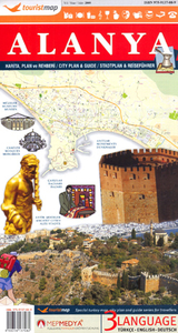
Alanya Tourist Plan Stanfords
£6.95
Vouchers
No voucher codes found.
Do you know a voucher code for this product or supplier? Add it to Insights for others to use.
Do you know a voucher code for this product or supplier? Add it to Insights for others to use.
 Denmark