
 United Kingdom
 France
 Germany
 Netherlands
 Sweden
 USA
USA
 Italy
Italy
 Spain
Spain
More From Contributor
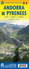


Andorra Trail Running 40K Ed. Alpina Map
Alternative coverage of Andorra at 1:40, 000 from Editorial Alpina on a contoured and GPS compatible map with the highlighting and numbering of trails adjusted to correspond to the descriptions in the accompanying booklet, including a 101km Andorra Grand Trail.The map has contours at 20m intervals, enhanced by relief shading and vegetation colouring, and a 5-km UTM grid. The overprint clearly shows the trails described in the accompanying booklet plus the GR long distance routes (i.e. without highlighting shorter local walks). Symbols indicate different types of accommodation (refuges, campsites, etc), locations for other recreational pursuits (climbing, canyoning, horse riding, etc), and other facilities and places of interest. Road network shows locations of petrol stations.
Accompanying booklet provides descriptions of 13 trails, including the 101km Andorra Grand Trail. Map legend and the descriptions on are in Catalan only. PLEASE NOTE: the publisher`s coverage image on the back cover of the booklet is incorrect – the map covers a slightly smaller area, as shown on our website.To see other titles in this extensive Editorial Alpina series please click on the series link.
Accompanying booklet provides descriptions of 13 trails, including the 101km Andorra Grand Trail. Map legend and the descriptions on are in Catalan only. PLEASE NOTE: the publisher`s coverage image on the back cover of the booklet is incorrect – the map covers a slightly smaller area, as shown on our website.To see other titles in this extensive Editorial Alpina series please click on the series link.
Product Description
Reviews/Comments
Add New
Vouchers
No voucher codes found.
Do you know a voucher code for this product or supplier? Add it to Insights for others to use.
Do you know a voucher code for this product or supplier? Add it to Insights for others to use.
 Denmark