More From Contributor

£9.99
Seville, Cordoba, Cadiz or Malaga
- Andalusia, at the crossroad of Europe & Africa, has figured prominently in the history
...
Archived Product
£9.99
Andalucía Autonomous Region of Spain at 1:400, 000 on a large physical map from the IGN/CNIG
- country’s civilian survey organization
...
Archived Product
£19.95
Andalusian Sierras from Malaga to Gibraltar in a series of nature guides to ecologically important regions of Europe from the Crossbill Guides Foundation, with 14 special eco-routes for exploring the area on foot, by bike or by car, including a route for watching bird migration along the Straits of Gibraltar. The Crossbill Guides Foundation, based in the Netherlands, is a non-profit organization dedicated to increasing public involvement with nature conservation. Its aim is to produce comprehensive guides & other services for nature enthusiasts & tourist to all major European natural areas. The guides are prepared in consultation with local experts. Each title, produced on high quality paper & illustrated with numerous colour photos, is divided into four sections: An extensive introduction to the area, including its climate, topography & habitat types (bogs, fens, mires, meadows, forests, etc), history & nature conservation, etc. Fauna & flora Recommended routes to explore the region on foot, by bike or by car, each accompanied by a map cross-referenced to the text plus a list of selected important species to be found along the route. Practical tourist information & observation tips, including a list of local species with names in English, Latin, German & Dutch. ...
Archived Product
£8.99
Brittany West Coast in the Footprint Focus Guides, which are targeted at cities, regions & countries worldwide that have no, or very limited, coverage from other publishers. Widely recognised for their reliability & independent writing style, Footprint Focus guides all have the same layout. Smaller than their sister Handbooks, the Focus guides are intended to streamline the information contained so that you have more of what you need, without losing Footprint ...
Archived Product
£23.99
Map No. 10146, Andøya, in the new topographic survey of Norway at 1:50, 000 covering the country on 195 double-sided sheets & first published by Nordeca in 2011
- 2012; fully GPS compatible, indicating waymarked footpaths, campsites, tourist huts, illuminated ski runs, etc. The maps, now published by Nordeca, the successors to Statens Kartverk & its subsequent owners the Ugland Group, are printed on light, waterproof & tear-resistant synthetic paper. Each map covers an area of 62x 45 kilometres (39 x 28 miles approx.), with a 2-km overlap between the sheets. The maps have contours at 20m intervals (10m glacier contours), plus colouring & graphics to show cultivated areas, bogs, forests, etc. In addition to all the information expected of topographic mapping at this scale the maps distinguish between waymarked & unmarked footpaths & show campsites, tourist huts (serviced/self service/no supplies), country hotels & restaurants, & illuminated ski trails. The series uses EUREF89 (WGS84) datum & the maps have a 1-km UTM grid. Map legend is in Norwegian & English. Each title comes in a sturdy protective card envelope.
...
Archived Product
£12.99
Map No. 1052, Andelfingen, in the topographic survey of Switzerland at 1:25, 000 from Bundesamt für Landestopographie (swisstopo), covering the whole country on 247 small format sheets, with special larger maps published for popular regions including some titles now available in hiking versions. Highly regarded for their superb use of graphic relief & hill shading, the maps give an almost 3-D picture of Switzerland`s mountainous terrain. Contours are at 10 m intervals, with 20m intervals in the mountainous areas. All the maps have a 1-km grid for Swiss national coordinates (datum CH 1903). * Small format sheets (Nos. 1011
- 1374)* Map legend in the language of the area covered by the map. Additional margin ticks show latitude & longitude in steps of 2`. The area covered by each map is 17 x 12 km (11 x 7 miles approx). * Special larger sheets (Nos. from 2501 onwards) – STANDARD editions:* No map legend is included but a separate leaflet can be provided instead. The area covered by each map is 25 x 17 km (15 x 11 miles approx).* Special larger sheets (Nos. from 2501 onwards) – HIKING editions:* An overprint highlights hiking, mountain & alpine paths, including regional & national long-distance trails. The maps also show bus routes with bus stops, plus inns in remote locations. The area covered by each map is 25 x 17 km (15 x 11 miles approx).
...
Archived Product
£9.50
Topographical survey of Belgium at 1:20, 000 from Nationaal Geografisch Instituut / Institut Géographique National, the country’s national survey organization. Each 20K map covers one quarter of the corresponding 1:50, 000 map (with adjustments in the border & coastal areas). The maps provide all the information expected of topographic mapping at this scale & in addition have an unusually large amount of vegetation and/or land use information (different types of woodlands, gardens, orchards, heath, etc). The maps have a 1-km UTM grid, with margin ticks for latitude & longitude at intervals of 1`. Map legend & a glossary of terms used on the maps include English. Stanfords keeps as regular stock 20K maps for the World War I battlefields around the Ypres, Messines & Passchendaele, & for the area of the Battle of Waterloo. The 1:20, 000 survey covers the whole of Belgium & maps for other regions can be supplied as special orders. To see the list of titles in this series please click on the series link.PLEASE NOTE: the Long-Distance Footpaths Map of Belgium at 1:300, 000 which shows the division of Belgium into the 50K survey sheets can also be used to see in more detail coverage by the 20K maps. ...
Archived Product
£12.99
Andermatt area at 1:33, 333 on light, waterproof & tear-resistant map No. 3314T published by Swisstopo in cooperation with the Swiss Hiking Federation. Cartography is the same as in Swisstopo’s 50K hiking maps, simply enlarged to 1:33, 333 for extra clarity but without additional information. 1:33, 333 editions of Swisstopo’s hiking maps have cartography identical to the standard version of the country’s 1:50, 000 topographic survey, highly regarded for its superb use of graphic relief & hill shading to provide an almost 3-D picture of Switzerland`s mountainous terrain. Contours are at 20m intervals. An overprint highlights routes maintained by the SHF, distinguishing between hiking routes, mountain routes requiring proper footwear, & alpine routes where equipment is needed. Paths which are part of the national or regional network of long-distance hiking routes are specially marked & in the more recent editions are annotated with their official numbers. The maps show mountain huts, refuges & in remote areas also inns, plus roads with bus service & the positions of bus stops. All the maps have a 1-km grid of the Swiss national coordinates. For a list of all the titles in this series, please click on the series link. ...
Archived Product
£22.99
The best rides in the freeride hot spots of the Alps – this is the simple formula of the Freeride Maps. The first map available to freeriders is making the locals freeride knowledge available to a broad public. All ridable slopes, drops & couloirs are marked as freeride corridors in different colours for three difficulty ratings: blue for technically easy terrain, yellow requires advanced to very advanced ability & red is extremely difficult terrain that is partially exposed & therefore reserved to crack riders. Short ascents are marked with red lines. The Freeride Maps are based on topographic maps 1:25, 000. They contain all essential information about the terrain that is necessary for planning & going freeriding. The maps are printed on water resistant & indestructible paper. On the back side, the maps include all relevant planning, safety & rescue information. ...
Archived Product
£4.95
ADAC, Germany's equivalent of the British Automobile Association publishes an extensive series of street plans which provide detailed high-quality mapping of all the major towns & cities, including their outer suburbs. The plans name all the individual streets & indicate all the main landmarks & public buildings. All public transport facilities are shown: buses, trams, underground & overland rail lines. One way streets & car parks are indicated. Plans of larger cities include an enlargement for the city centre. The plans also show the administrative & postal divisions & have an extensive street index which, where appropriate, shows individual postal codes for each street. On the reverse, each plan has a road map at 1:100, 000, covering a very wide area around the city. Map legend

Includes::
English.

...
Archived Product

Andeer Swisstopo 1235

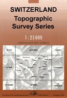
Map No. 1235, Andeer, in the topographic survey of Switzerland at 1:25, 000 from Bundesamt für Landestopographie (swisstopo), covering the whole country on 247 small format sheets, with special larger maps published for popular regions including some titles now available in hiking versions.Highly regarded for their superb use of graphic relief and hill shading, the maps give an almost 3-D picture of Switzerland`s mountainous terrain. Contours are at 10 m intervals, with 20m intervals in the mountainous areas. All the maps have a 1-km grid for Swiss national coordinates (datum CH 1903). *Small format sheets (Nos. 1011 - 1374)*Map legend in the language of the area covered by the map. Additional margin ticks show latitude and longitude in steps of 2`. The area covered by each map is
17 x 12 km (11 x 7 miles approx). *Special larger sheets (Nos. from 2501 onwards) – STANDARD editions:* No map legend is included but a separate leaflet can be provided instead. The area covered by each map is 25 x 17 km (15 x 11 miles approx).*Special larger sheets (Nos. from 2501 onwards) – HIKING editions:* An overprint highlights hiking, mountain and alpine paths, including regional and national long-distance trails. The maps also show bus routes with bus stops, plus inns in remote locations. The area covered by each map is 25 x 17 km (15 x 11 miles approx).
RIP - This product is no longer available on our network. It was last seen on 25.09.2019

This page now acts as a permanent archive for this product. Add more information using the comments box below to ensure it can still be found by future generations.

Use our search facility to see if it is available from an alternative contributor.
  • Availability: Out Of Stock
  • Supplier: Stanfords
  • SKU: 9783302012353
Availability: In Stock
£12.99

Product Description

Map No. 1235, Andeer, in the topographic survey of Switzerland at 1:25, 000 from Bundesamt für Landestopographie (swisstopo), covering the whole country on 247 small format sheets, with special larger maps published for popular regions including some titles now available in hiking versions. Highly regarded for their superb use of graphic relief & hill shading, the maps give an almost 3-D picture of Switzerland`s mountainous terrain. Contours are at 10 m intervals, with 20m intervals in the mountainous areas. All the maps have a 1-km grid for Swiss national coordinates (datum CH 1903). * Small format sheets (Nos. 1011
- 1374)* Map legend in the language of the area covered by the map. Additional margin ticks show latitude & longitude in steps of 2`. The area covered by each map is 17 x 12 km (11 x 7 miles approx). * Special larger sheets (Nos. from 2501 onwards) – STANDARD editions:* No map legend is included but a separate leaflet can be provided instead. The area covered by each map is 25 x 17 km (15 x 11 miles approx).* Special larger sheets (Nos. from 2501 onwards) – HIKING editions:* An overprint highlights hiking, mountain & alpine paths, including regional & national long-distance trails. The maps also show bus routes with bus stops, plus inns in remote locations. The area covered by each map is 25 x 17 km (15 x 11 miles approx).

Reviews/Comments

Add New

Intelligent Comparison

Oooops!
We couldn't find anything!
Perhaps this product's unique.... Or perhaps we are still looking for comparisons!
Click to bump this page and we'll hurry up.

Price History

Vouchers

No voucher codes found.
Do you know a voucher code for this product or supplier? Add it to Insights for others to use.

Facebook

Jargon Buster

Hiking - An outdoor activity envolving walking in nature
swiss - Short for Switzerland, one of the richest countries in the world
switzerland - A landlocked country in western Europe. One of the richest countries in the world
Language - the method of communication used in different areas. Humans and computers have many different languages.
Km - Kilometre. A unit of measurement equal to 1000 metres.
Small - something that takes up less space than normal.
Popular - Something that is admired and liked by many people.
Regional - An adjective to describe a set geographic area.
Language - The way humans communicate either written and spoken.

Supplier Information

Stanfords
Stanfords was established in 1853 and opened their iconic Covent Garden flagship store in 1901. They have become the top retailer of maps, travel books and accessories in the UK and arguably offer the largest selection of maps and travel books worldwide. Famous names such as Captain Robert Falcon Scott, Ranulph Fiennes and Michael Palin have purchased from Stanfords. They now have a shop in Bristol and both stores together with other venues operate a calendar of events including talks, book signings and exhibitions. As a specialist map retailer, the map selection is comprehensive and includes road maps, street maps and walking maps from worldwide destinations, as well as a selection of world atlases and wall maps. Books include travel guides and travel literature. Stanfords also stock globes, from miniatures made of blue marble to magnificent floor-standing globes. The website features a selection of interesting articles on travel topics.
Page Updated: 2023-11-12 20:15:36

Community Generated Product Tags

Oh No! The productWIKI community hasn't generated any tags for this product yet!
Menu