
 United Kingdom
 France
 Germany
 Netherlands
 Sweden
 USA
USA
 Italy
Italy
 Spain
Spain
More From Contributor


Andalucia
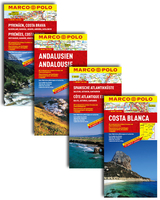
Andalucía on a large, double-sided indexed road map at 1:300, 000 from MairDumon, with special features to aid navigation and route planning plus street plans of the region’s main towns, etc. A fold-out extension of the map cover gives at-a-glance overview of the whole area covered by the map with the adjoining regions, highlighting main places of interest and making it much easier to find various localities on the main map and/or plan a route. A set of seven peel-on/peel-off stickers, removable without damaging the map, is provided to make routes or locations more prominent when navigating.Coverage extends from the Portuguese border to Murcia, and northwards to Mérida. Topography is well presented by relief shading with names of mountain ranges and peaks. Road network includes
minor roads, gives distances on main and many secondary routes, and indicates motorway tolls and services, entry restrictions and seasonal closures, steep gradients, routes not recommended for caravans, etc. Scenic routes are highlighted. Railway lines are included and local airports are marked.The map highlights numerous places of interest, both cultural and various natural sites, showing regional parks and other protected areas. Symbols mark selected campsites, youth hostels, mountain refuges, viewpoints, etc. The map has no geographical coordinates. The index, in a separate booklet attached to the map cover, lists towns and villages with their postcodes and includes geographical features such as rivers, mountains, plus places of interest. Multilingual map legend includes
English. Also provided are street plans of the region’s main cities, a distance/driving times table, plus basic motoring regulations.To see the other titles in this series please click on the series link.

Product Description
Reviews/Comments
Add New
Vouchers
No voucher codes found.
Do you know a voucher code for this product or supplier? Add it to Insights for others to use.
Do you know a voucher code for this product or supplier? Add it to Insights for others to use.
 Denmark