More From Contributor

£12.99
` People are calling this the new Apple Tree Yard, but I`d beg to differ
- fast, pacy & with enough twists & turns to keep you
...
Archived Product
£7.99
` Deftly plotted & superbly well researched, with an eerie relevance to the current debate surrounding the attitudes to & experiences of women in Westminster, Hollywood & beyond. An intelligent, absorbing page-turner that avoids all knee-jerk assumptions & easy answers` Laura Barnett, author of The Versions of Us ` The best courtroom drama since Apple Tree Yard.. . sensational` Clare Mackintosh A high-profile marriage thrust into the spotlight. A wife, determined to keep her family safe, must face a prosecutor who believes justice has been a long time coming. A scandal that will rock Westminster. & the women caught at the heart of it. Anatomy of a Scandal centres on a high-profile marriage that begins to unravel when the husband is accused of a terrible crime. Sophie is sure her husb&, James, is innocent & desperately hopes to protect her precious family from the lies which might ruin them. Kate is the barrister who will prosecute the case
- she is equally certain that James is guilty & determined he will pay for his crimes. `A compelling & cautionary story about how we can never truly know someone else; how even after twelve years of marriage, a wife might not know everything about her husb&. Brilliant, shocking, & gripping, once I started, I couldn`t stop reading` Claire Fuller, bestselling author of Our Endless Numbered Days ` Sarah Vaughan drip feeds revelations while exploring the power & privilege of political elite` Good Housekeeping ` Think last year`s drama Liar with a dash of Apple Tree Yard` Sunday Mirror ` That rare book that combines great writing, spot-on characterisation & a compulsive, page-turning narrative. I read it in one breathless day. Set against a fascinating backdrop of the Houses of Parliament, the Old Bailey & Oxford University, think House of Cards meets The Secret History. Meticulously researched, this is an outstanding read` Fiona Cummins, author of Rattle `A timely thriller about marriage, but also about power, who wields it, & how that affects who we believe` Stylist ` Expertly plotted courtroom drama.. . Gripping & beautifully written` Sunday Post ` Anatomy of a Scandal has bestseller written all over it` Veronica Henry, author of The Forever House `I was hooked right from the start. So beautifully written, clever & compelling. I was gripped right up to the final page` Claire Douglas, bestselling author of The Sisters & Local Girl Missing ` Am I allowed to choose my book of the year in May? Anatomy of a Scandal is astoundingly good
- a tour de force. I absolutely loved it` Eve Chase, bestselling author of Black Rabbit Hall ` Incredibly authentic, highly involving character drama here, in a story that could easily be ripped from the headlines` Booklikes.com

...
Archived Product
£14.99
Captain Tom Barnes is leading British troops in a war zone. Two boys are growing up there, sharing a prized bicycle & flying kites, before finding themselves separated once the soldiers appear in their countryside. On all sides of this conflict, people are about to be caught up in the violence, from the man who trains one boy to fight the infidel invaders to Barnes` family waiting for him to return home. We see them not as they see themselves, but as all the objects surrounding them do: shoes & boots, a helmet, a trove of dollars, a drone, that bike, weaponry, a bag of fertilizer, a medal, a beer glass, a snowflake, dog tags, an exploding IED & the medical implements that are subsequently employed. Anatomy of a Soldier is a moving, enlightening & fiercely dramatic novel about one man`s journey of survival & the experiences of those around him. Forty-five objects, one unforgettable story. ”A brilliant book, direct from the battle zone.” (Edna O` Brien). ” Compassionate & compelling.. . The language has a clarity about it that elevates it to the beautiful.” (Kate Hamer). ”A tour de force.. . It feels like war through the looking glass but it is utterly real.” (Nadeem Aslam). ...
Archived Product
£29.95
One of the titles in a series of maps of the administrative departments of Peru, with topography shown by altitude colouring & spot heights. Most maps also indicate cultivated areas. Scales vary considerably, given different sizes of the departments. Railways & four different types of roads & dirt tracks are shown, as well as local airports & aerodromes. The maps also show the subdivisions of the departments into provinces & districts, indicating administrative capital of each unit. Most sheets also include a panel with general information about the state (e.g. population distribution, climate, etc.). Latitude & longitude grid is drawn at 1º intervals, making this series very useful for identifying the locations of small places on the 1:100, 000 topographic survey of the country. Map legend is in Spanish only. Publication dates vary from mid-1980s to mid-1990s, with a handful of titles revised later. Each map shows one department only & no detail of any kind is given for the adjacent departments, beyond their names. ...
Archived Product
£12.99
Topographic survey of France at 1:25, 000 in IGN`s excellent TOP25 / Série Bleue series. All the maps are GPS compatible, with a 1km UTM grid plus latitude & longitude lines at 5’ intervals. Contours are at 5m intervals except for mountainous areas where the maps have contours at 10m intervals, vividly enhanced by hill shading & graphics for rocky terrain. Colouring with graphics indicates different types of vegetation or land use (deciduous or coniferous forests, moors, orchards, vineyards, etc). PLEASE NOTE: coverage of France at this scale is currently being revised – the format & the presentation of each title are indicated by the letters at the end of its Sheet Reference number (e.g. 0416ET, 3531ETR, 1923SB, etc.)MAPS WITH FULL TOURIST OVERPRINT & AN ENGLISH MAP LEGEND: all TOP25 maps & the SB editions of Série Bleue have an overprint highlighting waymarked walking trails including long-distance GR routes &, where appropriate, ski routes. Symbols indicate campsites, gîtes d’etape, refuges, equestrian centres & other recreational facilities or sites, tourist information centres, cultural heritage, etc. Towns & locations of particular interest are highlighted.- ET or OT = single-sided TOP25 map covering approx. 29x 21 km / 18x 13 miles.- ETR or OTR = waterproof & tear resistant TOP25 map covering the same area as the corresponding ET or OT number, but double-sided, printed on a smaller size sheet with a good overlap between the sides.- SB = Série Bleue map with full tourist overprint; these maps, first introduced in summer 2014, each cover approx. 29x 24km / 18x 15 miles.SÉRIE BLEUE maps with numbers ending in E (Est) or O (Ouest): most editions now indicate the GR routes, but do not show any other tourist information. Map legend is in French only. Each map covers approx. 14x 20km / 9x 12 miles. ...
Archived Product
£19.95
This pioneering book brings together for the first time the latest genetic evidence & combines it with archaeology & linguistics to produce a new history of Europe. Who are the Europeans? Where did they come from? In recent years scientific advances have yielded a mass of new data, turning cherished ideas upside down. The idea of migration in prehistory, so long out of favour, is back on the agenda. Visions of continuity now have to give way to a more dynamic view of Europes past, with one wave of migration followed by another, from the first human arrivals to the Vikings. ...
Archived Product
£6.39
A detailed topographic map of Ancholme Valley from the Ordnance Survey Explorer series, covering Barton-upon-Humber, Brigg, Scunthorpe & Kirton in Lindsey. Edition A1; Publication date February 2006 About this series: These highly detailed maps show all the administrative boundaries, settlements as small as isolated farms, the road network down to unfenced roads & country tracks, & field boundaries (hedges & drystone walls) which make navigation across the countryside much easier. Steep gradients on roads are indicated. Various landmarks, e.g. powerlines, archaeological sites, windmills, churches & lighthouses are shown & additional graphics indicate natural terrain features such as cliffs, scree, mud & vegetation variations. The contour interval is 5 metres in the lower parts of the country & 10 metres in the uplands, & spot heights are marked. Each map covers an area of 30 x 20km (i.e. approx. 19 x 12 miles), with some double-sided maps covering more, as indicated in the individual descriptions. The maps are fully GPS compatible, with the National Grid shown at 1km intervals & latitude & longitude indicated by margin ticks at 1'. The Explorer series has replaced the earlier, green-cover Pathfinder maps. The Explorer series is now complete & covers all of Engl&, Wales & Scotl&. Some sheets for popular areas like the National Parks are still branded as Outdoor Leisure (OL) maps, but are now included in this series as the cartography is the same as that in the Explorer Maps. The Explorer maps offer a substantial improvement on the Pathfinder series, with greater use of colour, larger area per map, & stronger emphasis on information for ramblers & tourists. This series is ideal for walking & other outdoor pursuits & each map shows a large amount of information for ramblers & tourists. Public rights of way are shown (except in Scotland), together with other routes with public access: National Trails & Recreational Paths, permitted paths & bridleways, & selected cycle routes. Open access land created under the Countryside & Rights of Way Act 2000 is marked. Tourist information

Includes::
caravan & camp sites, Park & Ride locations, recreation/leisure/sport centres, museums, historic buildings, English Heritage & National Trust sites, rural pubs, etc. The map legend is in English only, except for the tourist information content which is also in French & German.

...
Archived Product
£14.99
Ancholme Valley, Barton-upon-Humber, Brigg, Scunthorpe & Kirton in Lindsey area on a detailed topographic & GPS compatible map No. 281, waterproof version, from the Ordnance Survey’s 1:25, 000 Explorer series.MOBILE DOWNLOADS: this title & all the other OS Explorer maps include a code for downloading after purchase the digital version onto your smartphone or tablet for viewing on the OS smartphone app.OS EXPLORER SERIES: to see the list of all the titles in the OS Explorer series, both paper & waterproof versions, please click on the series link. The Explorer series, Ordnance Survey’s most detailed maps recommended for anyone enjoying outdoor activities, provides topographic coverage of Great Britain at 1:25, 000 on GPS compatible maps with hiking trails, cycling routes & extensive tourist information. Each printed map is available either on paper or as a waterproof & tear-resistant OS Active Map, as indicated in its title. Britain’s National Parks & other areas of particular tourist interest are presented on often double-sided OL (Outdoor Leisure) maps, whilst most standard format Explorers cover an area of 30 x 20km (approx. 19 x 12 miles). All three versions (paper, waterproof & digital) are the same & provide plenty of recreational & tourist information, indicating the traditional public right of way paths (except in Scotland where different laws apply), including bridleways & byways. National Trails & other long-distance paths are marked, as well as permissive footpaths or bridleways & on-road or traffic-free cycle routes with, where appropriate, their National/ Regional Cycle Network numbers. Boundaries of access land are clearly marked. A wide range of symbols provides additional tourist information, highlighting camping & caravanning sites, information offices & visitors’ centres, parking & picnicking places, country pubs, sport & recreational facilities including cycle hire locations & mountain biking trails, historic buildings & museums, etc. Exceptionally clear presentation of the landscape is provided by contours at 5m or in the uplands at 10m intervals, with additional spot heights plus colouring and/or graphics for different types of woodlands, orchards, heath, marshl&, scree or boulders, & other topographic features. For GPS users the maps have British National Grid lines at 1km intervals, with latitude & longitude given by margin ticks at 1`. Clearly laid out map legend

Includes::
French & German translations for the tourist information symbols.

...
Archived Product
£8.99
Ancholme Valley, Barton-upon-Humber, Brigg, Scunthorpe & Kirton in Lindsey area on a detailed topographic & GPS compatible map No. 281, paper version, from the Ordnance Survey’s 1:25, 000 Explorer series. MOBILE DOWNLOADS: this title & all the other OS Explorer maps include a code for downloading after purchase the digital version onto your smartphone or tablet for viewing on the OS smartphone app.OS EXPLORER SERIES: to see the list of all the titles in the OS Explorer series, both paper & waterproof versions, please click on the series link. The Explorer series, Ordnance Survey’s most detailed maps recommended for anyone enjoying outdoor activities, provides topographic coverage of Great Britain at 1:25, 000 on GPS compatible maps with hiking trails, cycling routes & extensive tourist information. Each printed map is available either on paper or as a waterproof & tear-resistant OS Active Map, as indicated in its title. Britain’s National Parks & other areas of particular tourist interest are presented on often double-sided OL (Outdoor Leisure) maps, whilst most standard format Explorers cover an area of 30 x 20km (approx. 19 x 12 miles). All three versions (paper, waterproof & digital) are the same & provide plenty of recreational & tourist information, indicating the traditional public right of way paths (except in Scotland where different laws apply), including bridleways & byways. National Trails & other long-distance paths are marked, as well as permissive footpaths or bridleways & on-road or traffic-free cycle routes with, where appropriate, their National/ Regional Cycle Network numbers. Boundaries of access land are clearly marked. A wide range of symbols provides additional tourist information, highlighting camping & caravanning sites, information offices & visitors’ centres, parking & picnicking places, country pubs, sport & recreational facilities including cycle hire locations & mountain biking trails, historic buildings & museums, etc. Exceptionally clear presentation of the landscape is provided by contours at 5m or in the uplands at 10m intervals, with additional spot heights plus colouring and/or graphics for different types of woodlands, orchards, heath, marshl&, scree or boulders, & other topographic features. For GPS users the maps have British National Grid lines at 1km intervals, with latitude & longitude given by margin ticks at 1`. Clearly laid out map legend

Includes::
French & German translations for the tourist information symbols.

...
Archived Product
£11.19
Laminated waterproof edition of a detailed topographic map of Ancholme Valley from the Ordnance Survey Explorer series, covering Barton-upon-Humber, Brigg, Scunthorpe & Kirton in Lindsey. Edition A1; Pubication date November 2006 About this series: These highly detailed maps show all the administrative boundaries, settlements as small as isolated farms, the road network down to unfenced roads & country tracks, & field boundaries (hedges & drystone walls) which make navigation across the countryside much easier. Steep gradients on roads are indicated. Various landmarks, e.g. powerlines, archaeological sites, windmills, churches & lighthouses are shown & additional graphics indicate natural terrain features such as cliffs, scree, mud & vegetation variations. The contour interval is 5 metres in the lower parts of the country & 10 metres in the uplands, & spot heights are marked. Each map covers an area of 30 x 20km (i.e. approx. 19 x 12 miles), with some double-sided maps covering more, as indicated in the individual descriptions. The maps are fully GPS compatible, with the National Grid shown at 1km intervals & latitude & longitude indicated by margin ticks at 1'. The Explorer series has replaced the earlier, green-cover Pathfinder maps. The Explorer series is now complete & covers all of Engl&, Wales & Scotl&. Some sheets for popular areas like the National Parks are still branded as Outdoor Leisure (OL) maps, but are now included in this series as the cartography is the same as that in the Explorer Maps. The Explorer maps offer a substantial improvement on the Pathfinder series, with greater use of colour, larger area per map, & stronger emphasis on information for ramblers & tourists. This series is ideal for walking & other outdoor pursuits & each map shows a large amount of information for ramblers & tourists. Public rights of way are shown (except in Scotland), together with other routes with public access: National Trails & Recreational Paths, permitted paths & bridleways, & selected cycle routes. Open access land created under the Countryside & Rights of Way Act 2000 is marked. Tourist information

Includes::
caravan & camp sites, Park & Ride locations, recreation/leisure/sport centres, museums, historic buildings, English Heritage & National Trust sites, rural pubs, etc. The map legend is in English only, except for the tourist information content which is also in French & German.

...
Archived Product

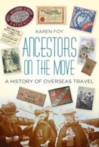
Ancestors On The Move: A History Of Overseas Travel

Ever wanted to understand more about your ancestor`s sea travels? What was life like aboard ship for both passengers and crew, how long did the journey take, what kind of conditions could be expected and what exotic locations might they have visited along the way? Following the tried and tested routes established by cargo ships, Karen Foy describes the development of passenger travel, the changing face of the vessels used and the demand for both comfort and speed. From transportation to trade, adventure to emigration, through persecution or for pleasure, she explains the reasons behind our ancestor`s desire for overseas travel and reveals the records and archives we can search to complete our own genealogical journey.
RIP - This product is no longer available on our network. It was last seen on 25.09.2019

This page now acts as a permanent archive for this product. Add more information using the comments box below to ensure it can still be found by future generations.

Use our search facility to see if it is available from an alternative contributor.
  • Availability: Out Of Stock
  • Supplier: Stanfords
  • SKU: 9780752499383
Availability: In Stock
£14.99

Product Description

Ever wanted to understand more about your ancestor`s sea travels? What was life like aboard ship for both passengers & crew, how long did the journey take, what kind of conditions could be expected & what exotic locations might they have visited along the way? Following the tried & tested routes established by cargo ships, Karen Foy describes the development of passenger travel, the changing face of the vessels used & the demand for both comfort & speed. From transportation to trade, adventure to emigration, through persecution or for pleasure, she explains the reasons behind our ancestor`s desire for overseas travel & reveals the records & archives we can search to complete our own genealogical journey.

Reviews/Comments

Add New

Intelligent Comparison

Oooops!
We couldn't find anything!
Perhaps this product's unique.... Or perhaps we are still looking for comparisons!
Click to bump this page and we'll hurry up.

Price History

Vouchers

No voucher codes found.
Do you know a voucher code for this product or supplier? Add it to Insights for others to use.

Facebook

Jargon Buster

History - Anything that happens in the past. An acedemic subject.
speed - A measurement of how fast an object travels between two points
Comfort - something that feels nice to the user. Often relaxing.
Adventure - an undertaking of an exciting challenge or experience.

Supplier Information

Stanfords
Stanfords was established in 1853 and opened their iconic Covent Garden flagship store in 1901. They have become the top retailer of maps, travel books and accessories in the UK and arguably offer the largest selection of maps and travel books worldwide. Famous names such as Captain Robert Falcon Scott, Ranulph Fiennes and Michael Palin have purchased from Stanfords. They now have a shop in Bristol and both stores together with other venues operate a calendar of events including talks, book signings and exhibitions. As a specialist map retailer, the map selection is comprehensive and includes road maps, street maps and walking maps from worldwide destinations, as well as a selection of world atlases and wall maps. Books include travel guides and travel literature. Stanfords also stock globes, from miniatures made of blue marble to magnificent floor-standing globes. The website features a selection of interesting articles on travel topics.
Page Updated: 2023-11-12 20:15:36

Community Generated Product Tags

Oh No! The productWIKI community hasn't generated any tags for this product yet!
Menu