
 United Kingdom
 France
 Germany
 Netherlands
 Sweden
 USA
USA
 Italy
Italy
 Spain
Spain
More From Contributor


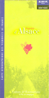
Alsace Wine Map
Wine map of Alsace showing the region’s wine growing areas according to their A.O.C. classification and the course of the famous Route des Vins, plus a list of Grands Crus and an inset with geological information. The map covers the southern slopes of the Vosges Mountains between Strasbourg and Mulhouse, with an inset for showing the northern vineyards near Wissembourg. Colouring distinguishes the Alsace Grand Cru vineyards, all cross-referenced to a list their names, from the more general AOC Alsace. Road network highlights the course of the region’s famous Route des Vins. Within the Vosges Mountains contour lines and spot heights indicate the topography. Map legend for the geological inset is in French only. For other information see below:The map is available in two editions,
both with the same mapping and additional information but with different colouring:IGN EDITON: has coloring of the surrounding countryside including the Vosges mountains in shades of green with the vineyards in stronger colours. A.O.C. Klevener de Heiligenstein is not listed in the legend although it is shown on the map. Main map legend includes English.BENOIS EDITION (this title):* has coloring of the surrounding countryside including the Vosges mountains in shades of brown and beige, with the vineyards in slightly paler colours than on the IGN version. A.O.C. Klevener de Heiligenstein is listed separately in the legend. Main map legend is only in French.WALL MAP EDITION: a flat version of the Benoit map.
both with the same mapping and additional information but with different colouring:IGN EDITON: has coloring of the surrounding countryside including the Vosges mountains in shades of green with the vineyards in stronger colours. A.O.C. Klevener de Heiligenstein is not listed in the legend although it is shown on the map. Main map legend includes English.BENOIS EDITION (this title):* has coloring of the surrounding countryside including the Vosges mountains in shades of brown and beige, with the vineyards in slightly paler colours than on the IGN version. A.O.C. Klevener de Heiligenstein is listed separately in the legend. Main map legend is only in French.WALL MAP EDITION: a flat version of the Benoit map.

Product Description
Reviews/Comments
Add New
Vouchers
No voucher codes found.
Do you know a voucher code for this product or supplier? Add it to Insights for others to use.
Do you know a voucher code for this product or supplier? Add it to Insights for others to use.
 Denmark