More From Contributor

£4.99
Algarve at 1:175, 000 is an indexed map with additional street plans & enlargements of popular regions on the reverse. The publisher has chosen to concentrate on creating a map which will primarily be of use for a tourist navigating between main points of interest as opposed to stressing more detailed cartography. Motorways, national, main & minor roads & some tracks are clearly marked. Routes of scenic beauty are highlighted. Useful petrol stations are shown, as are railways & airports; a plan of Faro airport is also provided. In keeping with the publisher ...
Archived Product
£12.99
Algarve in the Sunflower Landscapes guide series; exploring the best walking & touring possibilities in the region or area. Detailed information about touring by hired car or public transport, as well as on foot, is provided, helping walkers to navigate & plan day-trips. Shorter strolls are also included as an alternative for each main route for those seeking more leisurely days out. The guide is structured in two main parts ...
Archived Product
£12.95
This walking guide to the Algarve has over 51 walks with maps at 1:50, 000 at 1:100, 000 scales. The 22 coastal walks in this guide follow safe paths along the whole of the southern coastline of the Algarve; another 29 walks incorporate the splendour of a little frequented hinterland of the Algarve. From the superb unspoilt western coast they go across a landscape of forest & barrage weirs in the hinterland of Lagos to the gorges & picturesque peaks of the Monchique mountain range. The detailed route descriptions are preceded by up-to-date information in fact-file form; small walking maps marked with the line of the route make route finding easier & numerous photos complete the picture About this series: Rother Walking Guides were first published in 1920- since then Bergverlag Rother have continued to produce these comprehensive guides to ...
Archived Product
£12.99
Algarve Baedeker is divided into four main categories
- background, practicalities, tours & A-Z of sites. The guide is introduced
...
Archived Product
£9.50
Algarve at 1:100, 000 on an indexed, waterproof & tear-resistant road map with topographic & tourist information, published by Reise Know-How as part of their highly acclaimed World Mapping Project. The map is double-sided to provide the best balance between a good scale & a convenient size sheet. The map divides the region east/west with a generous overlap & Albufeira included on both sides. Coverage inland has Monchique in the middle of the map & extends to the Santa Clara reservoir & Almodovar. Road & rail networks are easy to see on a clear base which presents topography by altitude colouring with contours, spot heights & plenty of names of mountain ranges. National & natural parks are highlighted. Road network

Includes::
small local roads & selected country tracks & shows driving distances on main routes. Symbols highlight various places of interest including campsites, beaches, surfing & diving sites, golf courses, viewpoints, archaeological sites, etc. The map has a 10-km UTM grid plus latitude & longitude lines at intervals of 5

...
Archived Product
£9.99
Travellers Algarve & Southern Portugal is the perfect guidebook for visitors to a region that offers stunning beaches, dependable ...
Archived Product
£5.99
Algarve & Southern Portugal at 1:200, 000 from Marco Polo Travel Publishing on a large indexed map with four street plans & special features to aid route planning & navigation: a fold-out flap in the jacket gives an overview of the whole area covered by the map plus the adjoining regions & highlights main locations, with the grid reference system in the margins making it easier to find places on the main map. A set of seven peel-on/peel-off stickers, removable without damaging the map surface, is provided for making selected locations more prominent when navigating. The map, with cartography from the renowned German publishers Mair Dumont, boldly stresses main roads & motorways in strong colours & selected towns in large letters, but also shows minor roads & villages in considerable detail. Road information

Includes::
toll roads, traffic restrictions & seasonal closures, gradient marking for steep roads, scenic roads & special tourist routes, etc. Motorway services clearly indicate types of facilities available there. Railway network is shown with stations &

Includes::
tourist lines Picturesque towns or villages & sites worth visiting, including areas with interesting landscape, are given star rating, & other tourist information

Includes::
campsites & youth hostels, landmarks, recreational facilities etc. National parks & other protected areas are highlighted. Topography is shown by relief shading with spot heights & colouring for wooded areas. The map shows plenty of names of geographical features, local forests, etc. Latitude & longitude grid is drawn at intervals of 10`. Multilingual map legend & all information include English. The index is in a separate booklet attached to the map cover & lists all locations with their postcodes. The booklet also contains street plans of central Lisbon, Cascais, Faro & Sintra, plus a distance/travelling times table, emergency numbers & main traffic regulations.


...
Archived Product
£12.99
Algarve in the Sunflower Landscapes guide series; exploring the best walking & touring possibilities in the region or area. Detailed information about touring by hired car or public transport, as well as on foot is provided, helping walkers to navigate & plan day-trips. Shorter strolls are also included as an alternative for each main route for those seeking more leisurely days out. The guide is structured in two main parts ...
Archived Product
£5.59
Algarve in the Directions series from Rough Guides; pocket-sized guides to a range of international regions & cities, practically designed to help visitors make the most of their trip. Ideal for shorter breaks of around a week, the guides cover the principal areas, towns & neighbourhoods within a region or city. Each section contains concise listings for what to see & do, as well as details of selected restaurants, caf ...
Archived Product
£5.99
Algarve in the Essential Guide Series from the AA exploring the best places to see & things to do in a range of popular destinations. Each illustrated, pocket-sized guide is divided into five sections
- the essence of the area, planning your trip, the best places to see, best things to do & an exploration of notable highlights, organised by area. An introductory chapter profiles each destination &

Includes::
notes on local cuisine & recommendations for short breaks. A planning section advises on pre-trip preparations & getting there & around as well as outlining useful language tips & what


...
Archived Product

Algarve

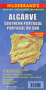
Algarve on an indexed road map at 1:100, 000 from Hildebrand, plus on the reverse indexed street plans of Lagos, Portimão, Faro and Albufeira, a road map of southern Portugal, distance tables and tourist notes.On one side the main map extends inland to Aljezur and Monchique. The hills of the hinterland are indicated by relief shading and spot heights. Road network emphasises motorway connections and principal routes, shown with driving distances, but also includes smaller roads and country tracks. Scenic routes are highlighted. The map also shows railways and local airports. Symbols indicate locations with various tourist facilities and places of interest: campsites, beaches and windsurfing/watersport sites, golf courses, etc. Latitude and longitude lines are drawn at 10’. The
index is under the map.On the reverse large panels provide indexed street plans of Algarve’s four main resorts: Lagos, Portimão, Faro and Albufeira, indicating main traffic arteries and highlighting important buildings. Also provided is an overview road map of Portugal south the Lisbon region, distance tables for the Algarve and for the whole of Portugal, plus notes about the Algarve, Costa do Estoril and Lisbon.. Map legend and all the text include English.
RIP - This product is no longer available on our network. It was last seen on 25.09.2019

This page now acts as a permanent archive for this product. Add more information using the comments box below to ensure it can still be found by future generations.

Use our search facility to see if it is available from an alternative contributor.
  • External links may include paid for promotion
  • Availability: Out Of Stock
  • Supplier: Stanfords
  • SKU: 9783889892911
Availability: In Stock
£9.99

Product Description

Algarve on an indexed road map at 1:100, 000 from Hildebr&, plus on the reverse indexed street plans of Lagos, Portimão, Faro & Albufeira, a road map of southern Portugal, distance tables & tourist notes. On one side the main map extends inland to Aljezur & Monchique. The hills of the hinterland are indicated by relief shading & spot heights. Road network emphasises motorway connections & principal routes, shown with driving distances, but also

Includes::
smaller roads & country tracks. Scenic routes are highlighted. The map also shows railways & local airports. Symbols indicate locations with various tourist facilities & places of interest: campsites, beaches & windsurfing/watersport sites, golf courses, etc. Latitude & longitude lines are drawn at 10’. The index is under the map. On the reverse large panels provide indexed street plans of Algarve’s four main resorts: Lagos, Portimão, Faro & Albufeira, indicating main traffic arteries & highlighting important buildings. Also provided is an overview road map of Portugal south the Lisbon region, distance tables for the Algarve & for the whole of Portugal, plus notes about the Algarve, Costa do Estoril & Lisbon.. Map legend & all the text include English.

Reviews/Comments

Add New

Intelligent Comparison

Oooops!
We couldn't find anything!
Perhaps this product's unique.... Or perhaps we are still looking for comparisons!
Click to bump this page and we'll hurry up.

Price History

Vouchers

No voucher codes found.
Do you know a voucher code for this product or supplier? Add it to Insights for others to use.

Facebook

Jargon Buster

Lisbon - The capital city of Portugal
Railways - A set of tracks that have been laid for the purpose of trains to travel up and down them
Network - A link and communication between things. Often computers or people.
Large - something that takes up more space than normal.
Road - a manmade lane or a path that is used to speed up travel.
Golf - A sport played on a large outside grass course, the aim to hit a small ball with a club into small holes.

Supplier Information

Stanfords
Stanfords was established in 1853 and opened their iconic Covent Garden flagship store in 1901. They have become the top retailer of maps, travel books and accessories in the UK and arguably offer the largest selection of maps and travel books worldwide. Famous names such as Captain Robert Falcon Scott, Ranulph Fiennes and Michael Palin have purchased from Stanfords. They now have a shop in Bristol and both stores together with other venues operate a calendar of events including talks, book signings and exhibitions. As a specialist map retailer, the map selection is comprehensive and includes road maps, street maps and walking maps from worldwide destinations, as well as a selection of world atlases and wall maps. Books include travel guides and travel literature. Stanfords also stock globes, from miniatures made of blue marble to magnificent floor-standing globes. The website features a selection of interesting articles on travel topics.
Page Updated: 2023-11-12 20:15:36

Community Generated Product Tags

Oh No! The productWIKI community hasn't generated any tags for this product yet!
Menu