More From Contributor
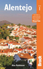
£12.99
Topographic survey of France at 1:25, 000 in IGN`s excellent TOP25 / Série Bleue series. All the maps are GPS compatible, with a 1km UTM grid plus latitude & longitude lines at 5’ intervals. Contours are at 5m intervals except for mountainous areas where the maps have contours at 10m intervals, vividly enhanced by hill shading & graphics for rocky terrain. Colouring with graphics indicates different types of vegetation or land use (deciduous or coniferous forests, moors, orchards, vineyards, etc). PLEASE NOTE: coverage of France at this scale is currently being revised – the format & the presentation of each title are indicated by the letters at the end of its Sheet Reference number (e.g. 0416ET, 3531ETR, 1923SB, etc.)MAPS WITH FULL TOURIST OVERPRINT & AN ENGLISH MAP LEGEND: all TOP25 maps & the SB editions of Série Bleue have an overprint highlighting waymarked walking trails including long-distance GR routes &, where appropriate, ski routes. Symbols indicate campsites, gîtes d’etape, refuges, equestrian centres & other recreational facilities or sites, tourist information centres, cultural heritage, etc. Towns & locations of particular interest are highlighted.- ET or OT = single-sided TOP25 map covering approx. 29x 21 km / 18x 13 miles.- ETR or OTR = waterproof & tear resistant TOP25 map covering the same area as the corresponding ET or OT number, but double-sided, printed on a smaller size sheet with a good overlap between the sides.- SB = Série Bleue map with full tourist overprint; these maps, first introduced in summer 2014, each cover approx. 29x 24km / 18x 15 miles.SÉRIE BLEUE maps with numbers ending in E (Est) or O (Ouest): most editions now indicate the GR routes, but do not show any other tourist information. Map legend is in French only. Each map covers approx. 14x 20km / 9x 12 miles. ...
Archived Product
£17.99
Topographic survey of Portugal at 1:50, 000 from the Instituto Geográfico do Exército, the country’s military survey organisation. The maps have contours at 20m intervals & in addition to the standard features shown on topographic mapping at this scale also indicate various types of terrain or vegetation (s&, terraces, rocks, woodlands, vineyards, etc). Each sheet covers an area of 32 x 20km (20 x 12.5 miles approx). The maps have a 1-km UTM grid plus latitude & longitude coordinates for the map corners. Map legend & a glossary of terms used on the maps include English.EDITION DATES: most titles in this series date from 1990s or later. To see all the titles in this series please click on the series link. ...
Archived Product
£17.99
Topographic survey of Portugal at 1:50, 000 from the Instituto Geográfico Português, the country’s civilian survey organisation. The maps have contours at 25m intervals & in addition to the standard features shown on topographic mapping at this scale also indicate various types of vegetation (vineyards, olive groves, etc). Each sheet covers an area of 32 x 20km (20 x 12.5miles approx). The maps have latitude & longitude margin ticks at 1’ intervals & UTM coordinates for the map corners – each sheet also shows conversion details from BBLx (Bessel-Bonnie system, Datum Lisbon) to UTM. Map legend is in Portuguese only.EDITION DATES: most titles in this series have now been updated in the 1990s or later. To see all the titles in this series please click on the series link. ...
Archived Product
£15.99
Bradt`s Alentejo is the first full guide to the raw, beguiling heartland of southern Portugal. Dividing the Alentejo into three distinct sections, with detailed maps & itineraries suitable for all seasons, this guide offers by far the fullest & most complete coverage of the Alentejo region available. Aimed primarily at independent travellers & holidaymakers of all ages & on all budgets, it caters for nature lovers & hikers, history & archaeology enthusiasts, & anyone interested in discovering one of the least explored regions of western Europe. Regional food & wine specialities are also covered, along with details of the Alentejo`s extraordinary range of accommodation, which is intricately bound with the region`s history, from historic castles, palaces & monasteries converted into hotels & pousadas, to farm stays on cork-growing estates & budget pensoes & albergarias (inns). ...
Archived Product
£9.95
Alentejo in a series of detailed, indexed touring maps from Turinta, the country’s leading map publishers, each with street plans of main towns. The map has altitude colouring & highlights protected areas, including the Vale do Guadiana Natural Park. Road network

Includes::
local country roads, most with driving distances. Railway lines are shown with stations. Symbols mark locations of pousadas, campsites, monuments & historical sites, golf courses, & other places of interest. The map is indexed & has a UTM grid. Map legend

Includes::
English. On the reverse there are street plans of Beja, Castelo Branco, Evora, Leiria, Portoalegre, Setúbal, & Santarém, all showing locations of tourist offices plus places of interest. Also included is a distance table.


...
Archived Product
£7.99
The new novel by the author of The Alchemist. Aleph marks a return to Paulo Coelho`s beginnings. In a frank & surprising personal story, one of the world`s most beloved authors embarks on a remarkable & transformative journey of self-discovery. Facing a grave crisis of faith, & seeking a path of spiritual renewal & growth, Paulo decides to start over: to travel, to experiment, to reconnect with people & the world. On this journey through Europe, Africa, & Asia, he will again meet Hilal-the woman he loved 500 years before-an encounter that will initiate a mystical voyage through time & space, through past & present, in search of himself. Aleph is an encounter with our fears & our sins; a search for love & forgiveness, & the courage to confront the inevitable challenges of life. ...
Archived Product
£17.99
` Every time gardens welcomed us, we said to them, Aleppo is our aim & you are merely the route.` Al-Mutanabbi Aleppo lies in ruins. Its streets are plunged in darkness, most of its population has fled. But this was once a vibrant world city, where Muslims, Christians & Jews lived & traded together in peace. Few places are as ancient & diverse as Aleppo
- one of the oldest, continuously inhabited cities in the world
- successively ruled by the Assyrian, Persian, Greek, Roman, Arab, Ottoman & French empires. Under the Ottomans, it became the empire`s third largest city, after Constantinople & Cairo. It owed its wealth to its position at the end of the Silk Road, at a crossroads of world trade, where merchants from Venice, Isfahan & Agra gathered in the largest suq in the Middle East. Throughout the region, it was famous for its food & its music. For 400 years British & French consuls & merchants lived in Aleppo; many of their accounts are used here for the first time. In the first history of Aleppo in English, Dr Philip Mansel vividly describes its decline from a pinnacle of cultural & economic power, a poignant testament to a city shattered by Syria`s civil war.

...
Archived Product
£9.99
A poignant testament to the city shattered by Syria`s civil war. Aleppo lies in ruins, a casualty of Syria`s brutal civil war. Its streets are cloaked in darkness, its population scattered, its memories ravaged. But this was once a vibrant world city, where Muslims, Christians & Jews lived & traded together in peace. Few places are as ancient & diverse. At the crossroads of global trade, Aleppo drew merchants from Venice, Isfahan & Agra to the largest souq in the Middle East & it was from here that some of the world`s most enduring food, music & culture sprang. ...
Archived Product
£36.95
Military topographic survey mapping with contours. These maps are designed primarily as flying charts for aircraft, but they are useful as general topographical maps where nothing else is available. Contours are shown in feet, with elevation colouring & spot heights. Towns, villages, major roads, railways & airports are shown (but please note that many of the smaller settlements are not named, & the road information is not necessarily up to date). Some air navigation information also appears on the map, such as radio beacons & restricted flying zones. Double-sided sheet. ...
Archived Product

Alentejo Blue

Alentejo Blue is the story of the Portuguese village of Mamarrosa told through the lives of those who live there and those who are passing through - men and women, children and old people, locals, tourists and expatriates. For some, such as Teresa, a beautiful, dreamy village girl, it is a place from which to escape; for others - the dysfunctional Potts family - it is a way of running from trouble (but not eluding it). Vasco, a cafe owner who has never recovered from the death of his American wife, clings to a notion that his years in America make him superior to the other villagers. One English tourist makes Mamarrosa the subject of her fantasy of a new life, while for her compatriots, a young engaged couple, Mamarrosa is where their dreams finally fall apart. At the book's
opening an old man reflects on his long and troubled life in this beautiful and seemingly tranquil setting, and anticipates the return of Marco Afonso Rodrigues, the prodigal son of the village and a symbol of this now fast-changing world.The homecoming is the subject of continuing speculation, and when Marco Afonso Rodrigues does finally appear, villagers, tourists and expatriates are brought together and jealousies, passions and disappointments must inevitably collide.
RIP - This product is no longer available on our network. It was last seen on 25.09.2019

This page now acts as a permanent archive for this product. Add more information using the comments box below to ensure it can still be found by future generations.

Use our search facility to see if it is available from an alternative contributor.
  • External links may include paid for promotion
  • Availability: Out Of Stock
  • Supplier: Stanfords
  • SKU: 9780552771160
Availability: In Stock
£7.99

Product Description

Alentejo Blue is the story of the Portuguese village of Mamarrosa told through the lives of those who live there & those who are passing through
- men & women, children & old people, locals, tourists & expatriates. For some, such as Teresa, a beautiful, dreamy village girl, it is a place from which to escape; for others
- the dysfunctional Potts family
- it is a way of running from trouble (but not eluding it). Vasco, a cafe owner who has never recovered from the death of his American wife, clings to a notion that his years in America make him superior to the other villagers. One English tourist makes Mamarrosa the subject of her fantasy of a new life, while for her compatriots, a young engaged couple, Mamarrosa is where their dreams finally fall apart. At the book's opening an old man reflects on his long & troubled life in this beautiful & seemingly tranquil setting, & anticipates the return of Marco Afonso Rodrigues, the prodigal son of the village & a symbol of this now fast-changing world. The homecoming is the subject of continuing speculation, & when Marco Afonso Rodrigues does finally appear, villagers, tourists & expatriates are brought together & jealousies, passions & disappointments must inevitably collide.

Reviews/Comments

Add New

Intelligent Comparison

Oooops!
We couldn't find anything!
Perhaps this product's unique.... Or perhaps we are still looking for comparisons!
Click to bump this page and we'll hurry up.

Price History

Vouchers

No voucher codes found.
Do you know a voucher code for this product or supplier? Add it to Insights for others to use.

Facebook

Jargon Buster

Blue - A primary colour
World - A physical grouping, commonly used to describe earth and everything associated with ti
running - A sport or hobbie of moving rapidly on foot. Can also refer to the running of equipment or run time refering to the length of time an applicance can run or the quiet running of an applicance.
Children - A young life form within the early stages of physical development,
Family - A group of people that live together made up from parents and children.

Supplier Information

Stanfords
Stanfords was established in 1853 and opened their iconic Covent Garden flagship store in 1901. They have become the top retailer of maps, travel books and accessories in the UK and arguably offer the largest selection of maps and travel books worldwide. Famous names such as Captain Robert Falcon Scott, Ranulph Fiennes and Michael Palin have purchased from Stanfords. They now have a shop in Bristol and both stores together with other venues operate a calendar of events including talks, book signings and exhibitions. As a specialist map retailer, the map selection is comprehensive and includes road maps, street maps and walking maps from worldwide destinations, as well as a selection of world atlases and wall maps. Books include travel guides and travel literature. Stanfords also stock globes, from miniatures made of blue marble to magnificent floor-standing globes. The website features a selection of interesting articles on travel topics.
Page Updated: 2023-11-12 20:15:36

Community Generated Product Tags

Oh No! The productWIKI community hasn't generated any tags for this product yet!
Menu