More From Contributor
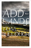
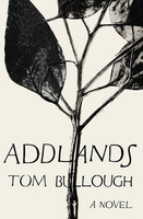
£7.95
Map No. 070, Adamello-Brenta NP, from Kompass in a series providing detailed coverage of the Dolomites & Lake Garda area & supplementing their main series of walking maps of Italy at 1:50, 000. Maps in this series have a more detailed base & smaller contour interval than coverage at 1:50, 000. Cartography: maps at 1:25, 000 have contours at 25-m intervals. An overprint shows local & long-distance footpaths, including all the high level routes (Alte Vie). The maps also show the via ferrata paths along the iron rails & ladders fitted into the rock faces. Other information

Includes::
various types of accommodation (campsites, alpine huts & refuges, etc.), recreational facilities, places of interest, local bus stops, etc. Many titles also have mountain bike trails or ski routes. Selected titles include on the reverse panorama drawings of the area, as indicated in the individual descriptions. Geographical coordinates: this title has no geographical coordinates. Map legend

Includes::
English.PLEASE NOTE BEFORE ORDERING! Booklets: many titles come with booklets describing the area and/or various hiking routes. These booklets are in Italian & German only, apart from a handful of titles where an English language booklet is specifically indicated in the individual description. So, unless English language booklet is actually mentioned, the map can only be supplied with an Italian/ German booklet. These booklets are not necessary to use the maps since, as stated above, full English language map legend is provided.


...
Archived Product
£28.99
The Add-a-Twist is the ultimate backpack organizer! Designed to easily slip into backpacks. Strong & tough for the most demanding adventures. Perfect for the gear & food you need to keep dry, safe & easy to find. The containers lock into each other & can be combined endlessly. Each container has a double-sealed lid that makes it waterproof & airtight.

Features:
- Designed to easily slip into & pull out of backpacks- Waterproof & airtight with double-sealed lid- Floats- Rugged & impact resistant- Versatile & adaptable to your needs- Easy to pack, hang & carry- Bayonet lock allows quick & easy access- Measuring lines
Includes::- 1x container large, 18.25 oz.- 1x container medium, 10.15 oz.- 1x container small, 3.75 oz.- 2x lid & 1x handle
Materials: PP & TPE


...
Archived Product
£9.99
Bob Shepton is an ordained minister in the Church of England in his late 70s, but spends most of his time sailing into the Arctic & making first ascents of inaccessible mountains. No tea parties for this vicar. Opening with the disastrous fire that destroyed his yacht whilst he was ice-bound in Greenl&, the book travels back to his childhood growing up on the rubber plantation his father managed in Malaysia, moving back to England after his father was shot by the Japanese during the war, boarding school, the Royal Marines, & the church. We then follow Bob as he sails around the world with a group of schoolboys, is dismasted off the Falklands, trapped in ice, & climbs mountains accessible only from iceberg-strewn water & with only sketchy maps available. Bob Shepton, winner of the 2013 Yachtsman of the Year Award, is an old-school adventurer, & this compelling book is in the spirit of sailing mountaineer HW Tilman, explorer Ranulph Fiennes, climber Chris Bonington & yachtsman Robin Knox-Johnston, all of whom have been either friends of Bob`s or an inspiration for his own exploits. ...
Archived Product
£3.50
Addington Hills & Croham Hurst in 1895 in a fascinating series of reproductions of old Ordnance Survey plans in the Alan Godfrey Editions, ideal for anyone interested in the history of their neighbourhood or family. This largely rural map is at the southern extremity of the OS London series & covers the south-eastern part of Croydon around Croham Hurst & Addington Hills. Features include Bramley Bank, Heathfield (at east edge of map), Ballards, Ballards Farm, Coombe Lodge, Thrift Wood, Croham Hurst, Croham House, Croham Farm, Old Fox Farm. 1903 directories for Addington & Sanderstead are on the reverse. About the Alan Godfrey Editions of the 25” OS Series: Selected towns in Great Britain & Ireland are covered by maps showing the extent of urban development in the last decades of the 19th & early 20th century. The plans have been taken from the Ordnance Survey mapping & reprinted at about 15 inches to one mile (1:4, 340). On the reverse most maps have historical notes & many also include extracts from contemporary directories. Most maps cover about one mile (1.6kms) north/south, one & a half miles (2.4kms) across; adjoining sheets can be combined to provide wider coverage.FOR MORE INFORMATION & A COMPLETE LIST OF ALL AVAILABLE TITLES PLEASE CLICK ON THE SERIES LINK. ...
Archived Product
£8.99
Addlands is the moving & engrossing story of the Hamer family & their home, the Funnon Farm, deep in the hills of the Welsh borders. There is Idris, proud & insular, a man of the plough & the prayer sheet, haunted by the First World War. Then there is the boy Oliver, who grows to be a near mythic giant in the community, a fighter, a drinker, inescapably rooted in their hard, remote valley. & there is Etty, Oliver`s mother, the centre of this close constellation, who navigates old ways & new technologies as she struggles to ensure her family`s survival. From the ancient silence in the hills to the encroaching roar of modernity, spanning seventy years, Addlands tells of human & animal; it speaks of the land & lets the land speak for itself. It is as vast & complex as a symphony but as pure & moving as a solo voice in an empty church. ...
Archived Product
£6.50
Topographic coverage of the Canary Islands at 1:25, 000 published by the Instituto Geográfico Nacional – Centro Nacional de Información Geografica, the country’s civilian survey organization. The maps have contours at 10m intervals & colouring and/or graphics to show different types of vegetation or land use. Boundaries of national parks & other protected areas are marked. In addition to all the usual information shown on topographic mapping at this scale: detailed presentation of the road network with rural tracks & paths, etc, the maps also show campsites. The maps have a 1-km UTM grid, plus margin ticks for latitude & longitude at 1` intervals. The majority of the titles have been published since late 1990s. Map legend is in Spanish only.COVERAGE: each 25K map covers one quarter of the corresponding 1:50, 000 map, with the numbering system: I = NW quarter, II = NE quarter, III = SW quarter, & IV = SE quarter. To see other titles in this series please click on the series link. ...
Archived Product
£9.95
Adelaide & its region in a series of waterproof & tear-resistant maps of Australian cities & their environs, with each title combining a selection of maps: the central area, the suburbs, & the wider environs. The map of the central part, more diagrammatic in style than found in most tourist street plans, shows one way streets & main buildings, with its short index listing some accommodation & main places of interest. The map of the city with its suburbs has an index listing all the suburbs, while the maps of the environs have indexes of the localities & highlight places of interest. No geographical coordinates are shown on the maps. Also included are diagrams of highway connections to Australia ...
Archived Product
£9.99
Adelaide & Region in a series of maps from Hema presenting Australia’s main cities with three maps: a detailed street plan of the central area, a road map of the city with its outer suburbs, plus a map of the wider surrounding region for out-of-town excursions. The Adelaide map contains a street plan of city centre highlighting locations of 35 places of interest & 28 hotels, a road map of Adelaide`s suburbs & environs at 1:80, 000, plus a regional map at 1:270, 000 extending south to include the Fleurieu Peninsula, Lake Alexandrina & the Younghusband Peninsula. Also provided is a diagram of Adelaide’s rail network, plus a detailed map at 1:9.217 of the Barossa Valley highlighting locations of its numerous wineries. Both the suburban & the regional maps are indexed & show the road network indicating unsurfaced roads & tracks. Symbols mark roadside rest areas, campsites, accredited information centres, places of interest, etc. Topography is indicated by names of mountain ranges & selected peaks, plus rivers & lakes; national & state parks, conservation areas & reserves are all highlighted. The suburban map also shows suburb names with their postal codes. The regional map has latitude & longitude grid at 15’ intervals. To see other titles in this series please click on the series link. ...
Archived Product
£10.99
Adelaide City Streets & Suburbs waterproof & tear-resistant map from UBD Gregory`s providing on one side a street plan of the city & its inner suburbs plus, on the reverse, an indexed road map covering Adelaide’s outer suburbs & the environs. On one side is a street plan of Adelaide’s its inner districts at 1:25, 000, extending north to Port Adelaide/ Dry Creek/ Valley View, south to Marino/ Coromadel Valley, & inland to Campbelltown/ Wattle Park/ Coromandel East. Roads & streets are classified into freeways, secondary & primary arterial roads, local access & collector roads, plus “un-trafficable” roads. Roundabouts, traffic lights, one way streets, car parks & even speed humps are marked. Streets are annotated with selected house numbers for easier identification of addresses. Symbols highlight various facilities & services. Administrative boundaries & postcode numbers are also shown. A short index lists just suburbs. On the reverse is a road map at 1:100, 000 covering the city with its outer suburbs & the surrounding environs, highlighting national or state parks & other protected areas, various places of interest including local vineyards, etc. Coverage extends north to Gawler with an inset extending coverage the Barossa Valley, & south to Aldinga Beach. To see a list of other street plans & directories from UBD Gregory`s please click on the series link. ...
Archived Product

Addlands

Addlands is the story of two generations of the Hamer family working the Funnon Farm. There is Idris, stubborn, strong, a man of the plough and the prayer-sheet, haunted by the war. Then comes Oliver, a near mythic giant bestriding the landscape, a fighter, a man of the hills as hard as the prehistoric stone. Then there is Etty, Oliver`s mother, the centre of this close constellation, watching new technologies and old ways converge on the farm and on the life of her son. Addlands is instantly a classic of rural British fiction. It is as vast and complex as a symphony but as pure and moving as a solo voice in an empty church. As much a book about birdsong as it is about closing time brawls, Addlands` beauty is in the clear truth of its language and the sheer humane depth of its
inquiries. It is a miraculous book which unfurls at the speed of life and bathes its reader in a rare golden light.
RIP - This product is no longer available on our network. It was last seen on 25.09.2019

This page now acts as a permanent archive for this product. Add more information using the comments box below to ensure it can still be found by future generations.

Use our search facility to see if it is available from an alternative contributor.
  • External links may include paid for promotion
  • Availability: Out Of Stock
  • Supplier: Stanfords
  • SKU: 9781783781645
Availability: In Stock
£14.99

Product Description

Addlands is the story of two generations of the Hamer family working the Funnon Farm. There is Idris, stubborn, strong, a man of the plough & the prayer-sheet, haunted by the war. Then comes Oliver, a near mythic giant bestriding the landscape, a fighter, a man of the hills as hard as the prehistoric stone. Then there is Etty, Oliver`s mother, the centre of this close constellation, watching new technologies & old ways converge on the farm & on the life of her son. Addlands is instantly a classic of rural British fiction. It is as vast & complex as a symphony but as pure & moving as a solo voice in an empty church. As much a book about birdsong as it is about closing time brawls, Addlands` beauty is in the clear truth of its language & the sheer humane depth of its inquiries. It is a miraculous book which unfurls at the speed of life & bathes its reader in a rare golden light.

Reviews/Comments

Add New

Intelligent Comparison

Oooops!
We couldn't find anything!
Perhaps this product's unique.... Or perhaps we are still looking for comparisons!
Click to bump this page and we'll hurry up.

Price History

Vouchers

No voucher codes found.
Do you know a voucher code for this product or supplier? Add it to Insights for others to use.

Facebook

Jargon Buster

strong - A descriptive word for an item that has physical strength
Stone - Or Rock is a naturally occuring mineral categorised into three types, Igneous, Sedimentary and Metamorphic
speed - A measurement of how fast an object travels between two points
Language - the method of communication used in different areas. Humans and computers have many different languages.
Classic - Something that is still like it was originally a high quality standard.
Family - A group of people that live together made up from parents and children.
Language - The way humans communicate either written and spoken.

Supplier Information

Stanfords
Stanfords was established in 1853 and opened their iconic Covent Garden flagship store in 1901. They have become the top retailer of maps, travel books and accessories in the UK and arguably offer the largest selection of maps and travel books worldwide. Famous names such as Captain Robert Falcon Scott, Ranulph Fiennes and Michael Palin have purchased from Stanfords. They now have a shop in Bristol and both stores together with other venues operate a calendar of events including talks, book signings and exhibitions. As a specialist map retailer, the map selection is comprehensive and includes road maps, street maps and walking maps from worldwide destinations, as well as a selection of world atlases and wall maps. Books include travel guides and travel literature. Stanfords also stock globes, from miniatures made of blue marble to magnificent floor-standing globes. The website features a selection of interesting articles on travel topics.
Page Updated: 2023-11-12 20:15:36

Community Generated Product Tags

Oh No! The productWIKI community hasn't generated any tags for this product yet!
Menu