More From Contributor
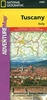
£9.99
Tuscany at 1:220, 000 in a series of Adventure maps from the National Geographic Society with cartography provided by Reise Know-How. The map is double-sided & printed on light waterproof & tear-resistant plastic paper. Cartographic information provided by Reise Know-How has been adjusted to follow the house style of the NGS Adventure series with greater emphasis on the country’s topography. Altitude colouring in broader bands has been replaced here by contours at 200m intervals enhanced by relief shading. National parks & other protected areas are prominently highlighted. Road network indicates scenic routes & gives driving distances selected secondary roads. Railway lines are included & airports are marked. Also shown are internal administrative boundaries with names of the provinces. A range of symbols highlight various places of interest including UNESCO World Heritage sites, churches & monasteries, beaches, etc. Latitude & longitude grid is at intervals of 10’ intervals & an extensive index of localities is provided. Overall, the NGS map presents a more vivid picture of the island’s topography, whilst the original RK-H version provides clearer information for touring by road or rail.PLEASE NOTE: to ensure regular supplies & faster delivery to our customers we keep this title as regular stock in its edition from Rough Guides which is identical to the Reise Know-How’s original version. The NGS version can be ordered on request. ...
Archived Product
£9.99
” Each volume of the Art & Architecture series is opulently illustrated. The highly readable texts provide concentrated information on accessing well-known & less-known sites in the world of art. An image of every piece of art that is described is included, allowing readers to easily recognize the original in situ. Insets on cultural & historical topics & illustrated glossaries, summaries & timelines supplement the body text
- leaving a deeper, more lasting impression of the works discussed.”
...
Archived Product
£18.99
Tuscany Cycling Atlas with 25 tours across the whole region totaling 1735kms, presented by the Verlag Esterbauer in guide with maps at 1:75, 000 showing the route & its variants. Extensive information is conveyed by symbols, indicating road surface, campsites & other accommodation, repair workshops, recreational facilities, places of interest, etc. A list of various types of accommodation facilities is included.IMPORTANT
- PLEASE NOTE BEFORE ORDERING
- ALL THE TEXT IN THIS TITLE IS GERMAN ONLY. MAP LEGEND

Includes::
ENGLISH (please see our sample image) & the information provided on the maps is sufficient to use this title without any knowledge of German.ABOUT THE BIKELINE SERIES: all the titles have been meticulously researched & are highly regarded in their native Germany. Most titles, as indicated in their individual descriptions, also include a separate section listing selected accommodation, from hotels to campsites, youth hostels & rooms in private houses, all with addresses, telephone numbers & price range. Information on towns along each route

Includes::
a list of places of interest, with opening hours, etc. Several of the guides also have street plans. To see the list of other titles in the Bikeline series please click on the series link.


...
Archived Product
£9.99
Laminated & waterproof tourist map of Tuscany with street plans of Florence, Siena, Pisa & Lucca. The main map at 1:400, 000 extends just over the border with Umbria to include the whole of Lake Trasimeno & Perugia. The map provides an overview of the region’s main road connections, with many local roads also included, & shows local railway links. Relief shading with names of hill ranges & selected peaks indicates the topography. Symbols highlight places of interest, archaeological sites, campsites, beaches & marinas, etc. On the reverse there are street plans of central Florence extending over the Arno to include the Boboli Gardens, Siena, Pisa & Lucca. The plans highlight numerous places of interest, selected hotels, etc. Both the main map & the street plans are indexed for localities/streets, main sights, hotels, etc. Also included is information on the region’s climate & a small administrative map of Italy. ...
Archived Product
£14.95
English edition of a guide with 23 cycle tours in Tuscany, ranging from 12km to 146km, covering a total distance of about 1600kms. Routes are mainly on paved roads with occasional detours on unmade tracks to avoid heavy traffic. Detailed maps show the routes & extensive information is conveyed by symbols, indicating road surface, campsites & other accommodation, repair workshops, recreational facilities, places of interest, etc. A list of various types of accommodation facilities is included. About this series: Unless specifically described as an English edition, all the remaining titles in this series have text in GERMAN only. Map legends include English & the information provided on the maps is sufficient to use these titles without any knowledge of German, particularly in the absence of similar products in English from other publishers. All the titles have been meticulously researched & are highly regarded in their native Germany. Most titles, as indicated in their individual descriptions, also include a separate section listing selected accommodation, from hotels to campsites, youth hostels & rooms in private houses, all with addresses, telephone numbers & price range. Information on towns along each route

Includes::
a list of places of interest, with opening hours, etc. Several of the guides also have street plans.

...
Archived Product
£5.99
Tuscany at 1:450, 000 on an Insight Flexi Map in their new format introduced to provide more convenient access to the special features of this series: various additional maps and/or street plans plus tourist information including a list of must-see sights. The map is tear-resistant, waterproof, & can be written on with non-permanent marker pens. On one side is a road map of Tuscany at 1:450, 000, indexed on the reverse for places & points of interest. Coverage extends north-east to La Spezia & north-west to Ravenna. The map has no geographical coordinates. On the reverse are this title’s additional

Features:

- Street plans of central Florence (including the south bank of the Arno with the Palazzo Pitti, etc), Pisa & Siena, Each indexed for streets & points of interest.- Brief descriptions of 21 main sights, neatly grouped into sections covering Florence & Around plus Elsewhere in Tuscany
- all prominently highlighted on the appropriate maps.- Information about Getting Around & Facts for Visitors, including tourist offices, public holidays, opening times, money, tipping, telecommunications & monthly climate charts. To see the list of other Insight Flexi titles in this series please click on the series link.


...
Archived Product
£11.00
Tuscany is home to Florence, the Renaissance, stunning landscapes, great wines
- & food. Simple, slow cooked, made
...
Archived Product
£4.99
Tuscany in the Compact Guide series from Insight is an accessible & handy reference guide, describing main sites & cultural highlights. Each illustrated guide

Includes::
an introductory chapter with a selection of the top ten things to do & gives visitors an insight into history, culture & geography. An extensive

...
Archived Product
£13.99
Insight Guides: Inspiring your next adventure. Insight Guide Tuscany offers you a uniquely comprehensive approach to getting the most out of your trip to one of the most popular destinations in the world. Engaging chapters consider the region`s fascinating history as birthplace of the Renaissance, putting into context the many artistic & architectural wonders on show. Inside Insight Guide Tuscany: Tips for exploring the breathtaking landscape & for tucking into the world-famous Tuscan cuisine & wine ensure that you don`t miss a thing. The great cities of Tuscany, including Florence, Siena, Lucca & Pisa, are covered in addition to the off-the-beaten-track Tuscan towns, such as San Gimignano & Montepulciano; Full-colour photographs throughout give you a true flavour of life in the region today; Detailed maps plot all the major sights you`ll want to see; Travel Tips sections offer selective advice on where to eat & the activities available. About Insight Guides: Insight Guides has over 40 years experience of publishing high-quality, visual travel guides. We produce around 400 full-color print guide books & maps as well as picture-packed e Books to meet different travelers` needs. Insight Guides` unique combination of beautiful travel photography & focus on history & culture together create a unique visual reference & planning tool to inspire your next adventure. ” Insight Guides has spawned many imitators but is still the best of its type.” (Wanderlust Magazine). ...
Archived Product
£7.99
Tuscany in the new Marco Polo Guide series designed to enable travellers to have fun & feel relaxed the moment they arrive to their destination. In a compact format & budget-priced, these guides feature full colour & high quality content with unique insider tips. The information is presented in a straightforward & engaging format with three main sections: an introduction to the location & including highlights & insider tips, a sightseeing & entertainment part, & a practical information chapter; all accompanied by atlas pages & a pull out map. The guides starts with a geographical & historical context, suggestions on what not to miss, great places for free, what to do if it rains, chill out, relax & unique experiences to make the visit even more memorable. The perfect route/day will show the best way to get to know a destination for those with limited time. The sightseeing chapters organise the area in sections & for each one show suggested routes, referenced to the atlas & pull-out map, best places & attractions with practical tips on how to avoid queues, get the best views, where to eat & drink, shopping, entertainment, where to stay & much more. The last section offers a few tours suggestions, travel with kids special pages, festivals & events calendar, travel tips, useful phrases & dos & don’ts. The road atlas pages offer detailed mapping cross-referenced to the sites featured in the book, & a fully indexed pull-out map with its own plastic wallet at the back of the guide. ...
Archived Product

Tuscany Flexi Map

Tuscany on a laminated, tear-resistant Insight Flexi Map, with a double-sided road map of the region at 1:380, 000, street plans of central Florence, Siena and Pisa, all indexed and highlighting numerous places of interest, plus extensive tourist information.The map presents Tuscany divided north/south, with no overlap between the two sides. The northern part includes La Spezia with Cinque Terre and Lake Trasimeno, with the southern part including Elba and extending to Orvieto and Viterbo. Topography is shown by relief shading, with names of main hill and mountain ranges. The maps present the region
RIP - This product is no longer available on our network. It was last seen on 25.09.2019

This page now acts as a permanent archive for this product. Add more information using the comments box below to ensure it can still be found by future generations.

Use our search facility to see if it is available from an alternative contributor.
  • External links may include paid for promotion
  • Availability: Out Of Stock
  • Supplier: Stanfords
  • SKU: 9781780054636
Availability: In Stock
£5.99

Product Description

Tuscany on a laminated, tear-resistant Insight Flexi Map, with a double-sided road map of the region at 1:380, 000, street plans of central Florence, Siena & Pisa, all indexed & highlighting numerous places of interest, plus extensive tourist information. The map presents Tuscany divided north/south, with no overlap between the two sides. The northern part

Includes::
La Spezia with Cinque Terre & Lake Trasimeno, with the southern part including Elba & extending to Orvieto & Viterbo. Topography is shown by relief shading, with names of main hill & mountain ranges. The maps present the region

Reviews/Comments

Add New

Intelligent Comparison

Oooops!
We couldn't find anything!
Perhaps this product's unique.... Or perhaps we are still looking for comparisons!
Click to bump this page and we'll hurry up.

Price History

Vouchers

No voucher codes found.
Do you know a voucher code for this product or supplier? Add it to Insights for others to use.

Facebook

Jargon Buster

Road - a manmade lane or a path that is used to speed up travel.
Resistant - Something that can repel against something.
Laminated - A thin layer of plastic that gives a coating and shine to a material.

Supplier Information

Stanfords
Stanfords was established in 1853 and opened their iconic Covent Garden flagship store in 1901. They have become the top retailer of maps, travel books and accessories in the UK and arguably offer the largest selection of maps and travel books worldwide. Famous names such as Captain Robert Falcon Scott, Ranulph Fiennes and Michael Palin have purchased from Stanfords. They now have a shop in Bristol and both stores together with other venues operate a calendar of events including talks, book signings and exhibitions. As a specialist map retailer, the map selection is comprehensive and includes road maps, street maps and walking maps from worldwide destinations, as well as a selection of world atlases and wall maps. Books include travel guides and travel literature. Stanfords also stock globes, from miniatures made of blue marble to magnificent floor-standing globes. The website features a selection of interesting articles on travel topics.
Page Updated: 2023-11-12 20:15:36

Community Generated Product Tags

Oh No! The productWIKI community hasn't generated any tags for this product yet!
Menu