More From Contributor
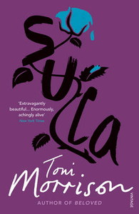
£102.99
First title of a series of 8 DVDs covering the whole country. About this series: The Swiss Map 25 series covers the whole of the country at 1:25, 000,

Includes::
the complete official Swiss footpath network & it is compatible with both Swiss Map 50 & 100, & with the Dufour Map. There are 8 DVD titles in the series, each also including the Swiss Map 500 covering the whole country. The cartography of Swiss Map 25 is equivalent to that of the printed Swiss Survey maps & the individually selectable map extracts can be easily printed & exported. The diversity of the graphic tools makes it possible to show political & administrative boundaries (including municipalities, districts & cantons), highlight castles, heritage sites & other tourist information, & search for all displayed place names. It is also possible to calculate distances, hiking times & profiles' elevation, to enter individual routes or add personal data to a map. Up-to-date information from the Switzerland Tourism organisation about holiday destinations, hotels, events & excursions can also be accessed from the map via the Internet. Each DVD is compatible with Windows, Mac & GPS (NMEA, Garmin & Magellan). All data is available in English, German, French & Italian. System requirements:1 GB free hard disk space Screen 1024 x 768 pixels Thousands of colours (16 bits) Internet Browser 4.x (or higher) Windows
- 2000 or XP
- Pentium processor III
- 256 MB RAMMacintosh
- Mac OS X 10.1.5 (or higher)
- G3 500 MHz
- 256 MB RAM


...
Archived Product
£8.99
In 1941, Irene Nemirovsky sat down to write a book that would convey the magnitude of what she was living through by evoking the domestic lives & personal trials of the ordinary citizens of France. Nemirovsky`s death in Auschwitz in 1942 prevented her from seeing the day, sixty-five years later, that the existing two sections of her planned novel sequence, Suite Francaise, would be rediscovered & hailed as a masterpiece. Set during the year that France fell to the Nazis, Suite Francaise falls into two parts. The first is a brilliant depiction of a group of Parisians as they flee the Nazi invasion; the second follows the inhabitants of a small rural community under occupation. Suite Francaise is a novel that teems with wonderful characters struggling with the new regime. However, amidst the mess of defeat, & all the hypocrisy & compromise, there is hope. True nobility & love exist, but often in surprising places. ...
Archived Product
£8.99
France, 1940. Lucile Angellier`s husband has been captured as a prisoner-of-war, & all she can do is wait for him
- & tend to
...
Archived Product
£17.99
The 1:50, 000 topographic map gives a more general picture of the ground features than a basic map. It shows settlements, houses, roads, cultivated areas, waterways, cutting areas, mires, rock exposures, & relief. One map sheet covers an area of 30 x 40 km & one centimetre corresponds to 500 metres on the ground. The 1:50, 000 topographic map is also an ideal complement to nautical charts as it provides useful information about the land areas adjacent to waterways. For example, all Finnish sea areas are covered by 1:50, 000 topographic map sheets. ...
Archived Product
£5.99
Suki`s favourite possession is her blue cotton kimono. A gift from her obachan, it holds special memories of her grandmother`s visit last summer. & Suki is going to wear it on her first day back to school
- no matter what anyone says. When it`s Suki`s turn to share with her classmates what she did during the summer, she tells them about the street festival she attended with her obachan & the circle dance that they took part in. In fact, she gets so carried away reminiscing that she`s soon humming the music & dancing away, much to the delight of her entire class! Filled with gentle enthusiasm & a touch of whimsy, Suki`s Kimono is the joyful story of a little girl whose spirit leads her to march
- & dance
- to her own drumbeat.


...
Archived Product
£7.99
Sulawesi on a double-sided map from Periplus combining coverage of the whole island with more detailed enlargements of its most visited areas including Tana Toraja, six street plans including Makassar, plus tourist tips. The whole of Sulawesi, including the surrounding smaller islands is shown at 1:2, 600, 000. West & South Sulawesi Provinces plus the northernmost tip of the island around Manado are also presented in greater detail, enlarged to 1:1, 000, 000 & 1:350, 000 respectively. The maps have altitude colouring to show the topography, with names of peaks, mountain ranges, etc. Road network

Includes::
selected local tracks & various places of interest are highlighted. All the maps show latitude & longitude lines. On the reverse the Tana Toraja area is presented at 1:85, 000 highlighting main hiking trails. This side also

Includes::
a large street plan of Makassar (1:20, 000), plus plans of Manado, Palu, Parepare & the Rantepao area with an enlargement for central Rantepao. All the plans indicate locations of hotels, restaurants, various services & places of interest. Only the street plan of Makassar is indexed.


...
Archived Product
£9.50
Sulawesi at 1:800, 000 on light, waterproof & tear-resistant plastic paper, with both topographic & tourist information. The map, part of Reise Know-How's highly acclaimed World Mapping Project, is double-sided to provide the best balance between a good scale & a convenient size sheet. Topography is shown by altitude colouring with spot heights & graphics indicating salt flats. Detailed presentation of the road network

Includes::
dirt roads & local tracks; railways, local airports & ferry connections to other islands of the Indonesian archipelago are also shown. Local administrative units are shown with their boundaries & names. National parks & other protected areas are highlighted. A wide range of symbols shows various places of interest including UNESCO sites, temples, museums & monuments, hot springs & other natural features, etc. Latitude & longitude lines are drawn at 30

...
Archived Product
£7.99
Sulawesi on a double-sided map from Periplus combining coverage of the whole island with more detailed enlargements of its most visited areas including Tana Toraja & the surrounding smaller islands, plus street plans including Makassar. The whole of Sulawesi, including the surrounding islands is shown at 1:2, 600, 000. Enlargements & street plans cover:- West & South Sulawesi Provinces at 1:1, 000, 000 with two enlargements: the Tana Tojara region at 1:150, 000 & within it the area around Rantepao at 1:25, 000, plus street plans of central Rantepao & of Makassar.
- North Sulawesi Province at 1:850, 000 with enlargements of its northern part at 1:450, 000 & the Bunaken Islands at 1:150, 000, plus a street plan of central Manado.
- Separate enlargements of Talaud Islands & Sangihe Islands (both 1:450, 000), plus Togean Islands at 1;1, 000, 000.- Street plans of central Palu & Pare Pare. The maps show the topography by bold altitude colouring & relief shading, with names of mountain ranges, etc. Road network emphasizes main routes but also

Includes::
selected local tracks. Ferry connections are also marked. The main map & the insets covering the larger chunks of Sulawesi have latitude & lines; the more detailed scale maps do not. Only the street plan of Makassar is indexed. All the panels highlight various places of interest, including beaches & diving sites. Street plans in addition show hotels. Map legend

Includes::
English; highlighted sights are named in English.


...
Archived Product
£10.99
Sulawesi with the Lesser Sunda Islands, the southernmost part of the Indonesian archipelago, including Lombok, Sumbawa, Sumba, Flores & Timor at 1:1, 500, 000 from Nelles, plus street plans of Palu, Manado, Makassar (Ujung Pandang). On one side is Sulawesi, with the Sangihe & Talaud islands off its north-eastern tip shown as an inset. Street plans highlighting hotels & other facilities show the centre of Palu & Manado. An enlargement presents the Tana Toraja area in greater detail. On the reverse coverage extends from the southern tip of Sulawesi with Makassar across the Flores Sea & the Banda Sea to the Lesser Sunda Islands from Lombok to Timor. Also provided is a street plan of Makassar (Ujung Pandang). Relief shading with spot heights & names of peaks presents each island’s topography. The map shows the road network, plus local airports & ferry connections. National parks or protected areas & numerous places of interest are prominently highlighted. On Timor boundaries of the Democratic Republic of East Timor are marked. Latitude & longitude are indicated by margin ticks at 1° intervals. The map has no index of localities or islands. Map legend

Includes::
English. To see other titles in the Nelles series of regional maps of Indonesia please click on the series link.

...
Archived Product
£6.99
Sulawesi on a double-sided map from Periplus combining coverage of the whole island with more detailed enlargements of its most visited areas including Tana Toraja & the surrounding smaller islands, plus street plans including Makassar. The whole of Sulawesi, including the surrounding islands is shown at 1:2, 600, 000. Enlargements & street plans cover:- The West & South Sulawesi provinces at 1:1, 000, 000 with two enlargements: the Tana Tojara region at 1:150, 000 & within it the area around Rantepao at 1:25, 000, plus street plans of central Rantepao, Makassar, & Pare Pare.- North Sulawesi province at 1:850, 000 with enlargements of its northern tip at 1:450, 000 & of the Bunaken Islands at 1:150, 000, plus a street plan of central Manado.
- Separate enlargements of Talaud Islands & Sangihe Islands (both 1:450, 000), plus Togean Islands (1:1, 000, 000).- Street plans of central Palu The maps show the topography by bold altitude colouring & relief shading, with names of mountain ranges, etc. Road network emphasizes main routes but also

Includes::
selected local tracks. Ferry connections are also marked. The main map & the insets covering the larger chunks of Sulawesi have latitude & lines; the more detailed scale maps do not. Only the street plan of Makassar is indexed. All the panels highlight various places of interest, including beaches & diving sites. Street plans in addition show hotels. Map legend

Includes::
English; highlighted sights are named in English.


...
Archived Product

Sula

As girls, Nel and Sula shared each other`s discoveries and dreams in the poor black mid-West of their childhood. Then Sula ran away to live her dreams and Nel got married. Ten years later Sula returns and no one, least of all Nel, trusts her. SULA is the story of the fear that makes people accept self-pity; the fear that will not countenance escape and that justifies itself through myth and legend. Sula herself is cast as a witch and demon by the people who resent her strength. They attack her with the most pervasive weapon of all, the weapon of language and story. But Sula is a woman of power, a wayward force who challenges the smallness of a world that tries to hold her down.
RIP - This product is no longer available on our network. It was last seen on 25.09.2019

This page now acts as a permanent archive for this product. Add more information using the comments box below to ensure it can still be found by future generations.

Use our search facility to see if it is available from an alternative contributor.
  • External links may include paid for promotion
  • Availability: Out Of Stock
  • Supplier: Stanfords
  • SKU: 9780099760016
Availability: In Stock
£7.99

Product Description

As girls, Nel & Sula shared each other`s discoveries & dreams in the poor black mid-West of their childhood. Then Sula ran away to live her dreams & Nel got married. Ten years later Sula returns & no one, least of all Nel, trusts her. SULA is the story of the fear that makes people accept self-pity; the fear that will not countenance escape & that justifies itself through myth & legend. Sula herself is cast as a witch & demon by the people who resent her strength. They attack her with the most pervasive weapon of all, the weapon of language & story. But Sula is a woman of power, a wayward force who challenges the smallness of a world that tries to hold her down.

Reviews/Comments

Add New

Intelligent Comparison

Oooops!
We couldn't find anything!
Perhaps this product's unique.... Or perhaps we are still looking for comparisons!
Click to bump this page and we'll hurry up.

Price History

Vouchers

No voucher codes found.
Do you know a voucher code for this product or supplier? Add it to Insights for others to use.

Facebook

Jargon Buster

Black - A colour which does not emit any colour of the spectrum. Black absorbs all frequencies of the spectrum.
Weapon - Any object that is used for malicious intent
World - A physical grouping, commonly used to describe earth and everything associated with ti
Language - the method of communication used in different areas. Humans and computers have many different languages.
Language - The way humans communicate either written and spoken.

Supplier Information

Stanfords
Stanfords was established in 1853 and opened their iconic Covent Garden flagship store in 1901. They have become the top retailer of maps, travel books and accessories in the UK and arguably offer the largest selection of maps and travel books worldwide. Famous names such as Captain Robert Falcon Scott, Ranulph Fiennes and Michael Palin have purchased from Stanfords. They now have a shop in Bristol and both stores together with other venues operate a calendar of events including talks, book signings and exhibitions. As a specialist map retailer, the map selection is comprehensive and includes road maps, street maps and walking maps from worldwide destinations, as well as a selection of world atlases and wall maps. Books include travel guides and travel literature. Stanfords also stock globes, from miniatures made of blue marble to magnificent floor-standing globes. The website features a selection of interesting articles on travel topics.
Page Updated: 2023-11-12 20:15:36

Community Generated Product Tags

Oh No! The productWIKI community hasn't generated any tags for this product yet!
Menu