
 United Kingdom
 France
 Germany
 Netherlands
 Sweden
 USA
USA
 Italy
Italy
 Spain
Spain
More From Contributor


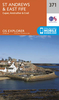


St Andrews OS ACTIVE Map
Map No. 59, St Andrews, in the waterproof and tear-resistant OS Active version of the Ordnance Survey Landranger series at 1:50, 000, including Kirkcaldy, Glenrothes, West Wemyss, East Wemyss, Methil, Leven, Thornton, Kennoway, Falkland, Ladybank, New Gilston, Lower Largo, Elie, St Monans, Pittenweem, Largoward, Stravithie, Kingsbarns, Ceres, Collessie, Cupar, Lindores, Brunton, Kilmany, Balmerino, Leuchars, Newport-on-Tay, Tayport, Errol and Inchture, plus the Firth of Tay, the Firth of Forth, Largo Bay, Fife Ness and Isle of May. Edition C3; Publication date April 2012About Ordnance Survey

Product Description
Reviews/Comments
Add New
Vouchers
No voucher codes found.
Do you know a voucher code for this product or supplier? Add it to Insights for others to use.
Do you know a voucher code for this product or supplier? Add it to Insights for others to use.
 Denmark