More From Contributor

£9.99
Map No. 107, Kingston upon Hull 1903-1908, in the Cassini Historical Series of old Ordnance Survey mapping of England & Wales at 1:50, 000 in a format designed to offer a convenient comparison with the present day coverage from the OS, & most locations in three different editions. Old historical maps have been combined so that the sheet lines correspond to the current Landranger series & reproduced with the scale changed from one inch to one mile to 1:50, 000. Most locations are covered by three separate maps, showing how the area has changed over the decades, with selected major cities also presented in a fourth edition. * Old Series: the first detailed survey mapping dating for most areas from the first half of the 19th century, in black & white & with relief shown by hachuring.* Revised New Series from 1880s/1900s, with some colouring & a mixture of hachuring & contour lines.* Popular Edition from the inter-war years, with contour lines & colouring to indicate woodlands, parks, etc.* New Popular Edition from the late 1940s, reproduced in the Cassini series for the major cities. Each map

Includes::
notes on the development of Ordnance Survey & the various series produced by them. For those interested in maps & cartography in general, the Cassini series also provides a fascinating insight into how Ordnance Survey cartographic style has developed over a period of over 100 years. Coverage

Includes::
present day Barton-upon-Humber, Welwick, Patrington, Keyingham, Withernsea, Hedon, Roos, Burton Pidsea, Bilton, Cottingham, Sproatley, Aldbrough, Wawne, Beverley, Skirlaugh, Tickton, Leven, Withernwick, Mappleton, Hornsea, Leconfield, Beswick, Brandesburton, Hutton Cranswick, North Frodingham, Skerne, Skipsea, Driffield, Barmston, Sunk Isl&, Easington & Kilnsea, with the Spurn Head & the northern part of the Humber Estuary.* PLEASE NOTE: Stanfords can also print on request mapping from all four series *centring the map on a location of your choice.* For more information please click on the link below.


...
Archived Product
£9.99
Map No. 107, Kingston upon Hull 1924, in the Cassini Historical Series of old Ordnance Survey mapping of England & Wales at 1:50, 000 in a format designed to offer a convenient comparison with the present day coverage from the OS, & most locations in three different editions. Old historical maps have been combined so that the sheet lines correspond to the current Landranger series & reproduced with the scale changed from one inch to one mile to 1:50, 000. Most locations are covered by three separate maps, showing how the area has changed over the decades, with selected major cities also presented in a fourth edition. * Old Series: the first detailed survey mapping dating for most areas from the first half of the 19th century, in black & white & with relief shown by hachuring.* Revised New Series from 1880s/1900s, with some colouring & a mixture of hachuring & contour lines.* Popular Edition from the inter-war years, with contour lines & colouring to indicate woodlands, parks, etc.* New Popular Edition from the late 1940s, reproduced in the Cassini series for the major cities. Each map

Includes::
notes on the development of Ordnance Survey & the various series produced by them. For those interested in maps & cartography in general, the Cassini series also provides a fascinating insight into how Ordnance Survey cartographic style has developed over a period of over 100 years. Coverage

Includes::
present day Barton-upon-Humber, Welwick, Patrington, Keyingham, Withernsea, Hedon, Roos, Burton Pidsea, Bilton, Cottingham, Sproatley, Aldbrough, Wawne, Beverley, Skirlaugh, Tickton, Leven, Withernwick, Mappleton, Hornsea, Leconfield, Beswick, Brandesburton, Hutton Cranswick, North Frodingham, Skerne, Skipsea, Driffield, Barmston, Sunk Isl&, Easington & Kilnsea, with the Spurn Head & the northern part of the Humber Estuary.* PLEASE NOTE: Stanfords can also print on request mapping from all four series *centring the map on a location of your choice.* For more information please click on the link below.


...
Archived Product
£9.09
Map No. 107, Kingston upon Hull, in the waterproof & tear-resistant OS Active version of the Ordnance Survey Landranger series at 1:50, 000, including Barton-upon-Humber, Welwick, Patrington, Keyingham, Withernsea, Hedon, Roos, Burton Pidsea, Bilton, Cottingham, Sproatley, Aldbrough, Wawne, Beverley, Skirlaugh, Tickton, Leven, Withernwick, Mappleton, Hornsea, Leconfield, Beswick, Brandesburton, Hutton Cranswick, North Frodingham, Skerne, Skipsea, Driffield, Barmston, Sunk Isl&, Easington & Kilnsea, with the Spurn Head & the northern part of the Humber Estuary. Edition C2, 2nd reprint with minor changes; Publication date April 2012 About Ordnance Survey ...
Archived Product
£10.39
Map No. 107, Kingston upon Hull, in a waterproof & tear-resistant version of the Ordnance Survey Landranger series at 1:50, 000, including Barton-upon-Humber, Welwick, Patrington, Keyingham, Withernsea, Hedon, Roos, Burton Pidsea, Bilton, Cottingham, Sproatley, Aldbrough, Wawne, Beverley, Skirlaugh, Tickton, Leven, Withernwick, Mappleton, Hornsea, Leconfield, Beswick, Brandesburton, Hutton Cranswick, North Frodingham, Skerne, Skipsea, Driffield, Barmston, Sunk Isl&, Easington & Kilnsea, with the Spurn Head & the northern part of the Humber Estuary. Edition C2; Revised for selected changes 2006; Copyright date: 2006; Reprinted with minor change 2007 This title is also available on our website in a paper version. Maps in this series are only published folded. Stanfords can also print flat versions of Ordnance Survey maps through the OS Select system, centring the map on a location of your choice & with a picture provided by you on the cover. For more information please click on the link at the bottom of this description. About Ordnance Survey ...
Archived Product
£12.99
” Bloody Paralyser” tells the story of the largest British bomber aircraft of World War 1 & the men who flew them. In 1915, the biggest plane ever seen in Britain, the Handley Page Type 0, took flight for the first time, a twin engine monster with a 100 foot wingspan, designed to be a `bloody paralyser` to the Germans. Operating mainly at night, the Handley Page bombers attacked German & German-occupied towns & cities with near impunity, disrupting the enemy`s industry & crippling its war effort. The men that flew in the bloody paralysers were the forerunners of the crews of Bomber Command in World War 2, & now their story is told in their own words. Bristling with Lewis guns, the lasting legacy of the aircraft was such that for many years after the war, any large aircraft came to be called a ` Handley Page` in Britain. ...
Archived Product
£14.99
At the heart of one of London`s busiest boroughs, nestled on the banks of the River Thames, lies Kingston upon Thames. This vibrant Surrey market town first appears on record in a royal document from AD 838 & by the tenth century it had become the place of coronation for Anglo-Saxon kings. The town itself has managed to retain many of its historical roots with the countless examples of beautiful architecture throughout the ages; Kingston upon Thames in 50 Buildings explores its history through a selection of the greatest of these treasures. In this unique study, Julian Mc Carthy celebrates the city`s architectural heritage in a new & accessible way with a tour of the town`s historic & modern buildings. ...
Archived Product
£5.95
Kingston upon Thames, Richmond, Epsom & Wimbledon Street Atlas from the Geographers` A-Z Map Company in a paperback format slightly smaller than A5. Map scale is 1:19, 000 (3.33” to a mile), with an enlargement showing the town centre of Kingston in greater detail at 1:9, 500 (6.67” to 1 mile). The atlas covers the south-western boroughs of London, extending south from Brentford, Chiswick & Hammersmith to include Banstead, Barnes, Cheam, Chessington, Esher, Ewell, Hampton, Hersham, Kew, New Malden, Putney, Surbiton, Teddington, Thames Ditton & Twickenham. Current edition of this title was published in 2016. To see other titles in this series of A-Z street atlases of towns & cities please click on the series link. A-Z also publish a series of County Street Atlases
- for a list of titles in that series please search for SI00000917.A-Z street atlases present motorways plus A & B roads highlighted by colouring & shown with route numbers. One way or restricted access streets & car parks are marked, as are in more recently published titles locations of speed cameras. Also shown are selected cycleway routes. Where appropriate, A & B roads are annotated with selected house numbers for easier identification of addresses. Railway lines are shown with stations & level crossings. Colouring indicates different types of buildings: educational, hospitals & healthcare, industrial, leisure & recreational, shopping centres & markets, public buildings, & places of interest. Symbols mark locations of facilities usually indicated on street mapping: post offices, emergency services, public toilets, etc. Also marked are postcode & local authority boundaries. Each page has the lines & coordinates of the British National Grid. The indexes list streets, places & areas, hospitals, industrial estates, blocks of flats on housing estates, railway stations, & selected places o interest; the latter are printed in contrasting colouring to make them easier to find.
...
Archived Product
£6.50
Kingston, Ontario on a double-sided map from Canadian Cartographics Corporation, combining a street plan of Kingston at 1:25, 000 with an enlargement of the downtown area, plus on the reverse individual street plans at 1:25, 000 of Gananoque, Brockville, Prescott, Iroquois, Cardinal, Morrisburg & Cornwall with an extension to Long Sault Parkway. Each street plan is indexed. The plans have colouring to indicate commercial, institutional or industrial use, etc. Main traffic arteries are highlighted & one way streets are marked. A range of symbols shows, as appropriate, parking facilities, bus terminals, metro and/or railway stations, various public facilities & services, places of interest, recreational centres, etc. ...
Archived Product
£5.99
Simon Webb’s Pocket Miscellany of facts about Kingston-upon-Thames explores both the modern life of this London borough, as well as its historical background. For over a century, Kingston-upon-Thames was the de facto capital of Engl&. This Royal borough & Surrey market town situated on the banks of the River Thames was the coronation site of seven Saxon kings & during the reign of Henry VIII its renowned Hampton Court Palace featured bowling alleys, tennis courts & a 36, 000 sq ft kitchen. Nowadays a renowned centre for retail & the arts, Kingston boasts green spaces, cafe culture & architecture. This engaging little book explores both the modern life of this most vibrant & exciting of London boroughs, as well as exploring its historical background. ...
Archived Product
£3.50
Kingswinford in 1901 in a fascinating series of reproductions of old Ordnance Survey plans in the Alan Godfrey Editions, ideal for anyone interested in the history of their neighbourhood or family. The map covers much of Kingswinford, to the west of the Black Country, extending southward to Mount Pleasant. Features include Stourbridge Workhouse, tramways, Halfway, Summer Hill, Summerhill House, Bradley Hall, etc. On the reverse is a 1912 directory of Kingswinford. About the Alan Godfrey Editions of the 25” OS Series: Selected towns in Great Britain & Ireland are covered by maps showing the extent of urban development in the last decades of the 19th & early 20th century. The plans have been taken from the Ordnance Survey mapping & reprinted at about 15 inches to one mile (1:4, 340). On the reverse most maps have historical notes & many also include extracts from contemporary directories. Most maps cover about one mile (1.6kms) north/south, one & a half miles (2.4kms) across; adjoining sheets can be combined to provide wider coverage.FOR MORE INFORMATION & A COMPLETE LIST OF ALL AVAILABLE TITLES PLEASE CLICK ON THE SERIES LINK. ...
Archived Product

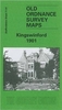
Kingston Upon Thames 1895

Kingston upon Thames in 1895 in a fascinating series of reproductions of old Ordnance Survey plans in the Alan Godfrey Editions, ideal for anyone interested in the history of their neighbourhood or family. The map covers the centre of Kingston upon Thames and part of Hampton Wick, stretching from Normansfield and Wick Road in Hampton Wick eastward to Park Road and Manorgate Road in Kingston, and from St Albans Road southward to Washington Road. Features include railway with Kingston and Hampton Wick stations, River Thames, All Saints church, brewery, Canbury Field, The Fairfield, Bunyon Chapel, Albany Club, Tiffins School, Norbiton Hall, St Peter`s church Norbiton, Royal Cambridge Asylum, St Paul`s church, Kingston Bridge, Normansfield, St John`s church Hampton Wick,
tannery, etc. Extracts from an 1897 street directory are on the reverse, including entries for Caversham Road, Church Street, Eden Street, Fairfield Road, Fife Road and Market Place. The map overlaps sheet No. London 140 covering Hampton Wick.About the Alan Godfrey Editions of the 25” OS Series:Selected towns in Great Britain and Ireland are covered by maps showing the extent of urban development in the last decades of the 19th and early 20th century. The plans have been taken from the Ordnance Survey mapping and reprinted at about 15 inches to one mile (1:4, 340). On the reverse most maps have historical notes and many also include extracts from contemporary directories. Most maps cover about one mile (1.6kms) north/south, one and a half miles (2.4kms) across; adjoining sheets
can be combined to provide wider coverage.FOR MORE INFORMATION AND A COMPLETE LIST OF ALL AVAILABLE TITLES PLEASE CLICK ON THE SERIES LINK.
RIP - This product is no longer available on our network. It was last seen on 25.09.2019

This page now acts as a permanent archive for this product. Add more information using the comments box below to ensure it can still be found by future generations.

Use our search facility to see if it is available from an alternative contributor.
  • External links may include paid for promotion
  • Availability: Out Of Stock
  • Supplier: Stanfords
  • SKU: 9781847847270
Availability: In Stock
£3.50

Product Description

Kingston upon Thames in 1895 in a fascinating series of reproductions of old Ordnance Survey plans in the Alan Godfrey Editions, ideal for anyone interested in the history of their neighbourhood or family. The map covers the centre of Kingston upon Thames & part of Hampton Wick, stretching from Normansfield & Wick Road in Hampton Wick eastward to Park Road & Manorgate Road in Kingston, & from St Albans Road southward to Washington Road. Features include railway with Kingston & Hampton Wick stations, River Thames, All Saints church, brewery, Canbury Field, The Fairfield, Bunyon Chapel, Albany Club, Tiffins School, Norbiton Hall, St Peter`s church Norbiton, Royal Cambridge Asylum, St Paul`s church, Kingston Bridge, Normansfield, St John`s church Hampton Wick, tannery, etc. Extracts from an 1897 street directory are on the reverse, including entries for Caversham Road, Church Street, Eden Street, Fairfield Road, Fife Road & Market Place. The map overlaps sheet No. London 140 covering Hampton Wick. About the Alan Godfrey Editions of the 25” OS Series: Selected towns in Great Britain & Ireland are covered by maps showing the extent of urban development in the last decades of the 19th & early 20th century. The plans have been taken from the Ordnance Survey mapping & reprinted at about 15 inches to one mile (1:4, 340). On the reverse most maps have historical notes & many also include extracts from contemporary directories. Most maps cover about one mile (1.6kms) north/south, one & a half miles (2.4kms) across; adjoining sheets can be combined to provide wider coverage.FOR MORE INFORMATION & A COMPLETE LIST OF ALL AVAILABLE TITLES PLEASE CLICK ON THE SERIES LINK.

Reviews/Comments

Add New

Intelligent Comparison

Oooops!
We couldn't find anything!
Perhaps this product's unique.... Or perhaps we are still looking for comparisons!
Click to bump this page and we'll hurry up.

Price History

Vouchers

No voucher codes found.
Do you know a voucher code for this product or supplier? Add it to Insights for others to use.

Facebook

Jargon Buster

Contemporary - Modern era design
Contemporary - A design reference to indicate post war modern design
History - Anything that happens in the past. An acedemic subject.
Road - a manmade lane or a path that is used to speed up travel.
Contemporary - An object that is living in the same time.
Hall - A room at the inside of an entrance of a house.
Ideal - Something that satisfies a perfect criteria.
Family - A group of people that live together made up from parents and children.

Supplier Information

Stanfords
Stanfords was established in 1853 and opened their iconic Covent Garden flagship store in 1901. They have become the top retailer of maps, travel books and accessories in the UK and arguably offer the largest selection of maps and travel books worldwide. Famous names such as Captain Robert Falcon Scott, Ranulph Fiennes and Michael Palin have purchased from Stanfords. They now have a shop in Bristol and both stores together with other venues operate a calendar of events including talks, book signings and exhibitions. As a specialist map retailer, the map selection is comprehensive and includes road maps, street maps and walking maps from worldwide destinations, as well as a selection of world atlases and wall maps. Books include travel guides and travel literature. Stanfords also stock globes, from miniatures made of blue marble to magnificent floor-standing globes. The website features a selection of interesting articles on travel topics.
Page Updated: 2023-11-12 20:15:36

Community Generated Product Tags

Oh No! The productWIKI community hasn't generated any tags for this product yet!
Menu