
 United Kingdom
 France
 Germany
 Netherlands
 Sweden
 USA
USA
 Italy
Italy
 Spain
Spain
More From Contributor


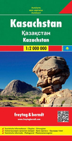
Kazakhstan F&B
Kazakhstan at 1:2, 000, 000 on a large, indexed map from Freytag & Berndt with a street plan of central Astana. Most of the country is shown on one side; eastern Kazakhstan including Almaty (Alma-Ata) is presented as a separate panel on the reverse, with a small overlap between the sides. All place names (including in the border areas of Russia) are in the Latin alphabet but with names of larger towns also in Cyrillic.Topography is indicated by relief shading with numerous spot heights, plus graphics for deserts, salt flats, swamps, water wells, etc. Protected areas are highlighted. Road network includes desert tracks, indicates border crossings, and shows driving distances on main routes. Railway lines are included, local airports and various places of interest are marked. The
map has latitude and longitude lines at 1º intervals and is indexed. Multilingual map legend includes English.Also provided is a plan of central Astana naming main streets and important buildings.
map has latitude and longitude lines at 1º intervals and is indexed. Multilingual map legend includes English.Also provided is a plan of central Astana naming main streets and important buildings.

Product Description
Reviews/Comments
Add New
Vouchers
No voucher codes found.
Do you know a voucher code for this product or supplier? Add it to Insights for others to use.
Do you know a voucher code for this product or supplier? Add it to Insights for others to use.
 Denmark