More From Contributor

£10.99
Hawaii Wall Map at 1:773, 000 from the National Geographic Society, size 88 x 57.5cm (35” x 22.5” approx) with a vivid presentation of the topography of the islands & the sea floor of the Pacific Ocean. An inset shows the whole Hawaiian archipelago, from Hawaii (the Big Island) itself in the east to Kure Atoll in the Northwestern Hawaiian Islands Coral Reef Ecosystem Reserve. Presentation of the larger islands on the main map, from Hawaii to Niihau, very effectively uses relief shading to show the volcanoes, indicating areas of lava flow. The islands have numerous spot heights (in feet) & plenty of names of geographical features, particularly along the coast. The surrounding seas are coloured to indicate the Hawaiian Ridge on which the islands sit & the sea floor. On individual islands the map shows main towns & villages, principal roads & airports. Latitude & longitude lines are drawn at 1° intervals. The inset shows the whole of the Hawaiian Archipelago, with additional arrows indicating trade winds & ocean currents. The accompanying notes explain the administrative status, i.e. the state of Hawaii does not include the Midway Islands which are administered by the US Navy. ...
Archived Product
£4.99
Hawaii in the Pocket Guide series from Berlitz; a collection of handy, pocket-sized guides dedicated to an extensive range of cities, regions & countries worldwide. Written in narrative form, individual guides explore the history, main sights & attractions, food & drink, accommodation & local culture of the destination in detail. Each Berlitz pocket guide has a similar format, with colour-coded sections helping readers locate information quickly in addition to distinctive chapters exploring the city or region. An introduction outlines the destination for visitors & a section dedicated to 'A Brief History' actually explores the area in relative depth. A where to go chapter is organized by region & city & is written in prose form with references to individual sites highlighted in bold for clarity. There are also further suggestions on where & when to eat. Recommendations for leisure activities in the region, including sport, nightlife & shopping, are also provided & tailored accordingly for each destination. Handy travel tips are listed alphabetically in a dedicated section, providing practical guidance & helping visitors make the most of their stay. The main hotels, particularly for cities, are also listed in an accommodation section, offering a brief overview with approximate price bandings & relevant contact details. ...
Archived Product
£19.99
Hawaii Recreational Atlas & Gazetteer at 1:84, 000 approx. in a series of large format paperback state atlases from De Lorme, with detailed, contoured, GPS compatible topographic mapping, plus an indexed street plan of Honolulu. Recreational information

Includes::
lists of natural area reverses, scenic drives, hiking trails, recreational areas, historic sites & attractions, recreational areas, golf courses, beaches, boating facilities, unique natural features, gardens, etc – all arranged by isl&. Also provided are general notes on Hawaii & its volcanic structure, a time line, plus a phrasebook of Hawaiian words & a pronunciation key. Each title in this De Lorme series covers one state & presents it at a scale much more detailed than used on most state road maps. Particularly popular areas are often also presented on enlargements. The maps are contoured, show variation of terrain (deserts, glaciers, wetlands, woodlands, etc) & have latitude & longitude and/or UTM grid lines for GPS use. Various types of protected areas are distinguished by the colouring of their boundaries, e.g. national or state parks, forests, etc. Also marked are Indian Reservations & restricted entry military zones. Road network is shown in much more detail than on other state mapping, with local roads, unsurfaced back roads & tracks, forest trails, etc. Where appropriate, old historical routes are marked. Railway lines & local airports or landing strips are included & the maps also indicate administrative boundaries. Symbols highlight various recreational areas & facilities such as campgrounds, unique natural features, etc. Each title contains extensive lists of outdoor adventure sites (grouped into activities such as hiking, biking, paddling, fishing, skiing, etc.), diverse family outing sites, campgrounds, & tables showing what facilities can be found in the state’s recreational areas. Each atlas also has an index of localities. To see the list of titles in this series please click on the series link.

...
Archived Product
£11.50
Hawaii at 1:200, 000 in a series of waterproof & tear-resistant, indexed regional maps of USA from Reise-Know-How’s highly acclaimed World Mapping Project, combining detailed presentation of the road network with topographic & tourist information. Each island is presented separately, with a small inset showing the whole group. Road network indicates tracks recommended for 4WD vehicles. The maps have both a latitude/longitude grid at 15` intervals & a UTM grid. Maps in the Reise-Know-How series covering the US have altitude colouring with spot heights shows each region’s topography, with national parks & other protected areas, as well as American Indian Reservations & restricted entry zones clearly marked. Road network indicates toll roads & scenic routes. Railways &, where appropriate, ferry routes are marked. The maps show both names & boundaries of local counties. Symbols highlight a variety of places of interest, including historical sites, amusement parks, natural features, golf courses & wintersport areas, etc. Each map is double-sided,

Includes::
an index of localities, & has a latitude & longitude grid. Map legend

Includes::
English. To see other titles in this series please click on the series link.


...
Archived Product
£30.00
Detailed physical wall map of Hawaii State at a scale of 1:750, 000. The cartography shows relief through a stunning, highly ...
Archived Product
£9.99
Map No. 230, Hawaii Volcanoes National Park, HI, in an extensive series of GPS compatible, contoured hiking maps of USA’s national & state parks or forests & other popular recreational areas. Cartography based on the national topographic survey, with additional tourist information. The map, printed on light, waterproof & tear-resistant plastic paper, covers the whole park at 1:100, 000 (contour interval 100 feet), plus its central section shown on the reverse at 1:50, 000 (contour interval 50 feet) with the K lauea Caldera at 1:25, 000 (contour interval 25 feet). Maps in this series highlight walking trails along with campsites & other accommodation, picnic sites, areas for various recreational pursuits such as horse riding or skiing, drinking water sources, & many other facilities of interest to the outdoor enthusiast. Cartography is based on information from the USGS (United States Geological Survey
- the country’s national survey organization), revised by the National Geographic Maps in cooperation with the National Park Service, USDA Forest Service, etc. Topography is excellently presented by contours (interval varies according to scale), enhanced by relief shading & colouring/graphics for wood cover, glaciers, etc. All heights are given in feet. The maps have a UTM grid plus latitude & longitude margin ticks & GPS waypoints for selected important locations. Each map is double-sided to give either maximum coverage of the chosen area or additional enlargements of its important sections. Accompanying notes provide useful information on relevant regulations, safety precautions, contact addresses, etc.* *IMPORTANT
- PLEASE NOTE: the series is very extensive, ranging in scale from 1:400, 000 for the vast national parks of Alaska to 1:25, 000 for local map in several states. We recommend, therefore, viewing the series by state rather than the whole list.*

...
Archived Product
£7.95
Kauai with Niihau at 1:150, 000 from Nelles, with several street plans. Bold relief shading with names of peaks & ridges, plus additional spot heights shows the topography. Road network

Includes::
partly surfaced roads & local tracks. Also shown are the island

...
Archived Product
£7.95
Kauai with Niihau at 1:150, 000 from Nelles, with several street plans. Bold relief shading with names of peaks & ridges, plus additional spot heights shows the topography. Road network

Includes::
partly surfaced roads & local tracks. Also shown are the island

...
Archived Product
£7.95
Hawaii or The Big Island at 1:330, 000 from Nelles, with several street plans & enlargements of its most visited areas. Bold relief shading with peak names & spot heights shows the topography & map is also annotated with dates of various lava flows. Road network

Includes::
partly surfaced roads & local tracks. Also shown are the island

...
Archived Product
£30.00
Popular cruising guide with text, colour photographs & detailed sketch maps. The charts cover all the main small boat anchorages & harbours on Hawaii, Molokai, Lanai, Oahu & Kauai & are based upon personal visits by cruising sailors. Text accompanying each chart offers advice on the best anchorages in different weather conditions, where to go diving, best approaches, what to do when you go ashore, etc.

Includes::
a guide to identifying common sea animals.

...
Archived Product

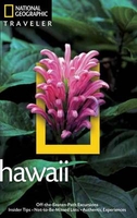
Hawaii Traveler Guide

Hawaii in the National Geographic Traveler guide series, produced by America’s leading travel publishers, exploring a range of cities, regions and countries worldwide and using the expertise and tradition of National Geographic to provide a comprehensive survey of each destination. Each of the guides in the series draws upon National Geographic’s rich history of travel experience and is researched by authors familiar with the area. Whilst the content is influenced by an American editorial style, individual titles are still accessible to a non-American audience, with a combination of practical guidance and detailed information included in each guide. The series also relies upon the extensive image libraries of National Geographic to present a rich visual image of each destination.
Individual National Geographic Traveler titles are organised uniformly, allowing readers to access information quickly and easily. Introductory sections provide information on Charting your Trip, with details of getting there and around and a History and Culture chapter profiling history, food and drink, land and landscape, flora and fauna and arts and literature. Chapter are arranged geographically by region, with notable cities and areas principally describing the main sites and attractions, with further information on directions, history and practicalities. There are also a number of individual features and insider tips throughout each guide covering subjects such as walking tours, local culture, driving tours, recommended local experiences and in-depth thematic short
histories of the culture and histories of individual regions. A Travelwise section at the back of each guide provides essential practical information on when to go, what to take, further reading, getting there and around, local etiquette, media, holidays, money matters, religion, smoking, time differences, opening times, travellers with disabilities and accommodation. Restaurants and hotels are listed with brief descriptions and information on prices, location, contact details and facilities for the relevant regional chapters in the guide.
RIP - This product is no longer available on our network. It was last seen on 25.09.2019

This page now acts as a permanent archive for this product. Add more information using the comments box below to ensure it can still be found by future generations.

Use our search facility to see if it is available from an alternative contributor.
  • External links may include paid for promotion
  • Availability: Out Of Stock
  • Supplier: Stanfords
  • SKU: 9781426212505
Availability: In Stock
£18.99

Product Description

Hawaii in the National Geographic Traveler guide series, produced by America’s leading travel publishers, exploring a range of cities, regions & countries worldwide & using the expertise & tradition of National Geographic to provide a comprehensive survey of each destination. Each of the guides in the series draws upon National Geographic’s rich history of travel experience & is researched by authors familiar with the area. Whilst the content is influenced by an American editorial style, individual titles are still accessible to a non-American audience, with a combination of practical guidance & detailed information included in each guide. The series also relies upon the extensive image libraries of National Geographic to present a rich visual image of each destination. Individual National Geographic Traveler titles are organised uniformly, allowing readers to access information quickly & easily. Introductory sections provide information on Charting your Trip, with details of getting there & around & a History & Culture chapter profiling history, food & drink, land & landscape, flora & fauna & arts & literature. Chapter are arranged geographically by region, with notable cities & areas principally describing the main sites & attractions, with further information on directions, history & practicalities. There are also a number of individual features & insider tips throughout each guide covering subjects such as walking tours, local culture, driving tours, recommended local experiences & in-depth thematic short histories of the culture & histories of individual regions. A Travelwise section at the back of each guide provides essential practical information on when to go, what to take, further reading, getting there & around, local etiquette, media, holidays, money matters, religion, smoking, time differences, opening times, travellers with disabilities & accommodation. Restaurants & hotels are listed with brief descriptions & information on prices, location, contact details & facilities for the relevant regional chapters in the guide.

Reviews/Comments

Add New

Intelligent Comparison

Oooops!
We couldn't find anything!
Perhaps this product's unique.... Or perhaps we are still looking for comparisons!
Click to bump this page and we'll hurry up.

Price History

Vouchers

No voucher codes found.
Do you know a voucher code for this product or supplier? Add it to Insights for others to use.

Facebook

Jargon Buster

History - Anything that happens in the past. An acedemic subject.
Accommodation - A room in which someone can live in, for example in a hotel
Practical - Weather a task is easy to carry out and realistically succeed.
Experience - To gain further knowledge by practising.
Regional - An adjective to describe a set geographic area.
Individual - A single separate item or person.
Combination - The process of two of more things being mixed or combined together.

Supplier Information

Stanfords
Stanfords was established in 1853 and opened their iconic Covent Garden flagship store in 1901. They have become the top retailer of maps, travel books and accessories in the UK and arguably offer the largest selection of maps and travel books worldwide. Famous names such as Captain Robert Falcon Scott, Ranulph Fiennes and Michael Palin have purchased from Stanfords. They now have a shop in Bristol and both stores together with other venues operate a calendar of events including talks, book signings and exhibitions. As a specialist map retailer, the map selection is comprehensive and includes road maps, street maps and walking maps from worldwide destinations, as well as a selection of world atlases and wall maps. Books include travel guides and travel literature. Stanfords also stock globes, from miniatures made of blue marble to magnificent floor-standing globes. The website features a selection of interesting articles on travel topics.
Page Updated: 2023-11-12 20:15:36

Community Generated Product Tags

Oh No! The productWIKI community hasn't generated any tags for this product yet!
Menu