
 United Kingdom
 France
 Germany
 Netherlands
 Sweden
 USA
USA
 Italy
Italy
 Spain
Spain
More From Contributor


Dublin Street Map
Dublin at 1:20, 000 on a large, double-sided street plan from the Ordnance Survey of Ireland covering the city beyond its motorway ring, with an enlargement showing the centre in greater detail, plus an index in a separate booklet. The plan is double-sided, dividing Dublin east/west with a good overlap between the sides, and provides coverage roughly within the M50 motorway ring, plus well beyond it in the west. Main traffic routes are highlighted and the map also shows the Garda speed enforcements zones; one way streets are indicated only on the city centre enlargement. Luas lines are shown with stops and railway stations are clearly marked. The map also shows the “dublinbikes” stations. Important buildings are prominently indicated by colours and symbols show various public
facilities. The index grid divides the city into 1-km squares: the index is in a separate booklet.The plan also includes an enlargement showing the city centre in greater detail at 1:7, 500, with more prominent colouring for various types of public places and symbols for notable buildings, tourist offices, museums, shopping centres, etc. Current 20th edition was published in summer 2013.
facilities. The index grid divides the city into 1-km squares: the index is in a separate booklet.The plan also includes an enlargement showing the city centre in greater detail at 1:7, 500, with more prominent colouring for various types of public places and symbols for notable buildings, tourist offices, museums, shopping centres, etc. Current 20th edition was published in summer 2013.

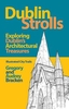
Product Description
Reviews/Comments
Add New
Vouchers
No voucher codes found.
Do you know a voucher code for this product or supplier? Add it to Insights for others to use.
Do you know a voucher code for this product or supplier? Add it to Insights for others to use.
 Denmark